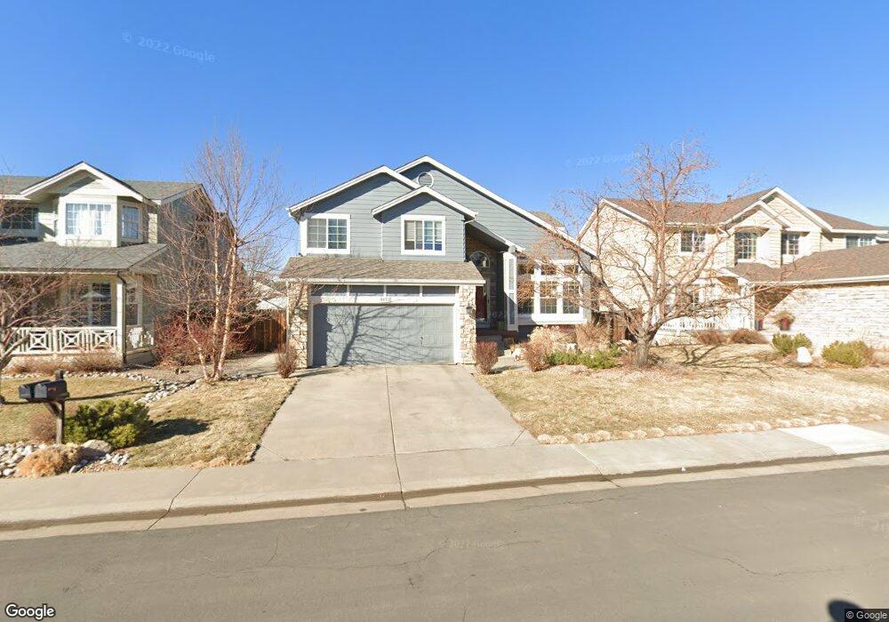
8657 W 95th Dr Westminster, CO 80021
Kings Mill NeighborhoodEstimated Value: $692,000 - $743,000
4
Beds
4
Baths
2,279
Sq Ft
$311/Sq Ft
Est. Value
About This Home
This home is located at 8657 W 95th Dr, Westminster, CO 80021 and is currently estimated at $709,501, approximately $311 per square foot. 8657 W 95th Dr is a home located in Jefferson County with nearby schools including Lukas Elementary School, Wayne Carle Middle School, and Standley Lake High School.
Ownership History
Date
Name
Owned For
Owner Type
Purchase Details
Closed on
Aug 31, 2016
Sold by
Craig David D and Craig Angela M
Bought by
Kohn Michael David and Carrillo Alexandra B
Current Estimated Value
Home Financials for this Owner
Home Financials are based on the most recent Mortgage that was taken out on this home.
Original Mortgage
$294,500
Outstanding Balance
$235,386
Interest Rate
3.45%
Mortgage Type
New Conventional
Estimated Equity
$474,115
Purchase Details
Closed on
Jun 28, 2013
Sold by
Briggs Jacob A and Briggs Colette L
Bought by
Craig David D and Craig Angela M
Home Financials for this Owner
Home Financials are based on the most recent Mortgage that was taken out on this home.
Original Mortgage
$190,000
Interest Rate
3.54%
Mortgage Type
New Conventional
Purchase Details
Closed on
May 28, 2010
Sold by
Ericksen Christopher and Ericksen Alyssa
Bought by
Briggs Jacob A and Briggs Colette L
Home Financials for this Owner
Home Financials are based on the most recent Mortgage that was taken out on this home.
Original Mortgage
$286,141
Interest Rate
5%
Mortgage Type
VA
Purchase Details
Closed on
Nov 5, 2004
Sold by
Stephenson Travis C and Stephenson Chelsea L
Bought by
Ericksen Christopher and Ericksen Alyssa
Home Financials for this Owner
Home Financials are based on the most recent Mortgage that was taken out on this home.
Original Mortgage
$245,900
Interest Rate
5.71%
Mortgage Type
Purchase Money Mortgage
Purchase Details
Closed on
Sep 27, 1998
Sold by
Pape Richard C and Pape Donita K
Bought by
Stephenson Travis C and Stephenson Chelsea L
Home Financials for this Owner
Home Financials are based on the most recent Mortgage that was taken out on this home.
Original Mortgage
$165,600
Interest Rate
6.92%
Purchase Details
Closed on
Apr 29, 1994
Sold by
The Ryland Group Inc
Bought by
Pape Richard C and Pape Donita K
Home Financials for this Owner
Home Financials are based on the most recent Mortgage that was taken out on this home.
Original Mortgage
$136,250
Interest Rate
7.76%
Create a Home Valuation Report for This Property
The Home Valuation Report is an in-depth analysis detailing your home's value as well as a comparison with similar homes in the area
Home Values in the Area
Average Home Value in this Area
Purchase History
| Date | Buyer | Sale Price | Title Company |
|---|---|---|---|
| Kohn Michael David | $409,500 | Land Title Guarantee Co | |
| Craig David D | $330,000 | Heritage Title | |
| Briggs Jacob A | $277,000 | Htco | |
| Ericksen Christopher | $275,900 | Title America | |
| Stephenson Travis C | $207,000 | North American Title | |
| Pape Richard C | $151,435 | Land Title |
Source: Public Records
Mortgage History
| Date | Status | Borrower | Loan Amount |
|---|---|---|---|
| Open | Kohn Michael David | $294,500 | |
| Previous Owner | Craig David D | $190,000 | |
| Previous Owner | Briggs Jacob A | $286,141 | |
| Previous Owner | Ericksen Christopher | $245,900 | |
| Previous Owner | Stephenson Travis C | $165,600 | |
| Previous Owner | Pape Richard C | $136,250 | |
| Closed | Stephenson Travis C | $20,700 |
Source: Public Records
Tax History Compared to Growth
Tax History
| Year | Tax Paid | Tax Assessment Tax Assessment Total Assessment is a certain percentage of the fair market value that is determined by local assessors to be the total taxable value of land and additions on the property. | Land | Improvement |
|---|---|---|---|---|
| 2024 | $3,278 | $43,039 | $10,986 | $32,053 |
| 2023 | $3,278 | $43,039 | $10,986 | $32,053 |
| 2022 | $2,750 | $35,360 | $8,219 | $27,141 |
| 2021 | $2,790 | $36,377 | $8,455 | $27,922 |
| 2020 | $2,491 | $32,666 | $8,079 | $24,587 |
| 2019 | $2,452 | $32,666 | $8,079 | $24,587 |
| 2018 | $2,029 | $26,133 | $5,950 | $20,183 |
| 2017 | $1,816 | $26,133 | $5,950 | $20,183 |
| 2016 | $1,842 | $24,589 | $6,233 | $18,356 |
| 2015 | $1,579 | $24,589 | $6,233 | $18,356 |
| 2014 | $1,579 | $19,645 | $5,572 | $14,073 |
Source: Public Records
Map
Nearby Homes
- 9567 Brentwood Way Unit A
- 9663 Brentwood Way Unit B
- 9705 Carr Cir
- 9703 Independence Dr Unit 9703
- 9702 Carr Cir
- 9677 Independence Dr Unit 9677
- 9409 Brentwood St
- 8755 W 96th Dr
- 9805 Garrison Ct
- 9263 W 98th Way
- 9324 Field Ln
- 9863 Zephyr Dr
- 9401 W 98th Ave
- 10690 Dover St
- 10074 Flower St
- 9805 Iris St
- 9495 Webster Way
- 9991 Holland Cir
- 10121 Flower St
- 9251 Wadsworth Blvd
- 8659 W 95th Dr
- 8653 W 95th Dr
- 8661 W 95th Dr
- 8656 W 95th Dr
- 8654 W 95th Dr
- 8651 W 95th Dr
- 8663 W 95th Dr
- 8658 W 95th Dr
- 8652 W 95th Dr
- 9586 Brentwood Way Unit A
- 9586 Brentwood Way Unit B
- 9586 Brentwood Way Unit C
- 9586 Brentwood Way Unit D
- 9574 Brentwood Way Unit A
- 9574 Brentwood Way Unit B
- 9574 Brentwood Way Unit C
- 9574 Brentwood Way Unit D
- 9574 Brentwood Way
- 8660 W 95th Dr
- 8650 W 95th Dr