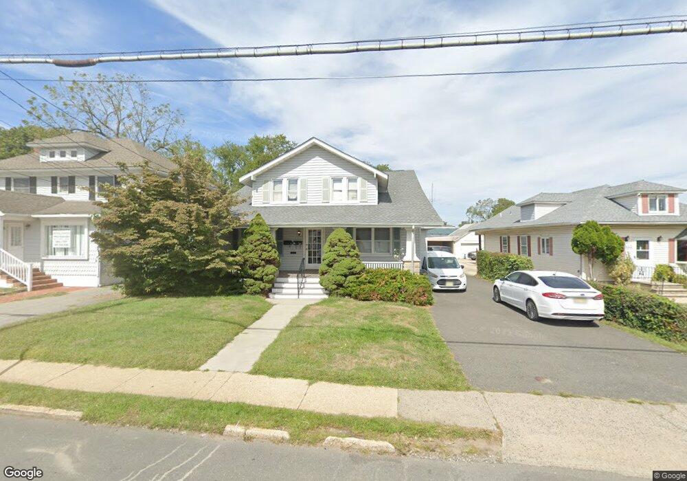
867 Broadway West Long Branch, NJ 07764
Estimated Value: $644,000 - $850,000
4
Beds
2
Baths
2,640
Sq Ft
$286/Sq Ft
Est. Value
About This Home
This home is located at 867 Broadway, West Long Branch, NJ 07764 and is currently estimated at $754,348, approximately $285 per square foot. 867 Broadway is a home located in Monmouth County with nearby schools including Betty McElmon Elementary School, Frank Antonides School, and Shore Regional High School.
Ownership History
Date
Name
Owned For
Owner Type
Purchase Details
Closed on
Jun 20, 2019
Sold by
Sgro Paul
Bought by
867 Broadway Wlb Llc
Current Estimated Value
Purchase Details
Closed on
Dec 1, 2010
Sold by
Penn Richard and Penn Katherine
Bought by
Sgro Paul
Create a Home Valuation Report for This Property
The Home Valuation Report is an in-depth analysis detailing your home's value as well as a comparison with similar homes in the area
Home Values in the Area
Average Home Value in this Area
Purchase History
| Date | Buyer | Sale Price | Title Company |
|---|---|---|---|
| 867 Broadway Wlb Llc | -- | None Available | |
| Sgro Paul | $205,000 | Red Bank Title Agency Inc | |
| Penn Richard | $125,000 | Red Bank Title Agency Inc |
Source: Public Records
Tax History Compared to Growth
Tax History
| Year | Tax Paid | Tax Assessment Tax Assessment Total Assessment is a certain percentage of the fair market value that is determined by local assessors to be the total taxable value of land and additions on the property. | Land | Improvement |
|---|---|---|---|---|
| 2025 | $8,492 | $669,700 | $252,100 | $417,600 |
| 2024 | $8,518 | $651,700 | $248,900 | $402,800 |
| 2023 | $8,518 | $609,700 | $216,300 | $393,400 |
| 2022 | $8,055 | $569,500 | $189,200 | $380,300 |
| 2021 | $8,055 | $417,000 | $171,500 | $245,500 |
| 2020 | $7,634 | $371,500 | $131,500 | $240,000 |
| 2019 | $7,565 | $370,100 | $131,500 | $238,600 |
| 2018 | $7,596 | $359,000 | $131,500 | $227,500 |
| 2017 | $7,554 | $340,900 | $120,400 | $220,500 |
| 2016 | $7,161 | $329,700 | $125,500 | $204,200 |
| 2015 | $7,058 | $324,500 | $125,500 | $199,000 |
| 2014 | $7,347 | $315,200 | $125,500 | $189,700 |
Source: Public Records
Map
Nearby Homes
- 863 Broadway
- 871 Broadway Unit 1
- 871 Broadway Unit 2
- 875 Broadway
- 879 Broadway
- 19 Oceanport Ave
- 874 Broadway
- 883 Broadway Unit 2
- 21 Oceanport Ave
- 864 Broadway
- 23 Oceanport Ave
- 887 Broadway
- 5 Oceanport Ave Unit 3
- 881 Broadway
- 881 Broadway
- 881 Broadway Unit Rear
- 40 N Linden Ave
- 52 N Linden Ave
- 12 Oceanport Ave
- 25 Oceanport Ave