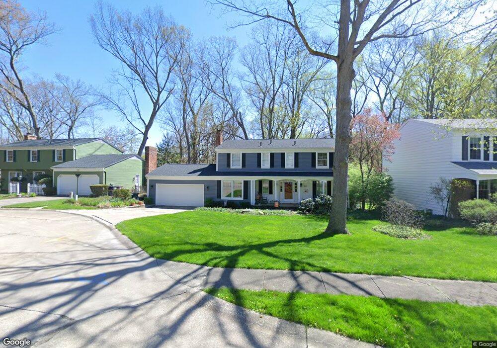
867 Lafayette Dr Akron, OH 44303
Merriman Hills NeighborhoodEstimated Value: $289,000 - $337,048
4
Beds
3
Baths
2,158
Sq Ft
$148/Sq Ft
Est. Value
About This Home
This home is located at 867 Lafayette Dr, Akron, OH 44303 and is currently estimated at $319,012, approximately $147 per square foot. 867 Lafayette Dr is a home located in Summit County with nearby schools including King Community Learning Center, Towpath Trail High School, and Our Lady Of The Elms Elementary School.
Ownership History
Date
Name
Owned For
Owner Type
Purchase Details
Closed on
Feb 9, 2022
Sold by
Moshier Nicole M and Moshier Jeffrey Scott
Bought by
Moshier Nicole M and Moshier Jeffrey Scott
Current Estimated Value
Home Financials for this Owner
Home Financials are based on the most recent Mortgage that was taken out on this home.
Original Mortgage
$200,000
Outstanding Balance
$134,958
Interest Rate
2.93%
Mortgage Type
New Conventional
Estimated Equity
$184,054
Purchase Details
Closed on
Jul 27, 2006
Sold by
Moshier Jeffrey S and Moshier Nicole M
Bought by
Moshier Nicole M
Purchase Details
Closed on
Jul 19, 2004
Sold by
Vandoros George D
Bought by
Moshier Jeffrey S and Moshier Nicole M
Home Financials for this Owner
Home Financials are based on the most recent Mortgage that was taken out on this home.
Original Mortgage
$146,700
Interest Rate
6.42%
Mortgage Type
Purchase Money Mortgage
Create a Home Valuation Report for This Property
The Home Valuation Report is an in-depth analysis detailing your home's value as well as a comparison with similar homes in the area
Home Values in the Area
Average Home Value in this Area
Purchase History
| Date | Buyer | Sale Price | Title Company |
|---|---|---|---|
| Moshier Nicole M | -- | New Title Company Name | |
| Moshier Nicole M | -- | Talon Group | |
| Moshier Jeffrey S | $156,700 | -- |
Source: Public Records
Mortgage History
| Date | Status | Borrower | Loan Amount |
|---|---|---|---|
| Open | Moshier Nicole M | $200,000 | |
| Previous Owner | Moshier Jeffrey S | $146,700 |
Source: Public Records
Tax History Compared to Growth
Tax History
| Year | Tax Paid | Tax Assessment Tax Assessment Total Assessment is a certain percentage of the fair market value that is determined by local assessors to be the total taxable value of land and additions on the property. | Land | Improvement |
|---|---|---|---|---|
| 2025 | $4,805 | $91,872 | $20,738 | $71,134 |
| 2024 | $4,805 | $91,872 | $20,738 | $71,134 |
| 2023 | $4,805 | $91,872 | $20,738 | $71,134 |
| 2022 | $4,634 | $69,598 | $15,708 | $53,890 |
| 2021 | $4,639 | $69,598 | $15,708 | $53,890 |
| 2020 | $4,568 | $69,600 | $15,710 | $53,890 |
| 2019 | $4,543 | $62,880 | $12,460 | $50,420 |
| 2018 | $4,481 | $62,880 | $12,460 | $50,420 |
| 2017 | $4,655 | $62,880 | $12,460 | $50,420 |
| 2016 | $4,558 | $62,880 | $12,460 | $50,420 |
| 2015 | $4,655 | $64,310 | $12,460 | $51,850 |
| 2014 | $4,617 | $64,310 | $12,460 | $51,850 |
| 2013 | $4,534 | $64,400 | $12,460 | $51,940 |
Source: Public Records
Map
Nearby Homes
- 856 Lafayette Dr
- 0 Belleau Wood Dr
- 711 Lafayette Dr
- 557 Letchworth Dr
- 481 Letchworth Dr
- 889 Eaton Ave
- 754 Merriman Rd
- 834 Eaton Park Ln
- 285 Nob Hill Dr
- 433 Delaware Ave
- 430 Delaware Ave
- 400 Delaware Ave
- 1056 Garman Rd
- 1036 Winhurst Dr
- 782 Memorial Pkwy
- 1057 N Portage Path
- 1085 Winhurst Dr
- 333 N Portage Path Unit 3
- 333 N Portage Path Unit 34
- 333 N Portage Path Unit 6
- 859 Lafayette Dr
- 875 Lafayette Dr
- 851 Lafayette Dr
- 866 Lafayette Dr
- 876 Lafayette Dr
- 660 Rocky Hollow Dr
- 848 Lafayette Dr
- 680 Rocky Hollow Dr
- 831 Lafayette Dr
- 865 Belleau Wood Dr
- 840 Lafayette Dr
- 859 Belleau Wood Dr
- 650 Shady Ledge Dr
- 849 Belleau Wood Dr
- 645 Shady Ledge Dr
- 670 Rocky Hollow Dr
- 832 Lafayette Dr
- 871 Belleau Wood Dr
- 821 Lafayette Dr
- 837 Belleau Wood Dr