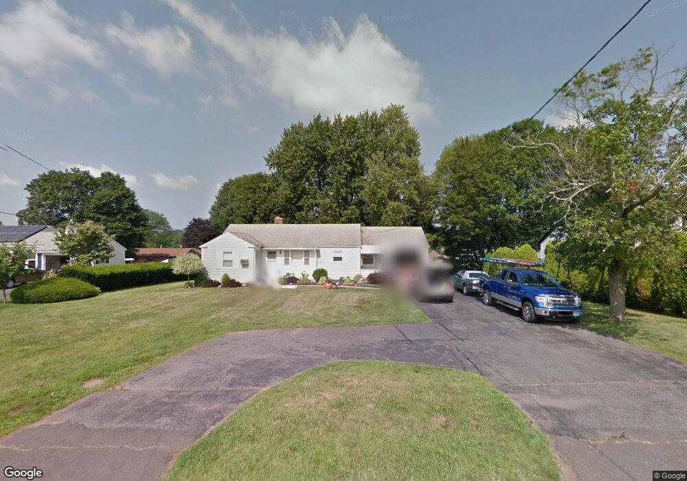
867 Maple St Wethersfield, CT 06109
Estimated Value: $369,000 - $382,000
2
Beds
2
Baths
1,302
Sq Ft
$288/Sq Ft
Est. Value
About This Home
This home is located at 867 Maple St, Wethersfield, CT 06109 and is currently estimated at $375,509, approximately $288 per square foot. 867 Maple St is a home located in Hartford County with nearby schools including Highcrest School, Silas Deane Middle School, and Wethersfield High School.
Ownership History
Date
Name
Owned For
Owner Type
Purchase Details
Closed on
Jul 23, 2025
Sold by
Martino Nicholas P
Bought by
Carrano Daniel A and Pandolfi Jamie L
Current Estimated Value
Home Financials for this Owner
Home Financials are based on the most recent Mortgage that was taken out on this home.
Original Mortgage
$330,000
Outstanding Balance
$328,301
Interest Rate
6.84%
Mortgage Type
Future Advance Clause Open End Mortgage
Estimated Equity
$47,208
Purchase Details
Closed on
Dec 14, 2020
Sold by
Donofrio-Spector Barbara
Bought by
Marino Nicholas P
Home Financials for this Owner
Home Financials are based on the most recent Mortgage that was taken out on this home.
Original Mortgage
$252,800
Interest Rate
2.7%
Mortgage Type
New Conventional
Create a Home Valuation Report for This Property
The Home Valuation Report is an in-depth analysis detailing your home's value as well as a comparison with similar homes in the area
Home Values in the Area
Average Home Value in this Area
Purchase History
| Date | Buyer | Sale Price | Title Company |
|---|---|---|---|
| Carrano Daniel A | $370,000 | -- | |
| Marino Nicholas P | $316,000 | None Available | |
| Marino Nicholas P | $316,000 | None Available |
Source: Public Records
Mortgage History
| Date | Status | Borrower | Loan Amount |
|---|---|---|---|
| Open | Carrano Daniel A | $330,000 | |
| Previous Owner | Marino Nicholas P | $252,800 |
Source: Public Records
Tax History
| Year | Tax Paid | Tax Assessment Tax Assessment Total Assessment is a certain percentage of the fair market value that is determined by local assessors to be the total taxable value of land and additions on the property. | Land | Improvement |
|---|---|---|---|---|
| 2025 | $9,019 | $218,790 | $91,730 | $127,060 |
| 2024 | $6,536 | $151,230 | $72,820 | $78,410 |
| 2023 | $6,318 | $151,230 | $72,820 | $78,410 |
| 2022 | $6,213 | $151,230 | $72,820 | $78,410 |
| 2021 | $6,151 | $151,230 | $72,820 | $78,410 |
| 2020 | $6,128 | $150,610 | $72,830 | $77,780 |
| 2019 | $6,136 | $150,610 | $72,830 | $77,780 |
| 2018 | $5,987 | $146,800 | $70,600 | $76,200 |
| 2017 | $5,838 | $146,800 | $70,600 | $76,200 |
| 2016 | $5,658 | $146,800 | $70,600 | $76,200 |
| 2015 | $5,606 | $146,800 | $70,600 | $76,200 |
| 2014 | $5,393 | $146,800 | $70,600 | $76,200 |
Source: Public Records
Map
Nearby Homes
- 268 Fox Hill Rd
- 18 Mcintosh Cir Unit 18
- 92 Berkshire Rd
- 70 Mountain Laurel Dr Unit 70
- 99 Elm Ridge Dr
- 36 Copper Beech Dr
- 20 Little Oak Ln Unit 20
- 1610 Silas Deane Hwy
- 11 Charter Rd
- 59 Chapin Ave
- 155 Old Common Rd
- 25 Heather Hill
- 34 Rose Ct
- 31 Ox Yoke Dr
- 89 Merriman Rd
- 0 Collier Rd
- 101 Collier Rd
- 9 Dogwood Ct
- 38 Butternut Ln
- 38 Wheeler Rd
- 875 Maple St
- 859 Maple St
- 54 Cloverdale Cir
- 62 Cloverdale Cir
- 870 Maple St
- 46 Cloverdale Cir
- 68 Cloverdale Cir
- 881 Maple St
- 851 Maple St
- 878 Maple St
- 40 Cloverdale Cir
- 74 Cloverdale Cir
- 888 Maple St
- 839 Maple St
- 55 Cloverdale Cir
- 47 Cloverdale Cir
- 65 Cloverdale Cir
- 82 Cloverdale Cir
- 36 Cloverdale Cir
- 896 Maple St
Your Personal Tour Guide
Ask me questions while you tour the home.