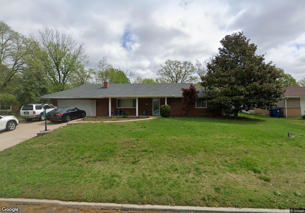
867 Reavis Barracks Rd Saint Louis, MO 63125
Lemay NeighborhoodEstimated Value: $299,000 - $320,000
2
Beds
2
Baths
1,900
Sq Ft
$162/Sq Ft
Est. Value
About This Home
This home is located at 867 Reavis Barracks Rd, Saint Louis, MO 63125 and is currently estimated at $308,446, approximately $162 per square foot. 867 Reavis Barracks Rd is a home located in St. Louis County with nearby schools including Forder Elementary School, Margaret Buerkle Middle School, and Mehlville High School.
Ownership History
Date
Name
Owned For
Owner Type
Purchase Details
Closed on
Dec 6, 2012
Sold by
Ngo Phung V and Bui Tram Hoang Thi
Bought by
Ngo Phung and Bui Tram Hoang Thi
Current Estimated Value
Home Financials for this Owner
Home Financials are based on the most recent Mortgage that was taken out on this home.
Original Mortgage
$106,500
Outstanding Balance
$18,868
Interest Rate
2.72%
Mortgage Type
New Conventional
Estimated Equity
$289,578
Purchase Details
Closed on
Sep 30, 2009
Sold by
Mcdaniel Mark W and Mcdaniel Judith Ann
Bought by
Nguyen Dung Huu and Ngo Phung
Home Financials for this Owner
Home Financials are based on the most recent Mortgage that was taken out on this home.
Original Mortgage
$160,714
Interest Rate
5.12%
Mortgage Type
FHA
Create a Home Valuation Report for This Property
The Home Valuation Report is an in-depth analysis detailing your home's value as well as a comparison with similar homes in the area
Home Values in the Area
Average Home Value in this Area
Purchase History
| Date | Buyer | Sale Price | Title Company |
|---|---|---|---|
| Ngo Phung | -- | Title Partners Agency Llc | |
| Ngo Phung | -- | Title Partners Agency Llc | |
| Nguyen Dung Huu | $195,000 | Atc |
Source: Public Records
Mortgage History
| Date | Status | Borrower | Loan Amount |
|---|---|---|---|
| Open | Ngo Phung | $106,500 | |
| Closed | Ngo Phung | $106,500 | |
| Closed | Nguyen Dung Huu | $160,714 |
Source: Public Records
Tax History Compared to Growth
Tax History
| Year | Tax Paid | Tax Assessment Tax Assessment Total Assessment is a certain percentage of the fair market value that is determined by local assessors to be the total taxable value of land and additions on the property. | Land | Improvement |
|---|---|---|---|---|
| 2025 | $3,603 | $50,260 | $18,300 | $31,960 |
| 2024 | $3,603 | $49,080 | $10,070 | $39,010 |
| 2023 | $3,393 | $49,080 | $10,070 | $39,010 |
| 2022 | $3,045 | $40,770 | $11,000 | $29,770 |
| 2021 | $2,795 | $40,770 | $11,000 | $29,770 |
| 2020 | $2,671 | $36,860 | $11,700 | $25,160 |
| 2019 | $2,664 | $36,860 | $11,700 | $25,160 |
| 2018 | $2,654 | $32,700 | $6,690 | $26,010 |
| 2017 | $2,647 | $32,700 | $6,690 | $26,010 |
| 2016 | $2,322 | $27,500 | $6,750 | $20,750 |
| 2015 | $2,189 | $27,500 | $6,750 | $20,750 |
| 2014 | $2,100 | $26,250 | $5,810 | $20,440 |
Source: Public Records
Map
Nearby Homes
- 1153 Calley Dr Unit 1153
- 660 Rochester Dr
- 669 Vista Conn Dr
- 669 Bellsworth Dr
- 502 Nannette Dr
- 600 Ellwine Dr
- 645 Vista Conn Dr
- 1275 Gardens Circle Dr Unit A
- 2228 Hagenstone Terrace
- 2669 Jonathan Dr
- 2105 Telford Dr
- 317 Tacoma Dr
- 2460 Lampong Dr Unit 100C
- 2745 Granda Dr
- 333 Pentonville Dr
- 385 Kingston Dr
- 2216 Apple Bud Ln
- 121 Jefferson Barracks Rd
- 2215 Apple Bud Ln
- 1716 Mayenne Ct Unit E
- 859 Reavis Barracks Rd
- 838 Middleboro Dr
- 851 Reavis Barracks Rd
- 848 Middleboro Dr
- 830 Middleboro Dr
- 870 Reavis Barracks Rd
- 860 Reavis Barracks Rd
- 2463 Telford Dr
- 822 Middleboro Dr
- 878 Reavis Barracks Rd
- 843 Reavis Barracks Rd
- 846 Reavis Barracks Rd
- 2451 Telford Dr
- 886 Reavis Barracks Rd
- 814 Middleboro Dr
- 893 Reavis Barracks Rd
- 859 Wycliffe Ct
- 863 Wycliffe Ct
- 855 Wycliffe Ct
- 2334 Rosegarden Dr