Estimated Value: $272,905 - $588,000
--
Bed
--
Bath
--
Sq Ft
6,534
Sq Ft Lot
About This Home
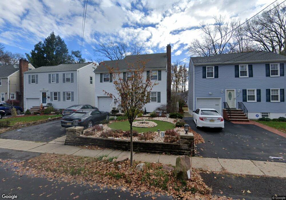
This home is located at 867 Salem Rd, Union, NJ 07083 and is currently estimated at $485,976. 867 Salem Rd is a home located in Union County with nearby schools including Livingston Elementary School and Union High School.
Ownership History
Date
Name
Owned For
Owner Type
Purchase Details
Closed on
Aug 29, 2008
Sold by
Barbosa Jose D and Barbosa Maria C
Bought by
Branco Victor
Current Estimated Value
Home Financials for this Owner
Home Financials are based on the most recent Mortgage that was taken out on this home.
Original Mortgage
$234,000
Outstanding Balance
$156,089
Interest Rate
6.58%
Mortgage Type
Purchase Money Mortgage
Estimated Equity
$329,887
Purchase Details
Closed on
Nov 30, 1999
Sold by
Raia Gary A and Raia Tracy A
Bought by
Barbosa Jose D and Barbosa Maria C
Home Financials for this Owner
Home Financials are based on the most recent Mortgage that was taken out on this home.
Original Mortgage
$127,000
Interest Rate
8.55%
Mortgage Type
Purchase Money Mortgage
Purchase Details
Closed on
Nov 12, 1997
Sold by
Albrecht Richard S and Albrecht Gertrude
Bought by
Raia Gary A and Raia Tracy A
Create a Home Valuation Report for This Property
The Home Valuation Report is an in-depth analysis detailing your home's value as well as a comparison with similar homes in the area
Home Values in the Area
Average Home Value in this Area
Purchase History
| Date | Buyer | Sale Price | Title Company |
|---|---|---|---|
| Branco Victor | $335,000 | Guardian Title Service Llc | |
| Barbosa Jose D | $173,000 | -- | |
| Raia Gary A | $100,000 | First American Title Ins Co |
Source: Public Records
Mortgage History
| Date | Status | Borrower | Loan Amount |
|---|---|---|---|
| Open | Branco Victor | $234,000 | |
| Previous Owner | Barbosa Jose D | $127,000 |
Source: Public Records
Tax History Compared to Growth
Tax History
| Year | Tax Paid | Tax Assessment Tax Assessment Total Assessment is a certain percentage of the fair market value that is determined by local assessors to be the total taxable value of land and additions on the property. | Land | Improvement |
|---|---|---|---|---|
| 2025 | $8,627 | $38,600 | $19,000 | $19,600 |
| 2024 | $8,364 | $38,600 | $19,000 | $19,600 |
| 2023 | $8,364 | $38,600 | $19,000 | $19,600 |
| 2022 | $8,074 | $38,600 | $19,000 | $19,600 |
| 2021 | $7,878 | $38,600 | $19,000 | $19,600 |
| 2020 | $7,721 | $38,600 | $19,000 | $19,600 |
| 2019 | $7,617 | $38,600 | $19,000 | $19,600 |
| 2018 | $7,487 | $38,600 | $19,000 | $19,600 |
| 2017 | $7,376 | $38,600 | $19,000 | $19,600 |
| 2016 | $7,197 | $38,600 | $19,000 | $19,600 |
| 2015 | $7,077 | $38,600 | $19,000 | $19,600 |
| 2014 | $6,919 | $38,600 | $19,000 | $19,600 |
Source: Public Records
Map
Nearby Homes
- 875 Salem Rd
- 969 Arnet Ave
- 795 Colonial Arms Rd
- 1370 Beverly Rd
- 365 Broadwell Ave
- 790 Green Ln Unit A1
- 717 Winchester Ave
- 1084 Woodland Ave
- 750 Midland Blvd
- 1031 Lowden Ave
- 600 Plymouth Rd
- 1040 Cranbrook Rd
- 578 Winchester Ave
- 1322 Marcella Dr
- 1393 Cornell Place
- 314 Fitzpatrick St
- 819 Greenwich Ln
- 631 Golf Terrace
- 1048 Chester St
- 292 Crann St
- 871 Salem Rd
- 861 Salem Rd
- 859 Salem Rd
- 881 Salem Rd
- 862 Colonial Arms Rd
- 853 Salem Rd
- 858 Colonial Arms Rd
- 856 Colonial Arms Rd Unit 1
- 885 Salem Rd
- 864 Salem Rd
- 851 Salem Rd
- 870 Salem Rd
- 275 Huguenot Ave
- 876 Salem Rd
- 860 Salem Rd
- 891 Salem Rd
- 303 Huguenot Ave
- 880 Salem Rd
- 893 Salem Rd
- 309 Huguenot Ave