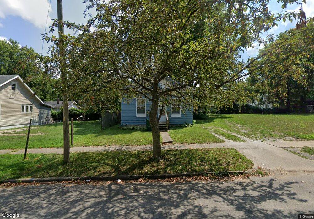
867 W Packard St Decatur, IL 62522
Garfield Park NeighborhoodEstimated Value: $31,851 - $47,000
2
Beds
1
Bath
1,610
Sq Ft
$23/Sq Ft
Est. Value
About This Home
This home is located at 867 W Packard St, Decatur, IL 62522 and is currently estimated at $36,713, approximately $22 per square foot. 867 W Packard St is a home located in Macon County with nearby schools including Stephen Decatur Middle School, St. Patrick School, and Teen Challenge-Home For Girls.
Ownership History
Date
Name
Owned For
Owner Type
Purchase Details
Closed on
Apr 8, 2024
Sold by
Mohamed Abdu S
Bought by
Carter Johnny L
Current Estimated Value
Purchase Details
Closed on
Oct 27, 2017
Sold by
Hunter Phillip
Bought by
Mohamed Abdu S
Purchase Details
Closed on
Sep 16, 2015
Sold by
Hunter Barbara J
Bought by
Hunter Phillip E
Purchase Details
Closed on
Jun 12, 2013
Sold by
Gray Earl M
Bought by
Hunter Barbara
Purchase Details
Closed on
Mar 7, 2012
Sold by
Brown Britt A
Bought by
Gray Earl
Purchase Details
Closed on
Aug 19, 2010
Sold by
Gilman Robert W and Gilman Amber N
Bought by
Lincoln Land Illinois Land Trust
Purchase Details
Closed on
Jul 20, 2010
Sold by
Nave Don
Bought by
Gilman Robert W and Gilman Amber
Purchase Details
Closed on
Dec 27, 2006
Sold by
Decatur Dominion Llc
Bought by
Beckett Mary Jane
Create a Home Valuation Report for This Property
The Home Valuation Report is an in-depth analysis detailing your home's value as well as a comparison with similar homes in the area
Home Values in the Area
Average Home Value in this Area
Purchase History
| Date | Buyer | Sale Price | Title Company |
|---|---|---|---|
| Carter Johnny L | -- | None Listed On Document | |
| Mohamed Abdu S | -- | -- | |
| Hunter Phillip E | -- | None Available | |
| Hunter Barbara | $7,500 | None Available | |
| Gray Earl | -- | None Available | |
| Lincoln Land Illinois Land Trust | -- | None Available | |
| Gilman Robert W | $6,000 | None Available | |
| Beckett Mary Jane | $5,000 | None Available |
Source: Public Records
Tax History Compared to Growth
Tax History
| Year | Tax Paid | Tax Assessment Tax Assessment Total Assessment is a certain percentage of the fair market value that is determined by local assessors to be the total taxable value of land and additions on the property. | Land | Improvement |
|---|---|---|---|---|
| 2024 | $493 | $5,097 | $437 | $4,660 |
| 2023 | $489 | $4,917 | $422 | $4,495 |
| 2022 | $474 | $4,635 | $390 | $4,245 |
| 2021 | $445 | $4,329 | $365 | $3,964 |
| 2020 | $439 | $4,129 | $349 | $3,780 |
| 2019 | $439 | $4,129 | $349 | $3,780 |
| 2018 | $456 | $4,343 | $129 | $4,214 |
| 2017 | $395 | $4,459 | $132 | $4,327 |
| 2016 | $399 | $4,504 | $133 | $4,371 |
| 2015 | -- | $4,425 | $131 | $4,294 |
| 2014 | -- | $3,857 | $176 | $3,681 |
| 2013 | $190 | $4,002 | $183 | $3,819 |
Source: Public Records
Map
Nearby Homes
- 837 W Grand Ave
- 1065 W Green St
- 875 N Monroe St
- 415 W Green St
- 844 N Edward St
- 1545 N Monroe St
- 1504 N Monroe St
- 1245 N Union St
- 917 N Wilder Ave
- 933 W Division St
- 1653 N Maple Ave
- 644 W Division St
- 958 W William St
- 925 W Olive St
- 254 N Pine St
- 1458 N Union St
- 1319 W Waggoner St
- 609 W William St
- 422 W William St
- 141 E Packard St
- 875 W Packard St
- 855 W Packard St
- 870 W Elm St
- 860 W Elm St
- 880 W Elm St
- 853 W Packard St
- 885 W Packard St
- 884 W Packard St
- 890 W Elm St
- 850 W Elm St
- 880 W Packard St
- 874 W Packard St
- 896 W Packard St
- 842 W Elm St
- 865 W Elm St
- 841 W Packard St
- 885 W Elm St
- 868 W Packard St
- 846 W Packard St
- 855 W Elm St