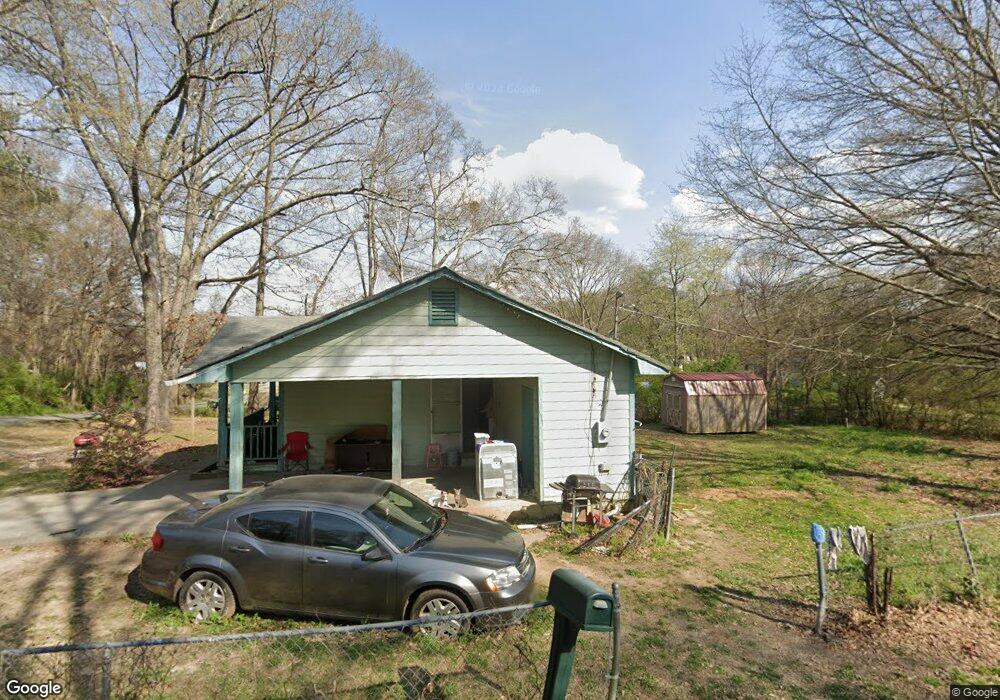
867 W Polk St Rockmart, GA 30153
Estimated Value: $193,000 - $200,845
3
Beds
2
Baths
1,300
Sq Ft
$151/Sq Ft
Est. Value
About This Home
This home is located at 867 W Polk St, Rockmart, GA 30153 and is currently estimated at $195,711, approximately $150 per square foot. 867 W Polk St is a home with nearby schools including Rockmart Middle School.
Ownership History
Date
Name
Owned For
Owner Type
Purchase Details
Closed on
Jan 18, 1994
Sold by
Alexander Foy H
Bought by
Cummings Helen G
Current Estimated Value
Purchase Details
Closed on
Jul 1, 1993
Sold by
Mccrary Jimmy
Bought by
Alexander Foy H
Purchase Details
Closed on
Sep 8, 1988
Sold by
Nations George
Bought by
Mccrary Jimmy
Purchase Details
Closed on
Aug 27, 1984
Sold by
Gibbons Valentine
Bought by
Nations George
Purchase Details
Closed on
Mar 4, 1980
Sold by
Nation George
Bought by
Gibbons Valentine
Purchase Details
Closed on
Aug 17, 1978
Sold by
Nation George
Bought by
Nation George
Purchase Details
Closed on
Sep 22, 1958
Bought by
Nation George
Create a Home Valuation Report for This Property
The Home Valuation Report is an in-depth analysis detailing your home's value as well as a comparison with similar homes in the area
Home Values in the Area
Average Home Value in this Area
Purchase History
| Date | Buyer | Sale Price | Title Company |
|---|---|---|---|
| Cummings Helen G | $47,500 | -- | |
| Alexander Foy H | $5,000 | -- | |
| Mccrary Jimmy | $3,500 | -- | |
| Nations George | -- | -- | |
| Gibbons Valentine | -- | -- | |
| Nation George | -- | -- | |
| Nation George | -- | -- |
Source: Public Records
Tax History Compared to Growth
Tax History
| Year | Tax Paid | Tax Assessment Tax Assessment Total Assessment is a certain percentage of the fair market value that is determined by local assessors to be the total taxable value of land and additions on the property. | Land | Improvement |
|---|---|---|---|---|
| 2024 | $1,439 | $68,852 | $4,800 | $64,052 |
| 2023 | $879 | $37,040 | $1,920 | $35,120 |
| 2022 | $755 | $31,824 | $1,920 | $29,904 |
| 2021 | $765 | $31,824 | $1,920 | $29,904 |
| 2020 | $767 | $31,824 | $1,920 | $29,904 |
| 2019 | $766 | $28,518 | $1,464 | $27,054 |
| 2018 | $762 | $27,643 | $1,464 | $26,179 |
| 2017 | $752 | $27,643 | $1,464 | $26,179 |
| 2016 | $752 | $27,643 | $1,464 | $26,179 |
| 2015 | $758 | $27,772 | $1,464 | $26,309 |
| 2014 | $385 | $27,569 | $1,260 | $26,309 |
Source: Public Records
Map
Nearby Homes
- 750 W Church St
- 713 Church St
- 1 Pine Mountain Rd
- 300 Church St
- 0 Pine Mountain St Unit 10620510
- 0 Pine Mountain St Unit 10620492
- 132 Highland Dr
- 103 Ivy St
- 119 Pearl St
- 222 Whitley Crossing
- 582 Barnwood Dr
- 540 N Marble St
- 256 Eastwood Path
- 0 Highway 278 Nathan Dean Bypass Unit 10134156
- 571 N Marble St
- 1044 Hutchings Mountain Rd
- 0 Brushy Mountain Unit 7595398
- 278 Oak Hill Dr
- 197 Oak Hill Dr
- 879 Dever St
- 855 W Polk St
- 883 Dever St
- 847 Polk St
- 884 Dever St
- 107 Harkness Dr
- 105 Harkness Dr
- 109 Harkness Dr
- 0 Harkness Dr Unit 8840698
- 0 Harkness Dr Unit 8777339
- 0 Harkness Dr Unit 8542585
- 0 Harkness Dr Unit 8440997
- 0 Harkness Dr Unit 8522172
- 0 Harkness Dr Unit 8480251
- 0 Harkness Dr Unit 7322396
- 0 Harkness Dr
- 900 Dever St
- 103 Harkness Dr
- 831 W Dever St
- 889 Martin Luther King jr St