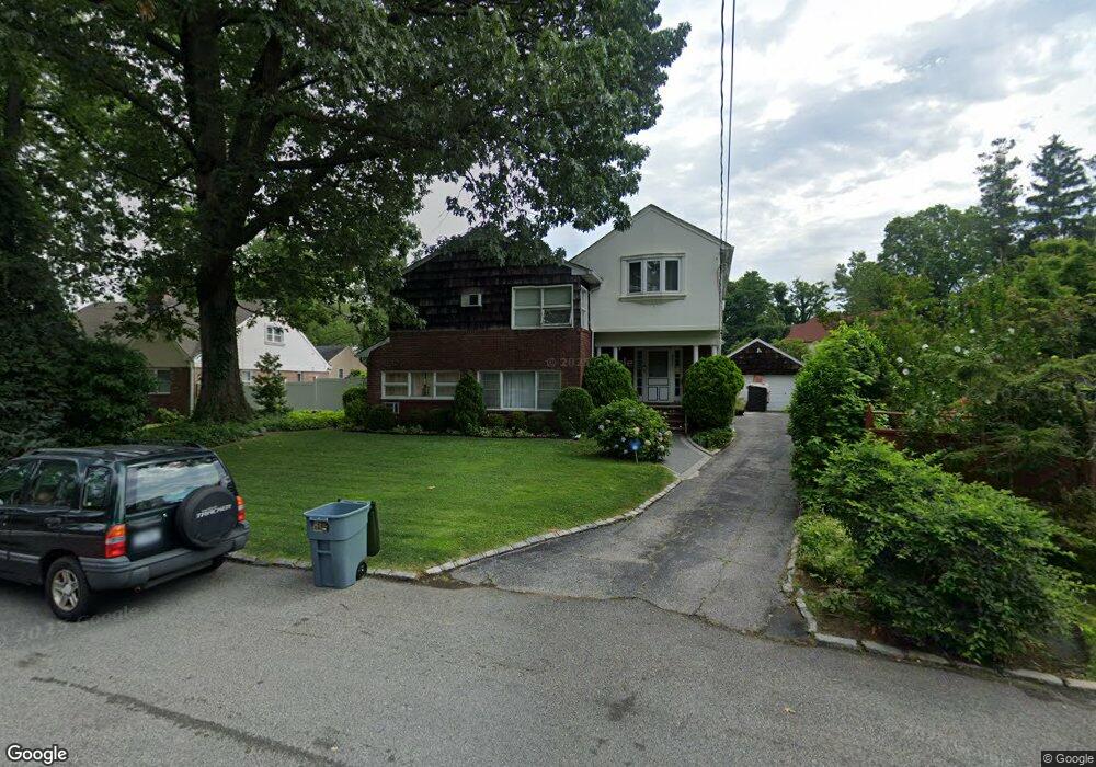
8671 Pinto St Hollis, NY 11423
Holliswood NeighborhoodEstimated Value: $1,487,102 - $1,861,000
--
Bed
--
Bath
3,400
Sq Ft
$497/Sq Ft
Est. Value
About This Home
This home is located at 8671 Pinto St, Hollis, NY 11423 and is currently estimated at $1,689,526, approximately $496 per square foot. 8671 Pinto St is a home located in Queens County with nearby schools including P.S. I.S. 178 The Holliswood School, George J. Ryan Middle School 216, and The Wellspring Schools.
Ownership History
Date
Name
Owned For
Owner Type
Purchase Details
Closed on
May 31, 2002
Sold by
Dumay Lancel and Dumay Lurline
Bought by
Ford Robertt and Ford Candida Cordice
Current Estimated Value
Home Financials for this Owner
Home Financials are based on the most recent Mortgage that was taken out on this home.
Original Mortgage
$550,000
Interest Rate
6.64%
Purchase Details
Closed on
Aug 18, 1997
Sold by
Etzbach Magdalene I and Etzbach Inge
Bought by
Dumay Lancel and Dumay Lurline
Home Financials for this Owner
Home Financials are based on the most recent Mortgage that was taken out on this home.
Original Mortgage
$248,000
Interest Rate
7.46%
Create a Home Valuation Report for This Property
The Home Valuation Report is an in-depth analysis detailing your home's value as well as a comparison with similar homes in the area
Home Values in the Area
Average Home Value in this Area
Purchase History
| Date | Buyer | Sale Price | Title Company |
|---|---|---|---|
| Ford Robertt | -- | -- | |
| Dumay Lancel | $328,500 | -- |
Source: Public Records
Mortgage History
| Date | Status | Borrower | Loan Amount |
|---|---|---|---|
| Previous Owner | Ford Robertt | $550,000 | |
| Previous Owner | Dumay Lancel | $248,000 |
Source: Public Records
Tax History Compared to Growth
Tax History
| Year | Tax Paid | Tax Assessment Tax Assessment Total Assessment is a certain percentage of the fair market value that is determined by local assessors to be the total taxable value of land and additions on the property. | Land | Improvement |
|---|---|---|---|---|
| 2025 | $12,752 | $63,971 | $16,398 | $47,573 |
| 2024 | $12,752 | $63,490 | $15,938 | $47,552 |
| 2023 | $12,030 | $59,897 | $13,869 | $46,028 |
| 2022 | $11,281 | $81,480 | $21,840 | $59,640 |
| 2021 | $11,219 | $80,940 | $21,840 | $59,100 |
| 2020 | $11,284 | $88,980 | $21,840 | $67,140 |
| 2019 | $11,068 | $76,200 | $21,840 | $54,360 |
| 2018 | $10,175 | $49,914 | $15,649 | $34,265 |
| 2017 | $9,599 | $47,089 | $16,109 | $30,980 |
| 2016 | $8,881 | $47,089 | $16,109 | $30,980 |
| 2015 | $5,138 | $44,424 | $22,803 | $21,621 |
| 2014 | $5,138 | $44,090 | $20,361 | $23,729 |
Source: Public Records
Map
Nearby Homes
- 86-79 Pinto St
- 19615 Como Ave
- 19922 Keno Ave
- 198-31 Pompeii Ave
- 8601 Marengo St
- 195-22 Mclaughlin Ave
- 19512 Mclaughlin Ave
- 198-02 Pompeii Ave Unit 1 B
- 87-16 Marengo St Unit 2B
- 19346 Mclaughlin Ave
- 19703 Mclaughlin Ave
- 87-24 Marengo St Unit 2B
- 198-44 Pompeii Ave Unit 1A
- 198-16 Mclaughlin Ave
- 87-44 Marengo St Unit 2A
- 196-35 Dunton Ave Unit 1
- 8649 Dunton St
- 195-12 Mclaughlin Ave
- 86-70 Francis Lewis Blvd Unit A-44
- 86-70 Francis Lewis Blvd Unit A55
- 8663 Pinto St
- 8679 Pinto St
- 8676 Marengo St
- 8687 Pinto St
- 8692 Marengo St
- 8692 Marengo St
- 8666 Marengo St
- 86-66 Marengo St
- 8688 Marengo St
- 8659 Pinto St
- 19630 Como Ave
- 8656 Marengo St
- 86-56 Marengo St
- 8680 Pinto St
- 8655 Pinto St
- 8684 Pinto St
- 8648 Marengo St
- 8658 Pinto St
- 8688 Pinto St
- 8649 Pinto St