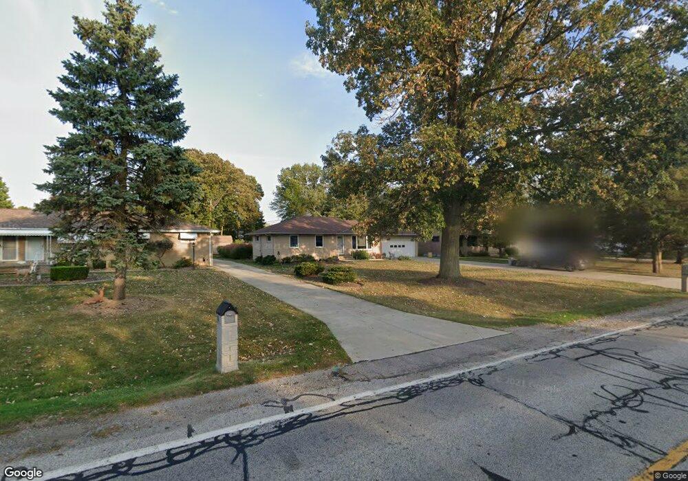
8671 Webster Rd Strongsville, OH 44136
Estimated Value: $239,487 - $265,000
3
Beds
1
Bath
1,188
Sq Ft
$216/Sq Ft
Est. Value
About This Home
This home is located at 8671 Webster Rd, Strongsville, OH 44136 and is currently estimated at $256,872, approximately $216 per square foot. 8671 Webster Rd is a home located in Cuyahoga County with nearby schools including Strongsville High School, The Academy of St. Bartholomew, and Sts Joseph & John Interparochial School.
Ownership History
Date
Name
Owned For
Owner Type
Purchase Details
Closed on
Oct 12, 2007
Sold by
Argento Anthony J and Marincek Susan M
Bought by
Argento Anthony J and Argento Susan M
Current Estimated Value
Purchase Details
Closed on
May 29, 1992
Sold by
Bockmore Rose B
Bought by
Argento Anthony J
Purchase Details
Closed on
May 4, 1987
Sold by
Bockmore Rose B
Bought by
Bockmore Rose B
Purchase Details
Closed on
Oct 14, 1976
Sold by
Bockmore Rose B
Bought by
Bockmore Rose B
Purchase Details
Closed on
Jan 1, 1975
Bought by
Bockmore Rose B
Create a Home Valuation Report for This Property
The Home Valuation Report is an in-depth analysis detailing your home's value as well as a comparison with similar homes in the area
Home Values in the Area
Average Home Value in this Area
Purchase History
| Date | Buyer | Sale Price | Title Company |
|---|---|---|---|
| Argento Anthony J | -- | Attorney | |
| Argento Anthony J | $95,000 | -- | |
| Bockmore Rose B | -- | -- | |
| Bockmore Rose B | -- | -- | |
| Bockmore Rose B | -- | -- |
Source: Public Records
Tax History
| Year | Tax Paid | Tax Assessment Tax Assessment Total Assessment is a certain percentage of the fair market value that is determined by local assessors to be the total taxable value of land and additions on the property. | Land | Improvement |
|---|---|---|---|---|
| 2025 | $3,717 | $79,170 | $13,720 | $65,450 |
| 2024 | $3,717 | $79,170 | $13,720 | $65,450 |
| 2023 | $3,697 | $59,050 | $15,650 | $43,400 |
| 2022 | $3,671 | $59,050 | $15,650 | $43,400 |
| 2021 | $3,642 | $59,050 | $15,650 | $43,400 |
| 2020 | $3,460 | $49,630 | $13,160 | $36,470 |
| 2019 | $3,358 | $141,800 | $37,600 | $104,200 |
| 2018 | $3,048 | $49,630 | $13,160 | $36,470 |
| 2017 | $2,984 | $44,980 | $10,360 | $34,620 |
| 2016 | $2,960 | $44,980 | $10,360 | $34,620 |
| 2015 | $2,869 | $44,980 | $10,360 | $34,620 |
| 2014 | $2,869 | $42,990 | $10,050 | $32,940 |
Source: Public Records
Map
Nearby Homes
- 9226 Rainier Ct
- 9890 Webster Rd
- 10134 Rosalee Ln
- 15888 Inglewood Ct
- 9841 Brookline Oval
- 16400 Commons Oval
- 9242 W 130th St
- 8761 Windfall Ct
- 0 Webster Rd
- 12770 Doula Ln
- 13397 Cherokee Trail
- 16225 N Laguardia Pkwy
- 12554 Meadowview Dr
- 14584 Baywood Ln
- 14557 Baywood Ln
- 7436 Pine River Ct Unit C52
- 14655 Baywood Ln
- 8963 Abbey Rd
- 15640 Glenridge Ave
- 7462 Pearl Rd
- 8713 Webster Rd
- 8623 Webster Rd
- 8721 Webster Rd
- 14729 Oakland Park Dr
- 8581 Webster Rd
- 8646 Oak Leaf Dr
- 14685 Oakland Park Dr
- 8630 Webster Rd
- 8805 Webster Rd
- 8684 Oak Leaf Dr
- 8712 Webster Rd
- 14657 Oakland Park Dr
- 14622 Century Oak Dr
- 8720 Webster Rd
- 8580 Webster Rd
- 8493 Webster Rd
- 8722 Oak Leaf Dr
- 8809 Webster Rd
- 8760 Webster Rd
- 14605 Oakland Park Dr
Your Personal Tour Guide
Ask me questions while you tour the home.