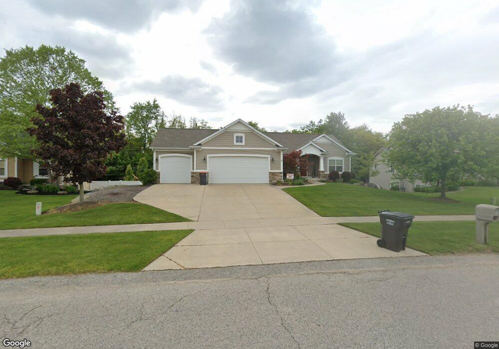
8673 Shore Way Dr SW Byron Center, MI 49315
Estimated Value: $480,933 - $609,000
3
Beds
3
Baths
1,730
Sq Ft
$318/Sq Ft
Est. Value
About This Home
This home is located at 8673 Shore Way Dr SW, Byron Center, MI 49315 and is currently estimated at $549,483, approximately $317 per square foot. 8673 Shore Way Dr SW is a home located in Kent County with nearby schools including Robert L. Nickels Intermediate School, Countryside Elementary School, and Byron Center West Middle School.
Ownership History
Date
Name
Owned For
Owner Type
Purchase Details
Closed on
Mar 30, 2020
Sold by
Vermurlen Joshua J
Bought by
Vermurlen Andrew S and Vermurlen Jackie
Current Estimated Value
Home Financials for this Owner
Home Financials are based on the most recent Mortgage that was taken out on this home.
Original Mortgage
$298,000
Outstanding Balance
$263,992
Interest Rate
3.4%
Mortgage Type
New Conventional
Estimated Equity
$285,491
Purchase Details
Closed on
Jun 19, 2006
Sold by
Vlaan Properties Inc
Bought by
Vermurlen Joshua J
Home Financials for this Owner
Home Financials are based on the most recent Mortgage that was taken out on this home.
Original Mortgage
$195,500
Interest Rate
6.73%
Mortgage Type
Construction
Create a Home Valuation Report for This Property
The Home Valuation Report is an in-depth analysis detailing your home's value as well as a comparison with similar homes in the area
Home Values in the Area
Average Home Value in this Area
Purchase History
| Date | Buyer | Sale Price | Title Company |
|---|---|---|---|
| Vermurlen Andrew S | $390,000 | None Available | |
| Vermurlen Joshua J | $52,900 | Lighthouse Title Inc |
Source: Public Records
Mortgage History
| Date | Status | Borrower | Loan Amount |
|---|---|---|---|
| Open | Vermurlen Andrew S | $298,000 | |
| Previous Owner | Vermurlen Joshua J | $195,500 |
Source: Public Records
Tax History Compared to Growth
Tax History
| Year | Tax Paid | Tax Assessment Tax Assessment Total Assessment is a certain percentage of the fair market value that is determined by local assessors to be the total taxable value of land and additions on the property. | Land | Improvement |
|---|---|---|---|---|
| 2025 | $3,845 | $217,100 | $0 | $0 |
| 2024 | $3,845 | $198,400 | $0 | $0 |
| 2023 | $3,677 | $185,900 | $0 | $0 |
| 2022 | $5,125 | $173,400 | $0 | $0 |
| 2021 | $4,988 | $159,400 | $0 | $0 |
| 2020 | $2,797 | $147,800 | $0 | $0 |
| 2019 | $4,022 | $144,800 | $0 | $0 |
| 2018 | $3,939 | $141,300 | $23,800 | $117,500 |
| 2017 | $3,726 | $125,600 | $0 | $0 |
| 2016 | $3,542 | $123,100 | $0 | $0 |
| 2015 | $3,482 | $123,100 | $0 | $0 |
| 2013 | -- | $111,800 | $0 | $0 |
Source: Public Records
Map
Nearby Homes
- 903 S Center Park Dr SW Unit 14
- 884 S Center Park Dr SW Unit 7
- 784 Petoskey Stone Dr
- 769 Sun Stone Dr SW
- 1729 Thyme Dr
- 760 Petoskey Stone SW
- 760 Petoskey Stone Dr
- The Fitzgerald Plan at Walnut Ridge
- The Marley Plan at Walnut Ridge
- The Hearthside Plan at Walnut Ridge
- The Balsam Plan at Walnut Ridge
- The Rutherford Plan at Walnut Ridge
- The Stockton Plan at Walnut Ridge
- The Georgetown Plan at Walnut Ridge
- The Mayfair Plan at Walnut Ridge
- The Birkshire II Plan at Walnut Ridge
- The Hadley Plan at Walnut Ridge
- The Jamestown Plan at Walnut Ridge
- The Crestview Plan at Walnut Ridge
- The Newport Plan at Walnut Ridge
- 8665 Shore Way Dr SW
- 8677 Shore Way Dr SW
- 8657 Shore Way Dr SW
- 8683 Shore Way Dr SW
- 8672 Shore Way Dr SW
- 8680 Shore Way Dr SW
- 8664 Shore Way Dr SW
- 8649 Shore Way Dr SW
- 8656 Shore Way Dr SW
- 1151 Shore Way Ct SW
- 8688 Shore Way Dr SW
- 8645 Shore Way Dr SW
- 8648 Shore Way Dr SW
- 1157 Shore Way Ct SW
- 1149 Shore Pointe SW
- 1169 Shore Way Ct SW
- 8640 Shore Way Dr SW
- 8637 Shore Way Dr SW
- 1131 Shore Point Dr SW
- 8705 Shore Way Dr SW