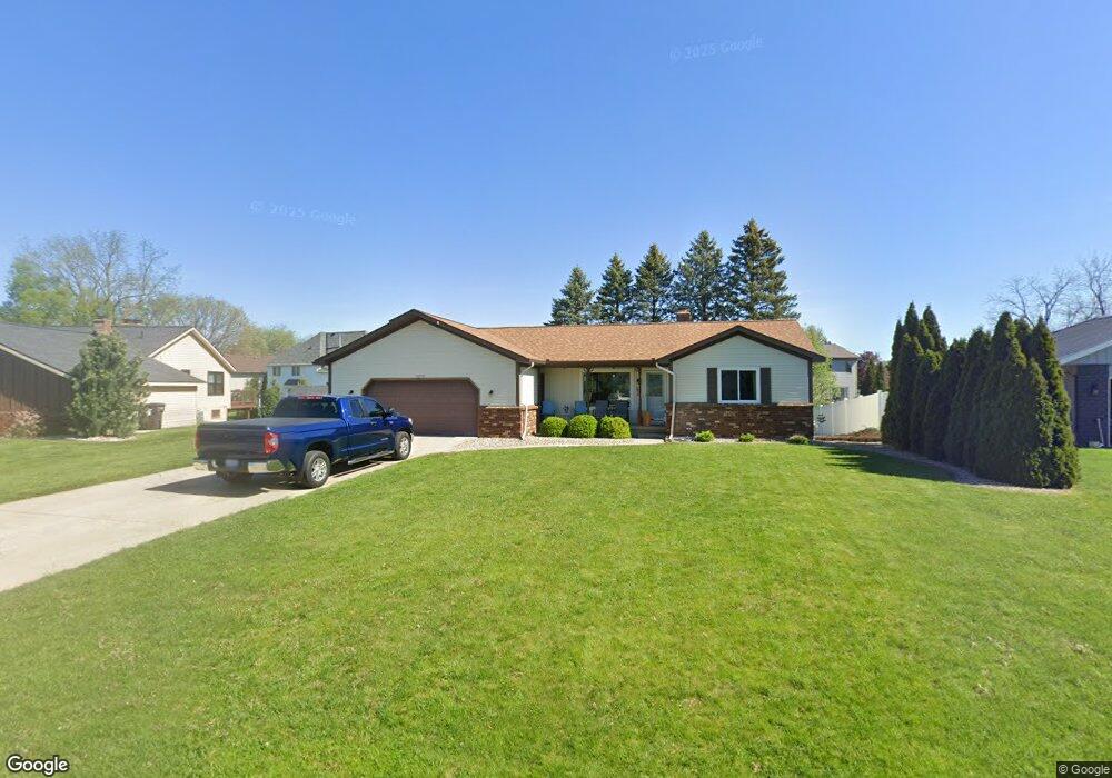
8678 Rivercrest Dr Jenison, MI 49428
Estimated Value: $341,000 - $388,000
4
Beds
2
Baths
2,300
Sq Ft
$158/Sq Ft
Est. Value
About This Home
This home is located at 8678 Rivercrest Dr, Jenison, MI 49428 and is currently estimated at $363,927, approximately $158 per square foot. 8678 Rivercrest Dr is a home located in Ottawa County with nearby schools including Bauerwood Elementary School, Jenison Junior High School, and Jenison High School.
Ownership History
Date
Name
Owned For
Owner Type
Purchase Details
Closed on
Dec 16, 2022
Sold by
Chase Calvin E and Chase Debra L
Bought by
Chase Calvin E and Chase Calvin E
Current Estimated Value
Purchase Details
Closed on
Feb 4, 2008
Sold by
John Karen and John Karen S
Bought by
Deutsche Bank National Trust Co and Gsamp Trust 2006-He1 Mortgage Pass Throu
Purchase Details
Closed on
Jan 10, 2008
Sold by
John Karen
Bought by
Deutsche Bank National Trust Co and Gsamp Trust 2006-He1 Mortgage Pass Throu
Purchase Details
Closed on
Jul 20, 2005
Sold by
John Larry W
Bought by
John Karen S
Home Financials for this Owner
Home Financials are based on the most recent Mortgage that was taken out on this home.
Original Mortgage
$164,900
Interest Rate
8.22%
Mortgage Type
Fannie Mae Freddie Mac
Create a Home Valuation Report for This Property
The Home Valuation Report is an in-depth analysis detailing your home's value as well as a comparison with similar homes in the area
Home Values in the Area
Average Home Value in this Area
Purchase History
| Date | Buyer | Sale Price | Title Company |
|---|---|---|---|
| Chase Calvin E | -- | Land Title | |
| Deutsche Bank National Trust Co | $5,000 | None Available | |
| Deutsche Bank National Trust Co | $114,750 | None Available | |
| John Karen S | -- | -- |
Source: Public Records
Mortgage History
| Date | Status | Borrower | Loan Amount |
|---|---|---|---|
| Previous Owner | John Karen S | $164,900 |
Source: Public Records
Tax History
| Year | Tax Paid | Tax Assessment Tax Assessment Total Assessment is a certain percentage of the fair market value that is determined by local assessors to be the total taxable value of land and additions on the property. | Land | Improvement |
|---|---|---|---|---|
| 2025 | $2,148 | $166,000 | $0 | $0 |
| 2024 | $21 | $153,400 | $0 | $0 |
| 2023 | $1,971 | $142,000 | $0 | $0 |
| 2022 | $2,164 | $117,800 | $0 | $0 |
| 2021 | $2,101 | $106,700 | $0 | $0 |
| 2020 | $2,078 | $103,100 | $0 | $0 |
| 2019 | $2,080 | $97,000 | $0 | $0 |
| 2018 | $1,939 | $91,700 | $0 | $0 |
| 2017 | $1,906 | $90,600 | $0 | $0 |
| 2016 | $1,894 | $86,300 | $0 | $0 |
| 2015 | $1,808 | $83,300 | $0 | $0 |
| 2014 | $1,808 | $74,200 | $0 | $0 |
Source: Public Records
Map
Nearby Homes
- 1468 Maplewood Dr Unit 9
- 1215 Sycamore Dr
- 8148 Greenridge Dr
- 2145 Bauer Rd
- 1941 Newcastle Dr
- 8081 Weatherwax Dr Unit 44
- 625 Summerset Dr
- 9067 Hollace Ct
- 8252 Lamplight Dr
- 7425 Boulder Bluff Dr Unit 112
- 7522 Melody Ln
- 7439 Eastlane Ave
- 2550 Willow View Dr
- 7391 Terrace Ln
- 2488 Cedar West Dr
- 7350 Glendora Ave
- 7425 Pinegrove Dr Unit 98
- 7373 Pinegrove Dr Unit 109
- 7341 Pinegrove Dr
- 2272 Baldwin St
- 8686 Rivercrest Dr
- 8674 Rivercrest Dr
- 1270 Astro Ct
- 1256 Astro Ct
- 1280 Astro Ct
- 8700 Rivercrest Dr
- 8668 Rivercrest Dr
- 8681 Rivercrest Dr
- 8671 Rivercrest Dr
- 1242 Astro Ct
- 8709 Astro Dr
- 8686 Caprice Dr
- 1284 Astro Ct
- 8660 Rivercrest Dr
- 8714 Rivercrest Dr
- 8659 Rivercrest Dr
- 8701 Astro Dr
- 1263 Astro Ct
- 8728 Rivercrest Dr
- 1277 Caprice Ct
Your Personal Tour Guide
Ask me questions while you tour the home.