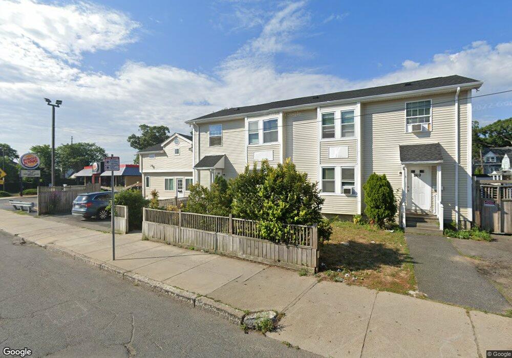
869 Cummins Hwy Mattapan, MA 02126
Mattapan Square NeighborhoodEstimated Value: $988,000 - $1,116,000
6
Beds
5
Baths
3,764
Sq Ft
$276/Sq Ft
Est. Value
About This Home
This home is located at 869 Cummins Hwy, Mattapan, MA 02126 and is currently estimated at $1,039,378, approximately $276 per square foot. 869 Cummins Hwy is a home located in Suffolk County with nearby schools including KIPP Academy Boston Charter School, Boston Preparatory Charter Public School, and Berea Seventh-day Adventist Academy.
Ownership History
Date
Name
Owned For
Owner Type
Purchase Details
Closed on
Nov 8, 2011
Sold by
Auguste Guerton M
Bought by
Auguste Colette
Current Estimated Value
Purchase Details
Closed on
Jun 4, 2001
Sold by
Worcester St Dev
Bought by
Auguste Guerton M
Home Financials for this Owner
Home Financials are based on the most recent Mortgage that was taken out on this home.
Original Mortgage
$223,600
Interest Rate
7.09%
Mortgage Type
Commercial
Purchase Details
Closed on
Aug 10, 1993
Sold by
Usa
Bought by
Cummins Hwy Rt
Home Financials for this Owner
Home Financials are based on the most recent Mortgage that was taken out on this home.
Original Mortgage
$30,000
Interest Rate
7.29%
Mortgage Type
Commercial
Create a Home Valuation Report for This Property
The Home Valuation Report is an in-depth analysis detailing your home's value as well as a comparison with similar homes in the area
Home Values in the Area
Average Home Value in this Area
Purchase History
| Date | Buyer | Sale Price | Title Company |
|---|---|---|---|
| Auguste Colette | -- | -- | |
| Auguste Guerton M | $279,500 | -- | |
| Cummins Hwy Rt | $27,500 | -- |
Source: Public Records
Mortgage History
| Date | Status | Borrower | Loan Amount |
|---|---|---|---|
| Previous Owner | Cummins Hwy Rt | $287,000 | |
| Previous Owner | Cummins Hwy Rt | $287,000 | |
| Previous Owner | Cummins Hwy Rt | $223,600 | |
| Previous Owner | Cummins Hwy Rt | $30,000 |
Source: Public Records
Tax History Compared to Growth
Tax History
| Year | Tax Paid | Tax Assessment Tax Assessment Total Assessment is a certain percentage of the fair market value that is determined by local assessors to be the total taxable value of land and additions on the property. | Land | Improvement |
|---|---|---|---|---|
| 2025 | $10,398 | $897,900 | $297,000 | $600,900 |
| 2024 | $9,835 | $902,300 | $267,600 | $634,700 |
| 2023 | $9,143 | $851,300 | $252,500 | $598,800 |
| 2022 | $9,262 | $851,300 | $252,500 | $598,800 |
| 2021 | $8,124 | $761,400 | $229,500 | $531,900 |
| 2020 | $6,393 | $605,400 | $231,000 | $374,400 |
| 2019 | $5,912 | $560,900 | $167,100 | $393,800 |
| 2018 | $5,249 | $500,900 | $167,100 | $333,800 |
| 2017 | $5,100 | $481,600 | $167,100 | $314,500 |
| 2016 | $4,816 | $437,800 | $167,100 | $270,700 |
| 2015 | $4,054 | $334,800 | $128,900 | $205,900 |
| 2014 | $3,900 | $310,000 | $128,900 | $181,100 |
Source: Public Records
Map
Nearby Homes
- 48-50 Rockdale St
- 95 Woodhaven St
- 10 Brockton St
- 770 Cummins Hwy Unit 1
- 770 Cummins Hwy Unit 22
- 90 Hollingsworth St
- 84 Blue Hills Pkwy
- 16 Blue Hill Ave
- 645 River St
- 23 Caton St
- 839-843 Cummins Hwy
- 1465 Blue Hill Ave
- 25 Alpine St Unit 7
- 27 Hawthorn Rd
- 24 Constitution Rd
- 4 Crossman St Unit 4
- 128 Blue Hills Pkwy
- 11 French St
- 231 Itasca St
- 96 Brook Rd
- 871 Cummins Hwy
- 8 Rockdale St Unit 10
- 8 Rockdale St Unit 2
- 10 Rockdale St Unit 2
- 12 Rockdale St Unit 14
- 853 Cummins Hwy
- 853 Cummins Hwy Unit 1
- 853 Cummins Hwy Unit 2
- 853 Cummins Hwy Unit 3
- 7 Rockdale St
- 16 Rockdale St Unit 18
- 849 Cummins Hwy
- 849 Cummins Hwy Unit 1
- 849 Cummins Hwy Unit 2
- 849 Cummins Hwy Unit 3
- 11 Rockdale St
- 876 Cummins Hwy Unit 3
- 876 Cummins Hwy Unit 1
- 884 Cummins Hwy Unit 8
- 15 Rockdale St