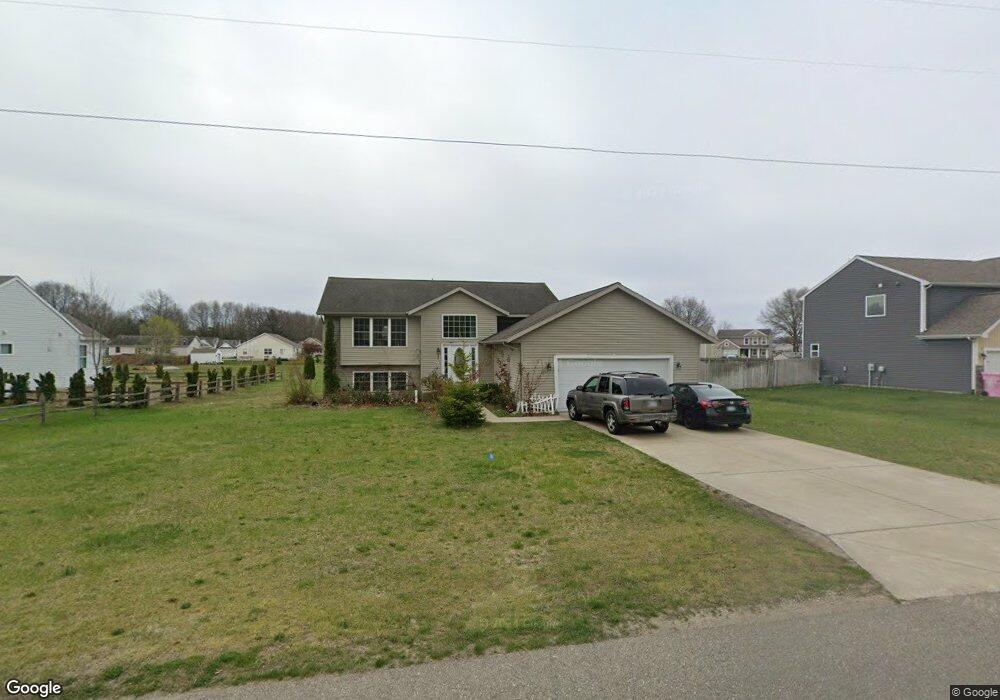
869 E Hile Rd Norton Shores, MI 49441
Estimated Value: $281,181 - $350,000
4
Beds
2
Baths
1,610
Sq Ft
$194/Sq Ft
Est. Value
About This Home
This home is located at 869 E Hile Rd, Norton Shores, MI 49441 and is currently estimated at $313,045, approximately $194 per square foot. 869 E Hile Rd is a home located in Muskegon County with nearby schools including Mona Shores High School, Edgewood Elementary Academy, and Dr. Martin Luther King Academy.
Ownership History
Date
Name
Owned For
Owner Type
Purchase Details
Closed on
Sep 8, 2023
Sold by
Ramo Amel Yousif and Ramo Tanya Hanna
Bought by
Ramo Amel Yousif and Ramo Tanya Hanna
Current Estimated Value
Purchase Details
Closed on
Dec 29, 2008
Sold by
Bush Terry and Bush Linda Scott
Bought by
Yousif Amel and Haseeb Tania
Home Financials for this Owner
Home Financials are based on the most recent Mortgage that was taken out on this home.
Original Mortgage
$112,000
Interest Rate
6.06%
Mortgage Type
Unknown
Purchase Details
Closed on
May 18, 2006
Sold by
Hile Properties Llc
Bought by
Bush Terry and Bush Linda Scott
Home Financials for this Owner
Home Financials are based on the most recent Mortgage that was taken out on this home.
Original Mortgage
$130,500
Interest Rate
6.56%
Mortgage Type
Construction
Create a Home Valuation Report for This Property
The Home Valuation Report is an in-depth analysis detailing your home's value as well as a comparison with similar homes in the area
Home Values in the Area
Average Home Value in this Area
Purchase History
| Date | Buyer | Sale Price | Title Company |
|---|---|---|---|
| Ramo Amel Yousif | -- | None Listed On Document | |
| Yousif Amel | $140,000 | None Available | |
| Bush Terry | -- | None Available |
Source: Public Records
Mortgage History
| Date | Status | Borrower | Loan Amount |
|---|---|---|---|
| Previous Owner | Yousif Amel | $112,000 | |
| Previous Owner | Bush Terry | $130,500 |
Source: Public Records
Tax History Compared to Growth
Tax History
| Year | Tax Paid | Tax Assessment Tax Assessment Total Assessment is a certain percentage of the fair market value that is determined by local assessors to be the total taxable value of land and additions on the property. | Land | Improvement |
|---|---|---|---|---|
| 2025 | $3,159 | $134,200 | $0 | $0 |
| 2024 | $2,476 | $123,200 | $0 | $0 |
| 2023 | $2,365 | $108,900 | $0 | $0 |
| 2022 | $2,883 | $94,700 | $0 | $0 |
| 2021 | $2,801 | $79,900 | $0 | $0 |
| 2020 | $2,770 | $77,700 | $0 | $0 |
| 2019 | $2,719 | $69,600 | $0 | $0 |
| 2018 | $2,655 | $69,800 | $0 | $0 |
| 2017 | $2,594 | $70,400 | $0 | $0 |
| 2016 | $2,009 | $68,900 | $0 | $0 |
| 2015 | -- | $68,000 | $0 | $0 |
| 2014 | $2,410 | $65,400 | $0 | $0 |
| 2013 | -- | $65,200 | $0 | $0 |
Source: Public Records
Map
Nearby Homes
- 4638 Lauren Dr
- 945 Petrie Ave
- 1065 Wilson Ct
- 1067 Aspen Dr
- 4476 Cedar Ln Unit 54
- 4468 Spruce Ct
- 4535 Thompson Rd
- 4875 Paul Ct
- V/L E Ellis Rd
- 1068 Englewood Ave
- 1130 Englewood Ave
- V/L 4535 Thompson Rd
- 4102 Highgate Rd
- 1404 E Ellis Rd
- 1283 E Ellis Rd Unit 18
- 1283 E Ellis Rd Unit 20
- 1283 E Ellis Rd Unit 19
- 1283 E Ellis Rd Unit 21
- 4677 Harvey St
- 1201 Shettler Rd
- 863 E Hile Rd
- 863 E Hile Rd
- 840 E Hile Rd
- 870 E Hile Rd
- 836 Torrie Cir
- 4613 Lauren Dr
- 880 E Hile Rd
- 4625 Lauren Dr
- 842 Torrie Cir
- 848 Torrie Cir
- 856 Torrie Cir
- 4637 Lauren Dr Unit 31
- 864 Torrie Cir Unit 26
- 4649 Lauren Dr
- 890 E Hile Rd
- 816 E Hile Rd
- 882 Torrie Cir
- 894 Torrie Cir
- 4616 Lauren Dr
- 831 Torrie Cir