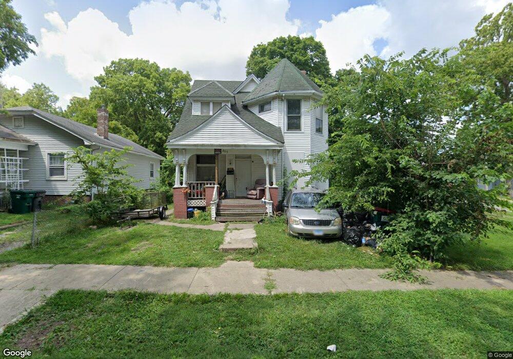
869 N College St Decatur, IL 62522
Estimated Value: $30,000 - $61,000
--
Bed
--
Bath
1,013
Sq Ft
$42/Sq Ft
Est. Value
About This Home
This home is located at 869 N College St, Decatur, IL 62522 and is currently estimated at $42,862, approximately $42 per square foot. 869 N College St is a home located in Macon County with nearby schools including Hope Academy, St. Patrick School, and Teen Challenge-Home For Girls.
Ownership History
Date
Name
Owned For
Owner Type
Purchase Details
Closed on
Aug 1, 1985
Current Estimated Value
Create a Home Valuation Report for This Property
The Home Valuation Report is an in-depth analysis detailing your home's value as well as a comparison with similar homes in the area
Home Values in the Area
Average Home Value in this Area
Purchase History
| Date | Buyer | Sale Price | Title Company |
|---|---|---|---|
| -- | $9,000 | -- |
Source: Public Records
Tax History Compared to Growth
Tax History
| Year | Tax Paid | Tax Assessment Tax Assessment Total Assessment is a certain percentage of the fair market value that is determined by local assessors to be the total taxable value of land and additions on the property. | Land | Improvement |
|---|---|---|---|---|
| 2024 | $445 | $4,600 | $436 | $4,164 |
| 2023 | $442 | $4,438 | $421 | $4,017 |
| 2022 | $428 | $4,183 | $389 | $3,794 |
| 2021 | $402 | $3,907 | $364 | $3,543 |
| 2020 | $396 | $0 | $0 | $0 |
| 2019 | $396 | $3,726 | $348 | $3,378 |
| 2018 | $424 | $4,038 | $273 | $3,765 |
| 2017 | $434 | $4,146 | $280 | $3,866 |
| 2016 | $443 | $4,188 | $283 | $3,905 |
| 2015 | $421 | $4,114 | $278 | $3,836 |
| 2014 | $346 | $3,587 | $455 | $3,132 |
| 2013 | $355 | $3,722 | $472 | $3,250 |
Source: Public Records
Map
Nearby Homes
- 415 W Green St
- 844 N Edward St
- 875 N Monroe St
- 1245 N Union St
- 837 W Grand Ave
- 422 W William St
- 330 W William St
- 141 E Packard St
- 609 W William St
- 254 N Pine St
- 1065 W Green St
- 452 W Prairie Ave
- 233 N Edward St
- 442 W Prairie Ave
- 366 W Prairie Ave
- 1545 N Monroe St
- 1504 N Monroe St
- 1458 N Union St
- 958 W William St
- 717 W Prairie Ave Unit 2
- 861 N College St
- 525 W King St
- 853 N College St
- 555 W King St
- 532 W King St
- 905 N College St
- 475 W King St
- 909 N College St
- 465 W King St
- 842 N College St
- 842 N Monroe St
- 455 W King St
- 825 N College St
- 904 N College St
- 445 W King St
- 916 N College St
- 826 N College St
- 836 N College St
- 811 N College St
- 435 W King St