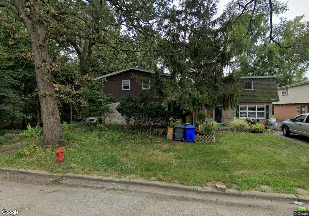
8695 Circle Dr Brookfield, IL 60513
Estimated Value: $253,000 - $535,293
4
Beds
2
Baths
2,870
Sq Ft
$140/Sq Ft
Est. Value
About This Home
This home is located at 8695 Circle Dr, Brookfield, IL 60513 and is currently estimated at $402,073, approximately $140 per square foot. 8695 Circle Dr is a home located in Cook County with nearby schools including Lincoln Elementary School, George Washington Middle School, and J. Sterling Morton High School West.
Ownership History
Date
Name
Owned For
Owner Type
Purchase Details
Closed on
Jun 9, 2017
Sold by
Cit Bank Na
Bought by
Chicago Title Land Trust Co and Trust Agreement 8002374879
Current Estimated Value
Purchase Details
Closed on
Jan 5, 2016
Sold by
Janikas Cathleen J and Janikas Cathy
Bought by
Cit Bank Na
Purchase Details
Closed on
Aug 16, 1993
Sold by
Pinnacle Bank
Bought by
Janikas Raymond J and Janikas Cathleen J
Home Financials for this Owner
Home Financials are based on the most recent Mortgage that was taken out on this home.
Original Mortgage
$77,000
Interest Rate
7.15%
Create a Home Valuation Report for This Property
The Home Valuation Report is an in-depth analysis detailing your home's value as well as a comparison with similar homes in the area
Home Values in the Area
Average Home Value in this Area
Purchase History
| Date | Buyer | Sale Price | Title Company |
|---|---|---|---|
| Chicago Title Land Trust Co | $50,000 | Fidelity National Title | |
| Cit Bank Na | -- | Attorney | |
| Janikas Raymond J | -- | -- |
Source: Public Records
Mortgage History
| Date | Status | Borrower | Loan Amount |
|---|---|---|---|
| Previous Owner | Janikas Raymond J | $77,000 |
Source: Public Records
Tax History
| Year | Tax Paid | Tax Assessment Tax Assessment Total Assessment is a certain percentage of the fair market value that is determined by local assessors to be the total taxable value of land and additions on the property. | Land | Improvement |
|---|---|---|---|---|
| 2025 | $18,141 | $56,000 | $5,451 | $50,549 |
| 2024 | $18,141 | $56,000 | $5,451 | $50,549 |
| 2023 | $10,908 | $56,000 | $5,451 | $50,549 |
| 2022 | $10,908 | $27,993 | $4,740 | $23,253 |
| 2021 | $10,444 | $27,992 | $4,740 | $23,252 |
| 2020 | $10,104 | $27,992 | $4,740 | $23,252 |
| 2019 | $17,384 | $47,675 | $4,266 | $43,409 |
| 2018 | $16,963 | $47,675 | $4,266 | $43,409 |
| 2017 | $16,404 | $47,675 | $4,266 | $43,409 |
| 2016 | $14,696 | $39,973 | $3,792 | $36,181 |
| 2015 | $14,334 | $39,973 | $3,792 | $36,181 |
| 2014 | $14,126 | $39,973 | $3,792 | $36,181 |
| 2013 | $13,577 | $41,843 | $3,792 | $38,051 |
Source: Public Records
Map
Nearby Homes
- 8636 40th St
- 3901 Custer Ave
- 3845 Mccormick Ave
- 4040 Rose Ave
- 4053 Rose Ave
- 4038 Grove Ave
- 8803 Ogden Ave
- 4120 Grove Ave
- 8424 Greenview Ave
- 8667 Plainfield Rd
- 4243 Konrad Ave
- 4247 Anna Ave
- 213 W Quincy St Unit 1
- 4249 Custer Ave
- 9016 Southview Ave
- 4023 Oak Ave
- 8625 43rd St
- 3708 Sunnyside Ave
- 9031 Fairview Ave
- 4230 Prairie Ave
- 8697 Circle Dr
- 8697 Circle Dr Unit F
- 8699 Circle Dr
- 8701 Circle Dr
- 3911 Circle Dr
- 8703 Circle Dr
- 8703 Circle Dr
- 3907 Circle Dr
- 8705 Circle Dr
- 3908 Circle Dr
- 3903 Circle Dr
- 3904 Circle Dr
- 3901 Circle Dr
- 8709 Circle Dr Unit 2
- 8709 Circle Dr
- 8708 Circle Dr
- 3900 Circle Dr
- 8710 Circle Dr
- 8641 Patricia Dr
- 8635 Patricia Dr
Your Personal Tour Guide
Ask me questions while you tour the home.