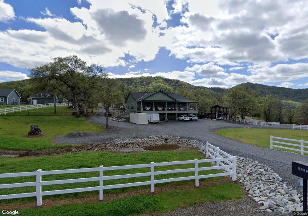
8695 John Day Dr Gold Hill, OR 97525
Estimated Value: $904,057 - $1,085,000
4
Beds
3
Baths
2,529
Sq Ft
$400/Sq Ft
Est. Value
About This Home
This home is located at 8695 John Day Dr, Gold Hill, OR 97525 and is currently estimated at $1,010,686, approximately $399 per square foot. 8695 John Day Dr is a home located in Jackson County with nearby schools including Sams Valley Elementary School and Crater High School.
Ownership History
Date
Name
Owned For
Owner Type
Purchase Details
Closed on
May 24, 2022
Sold by
Paris Brice D
Bought by
Paris Living Trust
Current Estimated Value
Purchase Details
Closed on
Oct 4, 2006
Sold by
Salyer Jim and Salyer Jodi
Bought by
Paris Brice D and Paris Kathleen G
Home Financials for this Owner
Home Financials are based on the most recent Mortgage that was taken out on this home.
Original Mortgage
$500,800
Interest Rate
6.43%
Mortgage Type
Purchase Money Mortgage
Purchase Details
Closed on
Dec 10, 2004
Sold by
Smith James F and Smith Diane K
Bought by
Salyer Jim and Salyer Jodi
Create a Home Valuation Report for This Property
The Home Valuation Report is an in-depth analysis detailing your home's value as well as a comparison with similar homes in the area
Home Values in the Area
Average Home Value in this Area
Purchase History
| Date | Buyer | Sale Price | Title Company |
|---|---|---|---|
| Paris Living Trust | -- | None Listed On Document | |
| Paris Brice D | $626,000 | Lawyers Title Ins | |
| Salyer Jim | $71,000 | First American |
Source: Public Records
Mortgage History
| Date | Status | Borrower | Loan Amount |
|---|---|---|---|
| Previous Owner | Paris Brice D | $500,800 |
Source: Public Records
Tax History Compared to Growth
Tax History
| Year | Tax Paid | Tax Assessment Tax Assessment Total Assessment is a certain percentage of the fair market value that is determined by local assessors to be the total taxable value of land and additions on the property. | Land | Improvement |
|---|---|---|---|---|
| 2025 | $6,220 | $513,310 | $91,870 | $421,440 |
| 2024 | $6,220 | $498,360 | $127,740 | $370,620 |
| 2023 | $6,014 | $483,850 | $124,020 | $359,830 |
| 2022 | $5,823 | $483,850 | $124,020 | $359,830 |
| 2021 | $5,657 | $469,760 | $120,400 | $349,360 |
| 2020 | $5,492 | $456,080 | $116,900 | $339,180 |
| 2019 | $5,366 | $429,910 | $110,180 | $319,730 |
| 2018 | $5,200 | $417,390 | $106,960 | $310,430 |
| 2017 | $5,077 | $417,390 | $106,960 | $310,430 |
| 2016 | $4,929 | $393,440 | $100,830 | $292,610 |
| 2015 | $4,748 | $393,440 | $100,830 | $292,610 |
| 2014 | $4,634 | $370,870 | $95,050 | $275,820 |
Source: Public Records
Map
Nearby Homes
- 11926 Blackwell Rd
- 11427 Blackwell Rd Unit 22
- 11427 Blackwell Rd Unit 2
- 8785 Blackwell Rd Unit North Side
- 8785 Blackwell Rd Unit South Side
- 8785 Blackwell Rd
- 4413 Merita Terrace
- 4223 Merita Terrace
- 6169 Tamarack Ln
- 14080 Highway 234
- 127 4th Ave
- 9816 Old Stage Rd
- 5142 Rogue River Hwy
- 10695 Killdee Ave
- 505 4th Ave
- 6251 Ventura Ln
- 6048 Tolo Rd
- 860 5th Ave
- 935 4th Ave
- 8401 Old Stage Rd Unit 27
- 8685 John Day Dr
- 8685 John Day Dr
- 8633 John Day Dr
- 8719 John Day Dr
- 5529 Fishers Ferry Rd
- 5529 Fishers Ferry
- 7000 Steelhead Place Unit 2
- 5535 Fishers Ferry
- 5565 Fishers Ferry
- 5565 Fishers Ferry Rd
- 7002 Steelhead Place
- 5620 Fishers Ferry
- 0 Steelhead Place
- 5595 Fishers Ferry
- 7021 Steelhead Place
- 8725 John Day Dr
- 7025 Steelhead Place
- 8908 John Day Dr
- 7007 Steelhead Place
- 8747 John Day Dr