Estimated Value: $832,457 - $970,000
7
Beds
2
Baths
3,852
Sq Ft
$235/Sq Ft
Est. Value
About This Home
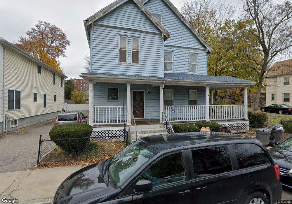
This home is located at 87 Bird St, Dorchester, MA 02125 and is currently estimated at $903,614, approximately $234 per square foot. 87 Bird St is a home located in Suffolk County with nearby schools including Uncommon Schools Roxbury Prep Dorchester Campus.
Ownership History
Date
Name
Owned For
Owner Type
Purchase Details
Closed on
Dec 1, 1998
Sold by
Miller Dard A and Huff Edwin L
Bought by
Beato Henry
Current Estimated Value
Purchase Details
Closed on
Sep 11, 1996
Sold by
Brown George and Brown Florence
Bought by
Brooks Melvin L and Brooks Cheryl J
Create a Home Valuation Report for This Property
The Home Valuation Report is an in-depth analysis detailing your home's value as well as a comparison with similar homes in the area
Home Values in the Area
Average Home Value in this Area
Purchase History
| Date | Buyer | Sale Price | Title Company |
|---|---|---|---|
| Beato Henry | $177,900 | -- | |
| Brooks Melvin L | $70,000 | -- |
Source: Public Records
Mortgage History
| Date | Status | Borrower | Loan Amount |
|---|---|---|---|
| Open | Brooks Melvin L | $243,000 | |
| Closed | Brooks Melvin L | $60,000 |
Source: Public Records
Tax History Compared to Growth
Tax History
| Year | Tax Paid | Tax Assessment Tax Assessment Total Assessment is a certain percentage of the fair market value that is determined by local assessors to be the total taxable value of land and additions on the property. | Land | Improvement |
|---|---|---|---|---|
| 2025 | $8,072 | $697,100 | $261,000 | $436,100 |
| 2024 | $7,589 | $696,200 | $322,000 | $374,200 |
| 2023 | $6,986 | $650,500 | $300,900 | $349,600 |
| 2022 | $6,322 | $581,100 | $268,800 | $312,300 |
| 2021 | $5,795 | $543,100 | $251,200 | $291,900 |
| 2020 | $4,955 | $469,200 | $201,600 | $267,600 |
| 2019 | $4,298 | $407,800 | $154,600 | $253,200 |
| 2018 | $3,886 | $370,800 | $154,600 | $216,200 |
| 2017 | $3,812 | $360,000 | $154,600 | $205,400 |
| 2016 | $3,960 | $360,000 | $154,600 | $205,400 |
| 2015 | $4,074 | $336,400 | $119,500 | $216,900 |
| 2014 | $3,832 | $304,600 | $119,500 | $185,100 |
Source: Public Records
Map
Nearby Homes
- 173 Magnolia St Unit 5
- 42 Monadnock St
- 47 Sargent St Unit 3
- 5 Wheelock Ave
- 96-98 Woodledge St
- 18 Sargent St Unit B
- 3 Ware St
- 35 Cunningham St
- 22 Ronan St
- 130 Howard Ave
- 60 Stanley St Unit 301
- 60 Stanley St Unit 302
- 60 Stanley St
- 60 Stanley St Unit 101
- 53 Woodford St
- 163 Howard Ave
- 38 Woodford St
- 20 Rill St
- 52 Bellevue St Unit 1
- 52 Bellevue St Unit 2
- 00 William t Morrissey Blvd
- 91 Bird St
- 89 Bird St
- 79 Bird St
- 97 Bird St
- 73 Bird St
- 80 Glendale St
- 6 Cedar Place
- 92 Bird St
- 4 Cedar Place
- 69 Bird St
- 78 Glendale St
- 76-78 Bird St Unit 78
- 76 Bird St Unit 78
- 25 Bodwell St
- 25 Bodwell St Unit 1
- 2 Cedar Place
- 72 Bird St Unit 74
- 65 Bird St
- 72 Glendale St Unit 74