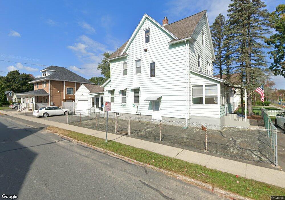
87 Boulevard Place West Springfield, MA 01089
Estimated Value: $312,000 - $393,000
3
Beds
2
Baths
1,838
Sq Ft
$194/Sq Ft
Est. Value
About This Home
This home is located at 87 Boulevard Place, West Springfield, MA 01089 and is currently estimated at $356,437, approximately $193 per square foot. 87 Boulevard Place is a home located in Hampden County with nearby schools including Hampden Charter School of Science West and St Thomas The Apostle School.
Ownership History
Date
Name
Owned For
Owner Type
Purchase Details
Closed on
Apr 13, 2005
Sold by
Newell Thomas H
Bought by
Newell Joan L and Newell Thomas H
Current Estimated Value
Home Financials for this Owner
Home Financials are based on the most recent Mortgage that was taken out on this home.
Original Mortgage
$125,000
Outstanding Balance
$64,505
Interest Rate
5.78%
Mortgage Type
Purchase Money Mortgage
Estimated Equity
$291,932
Create a Home Valuation Report for This Property
The Home Valuation Report is an in-depth analysis detailing your home's value as well as a comparison with similar homes in the area
Home Values in the Area
Average Home Value in this Area
Purchase History
| Date | Buyer | Sale Price | Title Company |
|---|---|---|---|
| Newell Joan L | -- | -- |
Source: Public Records
Mortgage History
| Date | Status | Borrower | Loan Amount |
|---|---|---|---|
| Open | Newell Joan L | $125,000 | |
| Previous Owner | Newell Joan L | $33,923 | |
| Previous Owner | Newell Joan L | $20,000 | |
| Previous Owner | Newell Joan L | $35,000 |
Source: Public Records
Tax History Compared to Growth
Tax History
| Year | Tax Paid | Tax Assessment Tax Assessment Total Assessment is a certain percentage of the fair market value that is determined by local assessors to be the total taxable value of land and additions on the property. | Land | Improvement |
|---|---|---|---|---|
| 2025 | $4,497 | $302,400 | $112,100 | $190,300 |
| 2024 | $4,233 | $285,800 | $112,100 | $173,700 |
| 2023 | $4,020 | $258,700 | $112,100 | $146,600 |
| 2022 | $3,628 | $230,200 | $101,700 | $128,500 |
| 2021 | $3,299 | $195,200 | $79,800 | $115,400 |
| 2020 | $3,305 | $194,500 | $79,800 | $114,700 |
| 2019 | $3,299 | $194,500 | $79,800 | $114,700 |
| 2018 | $3,316 | $194,500 | $79,800 | $114,700 |
| 2017 | $3,316 | $194,500 | $79,800 | $114,700 |
| 2016 | $3,225 | $189,800 | $75,100 | $114,700 |
| 2015 | $3,160 | $186,000 | $73,500 | $112,500 |
| 2014 | $513 | $186,100 | $73,500 | $112,600 |
Source: Public Records
Map
Nearby Homes
- 87 North Blvd
- 12 Angeline St
- 18 Angeline St
- 77 Boulevard Place
- 11 Maple St
- 101 North Blvd
- 17 Angeline St
- 17 Maple St
- 71 Boulevard Place
- 82 Boulevard Place
- 94 North Blvd
- 94 Boulevard Place
- 23 Angeline St
- 23 Maple St
- 23 Maple St Unit FL2
- 65 Boulevard Place
- 113 North Blvd
- 119 North Blvd
- 14 Maple St
- 32 Angeline St