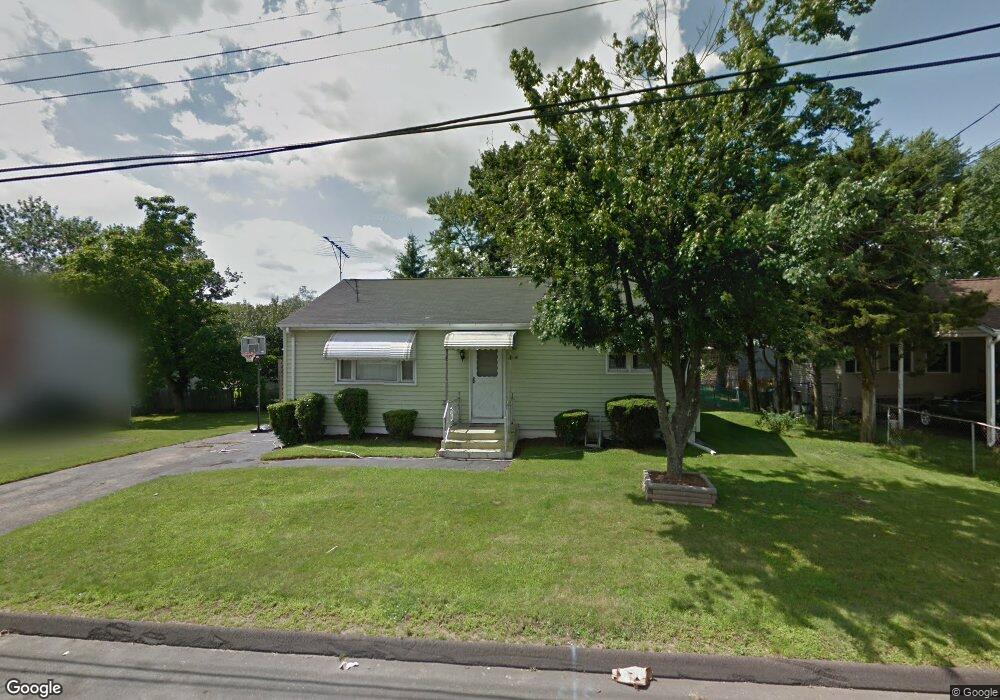
87 Dalton St West Haven, CT 06516
Allingtown NeighborhoodEstimated Value: $248,000 - $324,000
3
Beds
1
Bath
1,176
Sq Ft
$249/Sq Ft
Est. Value
About This Home
This home is located at 87 Dalton St, West Haven, CT 06516 and is currently estimated at $292,429, approximately $248 per square foot. 87 Dalton St is a home located in New Haven County with nearby schools including Carrigan 5/6 Intermediate School, Harry M. Bailey Middle School, and West Haven High School.
Ownership History
Date
Name
Owned For
Owner Type
Purchase Details
Closed on
Dec 1, 2000
Sold by
Weir Elizabeth P Est and Festa
Bought by
Galloway Patricia F
Current Estimated Value
Home Financials for this Owner
Home Financials are based on the most recent Mortgage that was taken out on this home.
Original Mortgage
$77,710
Outstanding Balance
$28,761
Interest Rate
7.76%
Mortgage Type
Purchase Money Mortgage
Estimated Equity
$263,668
Create a Home Valuation Report for This Property
The Home Valuation Report is an in-depth analysis detailing your home's value as well as a comparison with similar homes in the area
Home Values in the Area
Average Home Value in this Area
Purchase History
| Date | Buyer | Sale Price | Title Company |
|---|---|---|---|
| Galloway Patricia F | $82,000 | -- | |
| Galloway Patricia F | $82,000 | -- |
Source: Public Records
Mortgage History
| Date | Status | Borrower | Loan Amount |
|---|---|---|---|
| Open | Galloway Patricia F | $77,710 | |
| Closed | Galloway Patricia F | $77,710 | |
| Closed | Galloway Patricia F | $3,600 |
Source: Public Records
Tax History Compared to Growth
Tax History
| Year | Tax Paid | Tax Assessment Tax Assessment Total Assessment is a certain percentage of the fair market value that is determined by local assessors to be the total taxable value of land and additions on the property. | Land | Improvement |
|---|---|---|---|---|
| 2025 | $5,759 | $169,330 | $63,560 | $105,770 |
| 2024 | $5,159 | $107,730 | $44,030 | $63,700 |
| 2023 | $5,001 | $107,730 | $44,030 | $63,700 |
| 2022 | $4,914 | $107,730 | $44,030 | $63,700 |
| 2021 | $4,915 | $107,730 | $44,030 | $63,700 |
| 2020 | $4,831 | $93,800 | $35,700 | $58,100 |
| 2019 | $4,756 | $93,800 | $35,700 | $58,100 |
| 2018 | $4,626 | $93,800 | $35,700 | $58,100 |
| 2017 | $4,482 | $93,800 | $35,700 | $58,100 |
| 2016 | $4,346 | $93,800 | $35,700 | $58,100 |
| 2015 | $4,176 | $102,620 | $38,360 | $64,260 |
| 2014 | $4,092 | $102,620 | $38,360 | $64,260 |
Source: Public Records
Map
Nearby Homes
- 57 Dalton St
- 265 Tuthill St
- 7 Ipswich St
- 96 Medford St
- 62 Tuthill St
- 63 Cynthia Dr
- 194 Homeside Ave
- 84 Eileen Rd
- 588 Summit Dr
- 53 Pheasant Rd
- 342 W Spring St
- 49 Glade St Unit A4
- 47,47R,63,65R Coleman St
- 70 Coleman St
- 81 Homeside Ave
- 157 Bull Hill Ln Unit 102
- 12 Linda St
- 148 Kennedy Dr
- 79 Claudia Dr Unit 153
- 79 Claudia Dr Unit 256
- 81 Dalton St
- 93 Dalton St
- 104 Canton St
- 98 Canton St
- 1055 Orange Ave
- 96 Canton St
- 100 Canton St
- 79 Dalton St
- 111 Dalton St
- 1055 Boston Post Rd Unit STE A
- 1055 Boston Post Rd Unit A3
- 1055 Boston Post Rd Unit F3
- 1055 Boston Post Rd
- 1055 Boston Post Rd Unit 23
- 1055 Boston Post Rd Unit 3
- 128 Canton St
- 92 Canton St
- 69 Dalton St
- 89 Canton St
- 87 Canton St