Estimated Value: $158,890 - $174,000
--
Bed
2
Baths
2,248
Sq Ft
$73/Sq Ft
Est. Value
About This Home
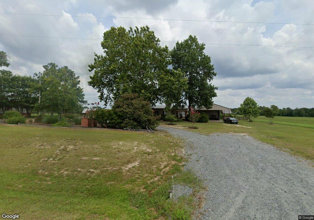
This home is located at 87 Ga Highway 127, Mauk, GA 31058 and is currently estimated at $164,630, approximately $73 per square foot. 87 Ga Highway 127 is a home located in Marion County with nearby schools including L.K. Moss Elementary School and Marion County Middle/High School.
Ownership History
Date
Name
Owned For
Owner Type
Purchase Details
Closed on
Nov 24, 2015
Sold by
Grier Justin and Grier Tebetha
Bought by
Grier Dean and Grier Susan
Current Estimated Value
Purchase Details
Closed on
Aug 10, 2010
Sold by
Grier Dean
Bought by
Grier Dean and Grier Susan
Purchase Details
Closed on
Jul 14, 1998
Sold by
Grier Dean and Grier Susan
Bought by
Grier Dean and Grier Susan
Purchase Details
Closed on
Jun 10, 1996
Bought by
Grier Dean and Grier Susan
Create a Home Valuation Report for This Property
The Home Valuation Report is an in-depth analysis detailing your home's value as well as a comparison with similar homes in the area
Home Values in the Area
Average Home Value in this Area
Purchase History
| Date | Buyer | Sale Price | Title Company |
|---|---|---|---|
| Grier Dean | -- | -- | |
| Grier Dean | -- | -- | |
| Grier Dean | $1,000 | -- | |
| Grier Dean | $1,000 | -- |
Source: Public Records
Tax History Compared to Growth
Tax History
| Year | Tax Paid | Tax Assessment Tax Assessment Total Assessment is a certain percentage of the fair market value that is determined by local assessors to be the total taxable value of land and additions on the property. | Land | Improvement |
|---|---|---|---|---|
| 2024 | $716 | $39,031 | $1,673 | $37,358 |
| 2023 | $730 | $39,031 | $1,673 | $37,358 |
| 2022 | $700 | $37,555 | $1,673 | $35,882 |
| 2021 | $695 | $37,555 | $1,673 | $35,882 |
| 2020 | $701 | $37,555 | $1,673 | $35,882 |
| 2019 | $698 | $37,555 | $1,673 | $35,882 |
| 2018 | $851 | $37,555 | $1,673 | $35,882 |
| 2017 | $919 | $37,555 | $1,673 | $35,882 |
| 2016 | $916 | $40,902 | $2,138 | $38,764 |
| 2015 | -- | $40,901 | $2,138 | $38,764 |
| 2014 | -- | $40,064 | $1,300 | $38,764 |
| 2013 | -- | $40,901 | $2,137 | $38,763 |
Source: Public Records
Map
Nearby Homes
- 5264 Georgia 41
- 349 New Hope Rd
- 0 Pineknot Rd
- 0 Fuller Rd Unit 22846458
- 245 Dog Track Rd
- 1164 Pineknot Rd
- 301 Blueville Rd
- 0 Palmer Cemetery Rd Unit 10588100
- 111 Sunnyside Dr
- 1675 Joe Wells Rd
- 65 Saddle Trail
- 2450 Fort Perry Rd
- 81 Brady Rd
- 117 Buttercup Ln
- 221 Flamingo Dr
- 0 Poll Mill Rd
- 1009 Walter Wells Rd
- 62 Brannon Montgomery Rd
- 11.36 Rd
- 0 Georgia 240
- 73 Ga Highway 127
- 17 Ga Highway 127
- 2 Ga Highway 127
- 5100 Georgia 41
- 5033 Ga Highway 41 N
- 42 Zuber Anthony Rd
- 5017 Ga Highway 41 N
- 30 Firehouse Rd
- 5100 Georgia 41
- 5100 Ga Highway 41 N
- 5100 Ga Highway 41 N
- 5100 Ga Highway 41 N
- 5100 N Ga Hwy 0041 N
- 5113 Ga Highway 41 N
- 53 Firehouse Rd
- 5135 Ga Highway 41 N
- 5155 Ga Highway 41 N
- 100 Firehouse Rd
- 64 Pope Ln
- 32 Dalmation Dr