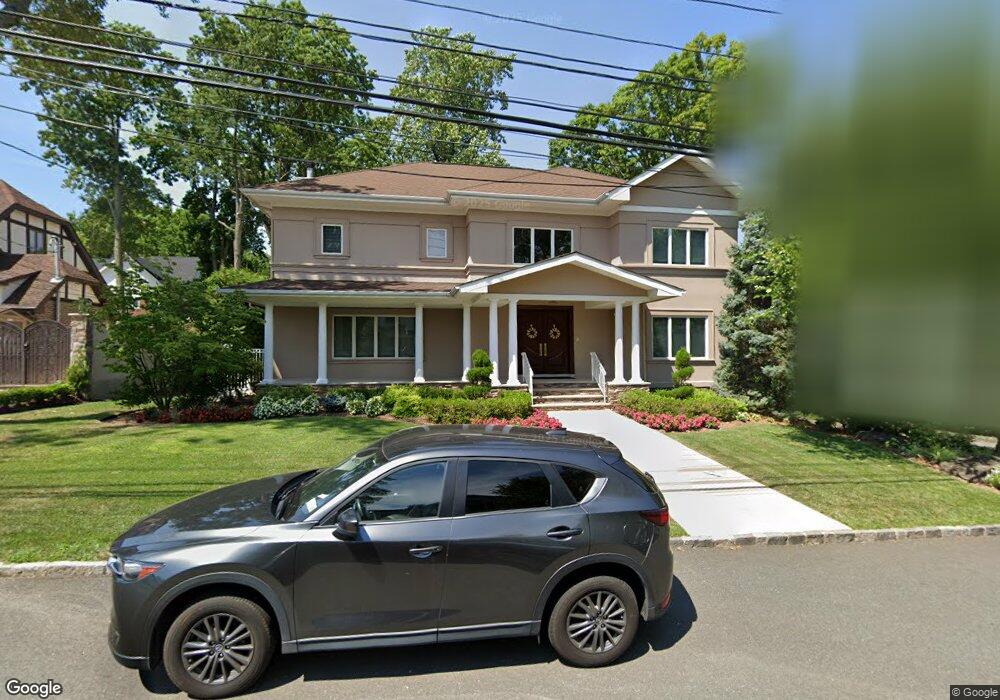
87 Merrick Ave Staten Island, NY 10301
Todt Hill NeighborhoodEstimated Value: $1,579,709 - $1,921,000
3
Beds
2
Baths
1,564
Sq Ft
$1,121/Sq Ft
Est. Value
About This Home
This home is located at 87 Merrick Ave, Staten Island, NY 10301 and is currently estimated at $1,753,677, approximately $1,121 per square foot. 87 Merrick Ave is a home located in Richmond County with nearby schools including P.S. 11 Thomas Dongan School, Myra S. Barnes Intermediate School 24, and Susan E Wagner High School.
Ownership History
Date
Name
Owned For
Owner Type
Purchase Details
Closed on
Mar 7, 2024
Sold by
Healy Michael B and Healy Janet M
Bought by
Michael B Healy And Janet Rampulla-Healy Irre and Healy
Current Estimated Value
Purchase Details
Closed on
Jul 7, 2000
Sold by
Massa Margaret
Bought by
Healy Michael B and Rampolla Healy Janet M
Home Financials for this Owner
Home Financials are based on the most recent Mortgage that was taken out on this home.
Original Mortgage
$250,000
Interest Rate
8.1%
Mortgage Type
Purchase Money Mortgage
Create a Home Valuation Report for This Property
The Home Valuation Report is an in-depth analysis detailing your home's value as well as a comparison with similar homes in the area
Home Values in the Area
Average Home Value in this Area
Purchase History
| Date | Buyer | Sale Price | Title Company |
|---|---|---|---|
| Michael B Healy And Janet Rampulla-Healy Irre | -- | None Listed On Document | |
| Healy Michael B | $602,000 | Stewart Title Insurance Co |
Source: Public Records
Mortgage History
| Date | Status | Borrower | Loan Amount |
|---|---|---|---|
| Previous Owner | Healy Michael B | $250,000 |
Source: Public Records
Tax History Compared to Growth
Tax History
| Year | Tax Paid | Tax Assessment Tax Assessment Total Assessment is a certain percentage of the fair market value that is determined by local assessors to be the total taxable value of land and additions on the property. | Land | Improvement |
|---|---|---|---|---|
| 2025 | $15,425 | $84,240 | $27,948 | $56,292 |
| 2024 | $15,425 | $76,800 | $34,471 | $42,329 |
| 2023 | $17,539 | $86,360 | $28,511 | $57,849 |
| 2022 | $16,264 | $84,900 | $28,920 | $55,980 |
| 2021 | $16,175 | $76,860 | $28,920 | $47,940 |
| 2020 | $17,983 | $84,960 | $28,920 | $56,040 |
| 2019 | $19,292 | $92,220 | $28,920 | $63,300 |
| 2018 | $17,793 | $87,283 | $24,054 | $63,229 |
| 2017 | $17,373 | $85,224 | $27,551 | $57,673 |
| 2016 | $16,073 | $80,400 | $28,920 | $51,480 |
| 2015 | $14,796 | $78,300 | $31,020 | $47,280 |
| 2014 | $14,796 | $77,100 | $29,925 | $47,175 |
Source: Public Records
Map
Nearby Homes
- 61 Woodhaven Ave
- 42 Elmhurst Ave
- 26 Highpoint Rd
- 14 Merrick Ave
- 200 Ocean Terrace
- 289 Ocean Terrace
- 44 Annfield Ct
- 367 Ocean Terrace
- 373 Ocean Terrace
- 46 Buttonwood Rd
- 120 Bolivar St
- 68 Circle Rd
- 25 Coverly Ave
- 59 Bogert Ave
- 306 Todt Hill Rd
- 116 Fine Blvd
- 116 Browning Ave
- 125 Benedict Rd
- 533 Ocean Terrace
- 105 Marshall Ave
- 99 Merrick Ave
- 75 Merrick Ave
- 412 Wooddale Ave
- 400 Wooddale Ave
- 426 Wooddale Ave
- 0 Merrick Ave
- 86 Merrick Ave
- 78 Merrick Ave
- 90 Merrick Ave
- 63 Merrick Ave
- 434 Wooddale Ave
- 70 Merrick Ave
- 415 Wooddale Ave
- 401 Wooddale Ave
- 425 Wooddale Ave
- 69 Elmhurst Ave
- 444 Wooddale Ave
- 11 Whitwell Place
- 114 Merrick Ave