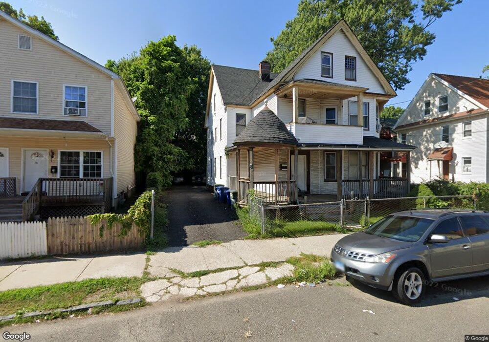
87 Olive St Unit 89 Bridgeport, CT 06605
West End-West Side NeighborhoodEstimated Value: $406,719 - $616,000
7
Beds
2
Baths
3,572
Sq Ft
$151/Sq Ft
Est. Value
About This Home
This home is located at 87 Olive St Unit 89, Bridgeport, CT 06605 and is currently estimated at $538,930, approximately $150 per square foot. 87 Olive St Unit 89 is a home located in Fairfield County with nearby schools including James J. Curiale School, Bassick High School, and Catholic Academy of Bridgeport-St. Raphael Academy.
Ownership History
Date
Name
Owned For
Owner Type
Purchase Details
Closed on
Apr 4, 2002
Sold by
Makena Props Corp
Bought by
Tshiteya Tshamala
Current Estimated Value
Home Financials for this Owner
Home Financials are based on the most recent Mortgage that was taken out on this home.
Original Mortgage
$147,650
Interest Rate
6.85%
Create a Home Valuation Report for This Property
The Home Valuation Report is an in-depth analysis detailing your home's value as well as a comparison with similar homes in the area
Home Values in the Area
Average Home Value in this Area
Purchase History
| Date | Buyer | Sale Price | Title Company |
|---|---|---|---|
| Tshiteya Tshamala | $150,000 | -- | |
| Tshiteya Tshamala | $150,000 | -- |
Source: Public Records
Mortgage History
| Date | Status | Borrower | Loan Amount |
|---|---|---|---|
| Open | Tshiteya Tshamala | $199,200 | |
| Closed | Tshiteya Tshamala | $147,650 |
Source: Public Records
Tax History
| Year | Tax Paid | Tax Assessment Tax Assessment Total Assessment is a certain percentage of the fair market value that is determined by local assessors to be the total taxable value of land and additions on the property. | Land | Improvement |
|---|---|---|---|---|
| 2025 | $7,524 | $173,160 | $51,820 | $121,340 |
| 2024 | $7,524 | $173,160 | $51,820 | $121,340 |
| 2023 | $7,524 | $173,160 | $51,820 | $121,340 |
| 2022 | $7,524 | $173,160 | $51,820 | $121,340 |
| 2021 | $7,524 | $173,160 | $51,820 | $121,340 |
| 2020 | $7,056 | $130,690 | $31,400 | $99,290 |
| 2019 | $7,056 | $130,690 | $31,400 | $99,290 |
| 2018 | $7,106 | $130,690 | $31,400 | $99,290 |
| 2017 | $7,106 | $130,690 | $31,400 | $99,290 |
| 2016 | $7,106 | $130,690 | $31,400 | $99,290 |
| 2015 | $7,770 | $184,130 | $47,500 | $136,630 |
| 2014 | $7,770 | $184,130 | $47,500 | $136,630 |
Source: Public Records
Map
Nearby Homes
- 60 Olive St
- 1146 Iranistan Ave Unit 1148
- 41 Washington Terrace
- 391 Coleman St
- 393 Laurel Ave Unit 203
- 700 Laurel Ave
- 697 Laurel Ave
- 357 Norman St
- 30 Pacific St Unit 32
- 49 Elmwood Place
- 120 Milne St Unit 122
- 865 Iranistan Ave
- 57 Milne St Unit 59
- 100 Lorraine St
- 41 Hanover St
- 162 Cottage St
- 1522 North Ave
- 150 Clinton Ave
- 1285 Norman St
- 757 Iranistan Ave Unit 759
- 1359 Iranistan Ave
- 77 Olive St Unit 79
- 1351 Iranistan Ave Unit 1353
- 1351 Iranistan Ave Unit 2
- 1369 Iranistan Ave
- 1333 Iranistan Ave
- 80 Olive St
- 142 Benham Ave
- 1321 Iranistan Ave
- 1321 Iranistan Ave Unit 2
- 130 Olive St Unit 132
- 130 Olive St Unit 1
- 74 Olive St
- 128 Benham Ave Unit 134
- 1356 Iranistan Ave
- 1362 Iranistan Ave
- 1385 Iranistan Ave
- 136 Benham Ave Unit 138
- 156 Benham Ave
- 68 Olive St
Your Personal Tour Guide
Ask me questions while you tour the home.