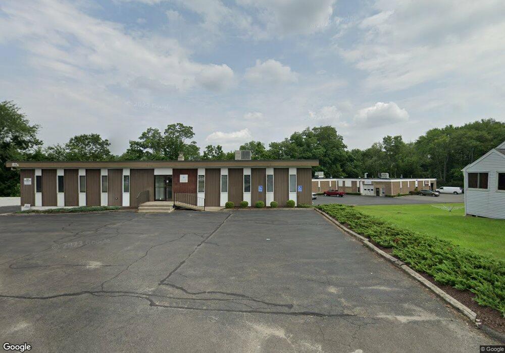
87 Sand Pit Rd Unit A2 Danbury, CT 06810
Germantown NeighborhoodEstimated Value: $2,758,497
Studio
--
Bath
--
Sq Ft
1.35
Acres Lot
About This Home
This home is located at 87 Sand Pit Rd Unit A2, Danbury, CT 06810 and is currently estimated at $2,758,497. 87 Sand Pit Rd Unit A2 is a home located in Fairfield County with nearby schools including Ellsworth Avenue School, Broadview Middle School, and Danbury High School.
Ownership History
Date
Name
Owned For
Owner Type
Purchase Details
Closed on
Jun 24, 1999
Sold by
Merante Felix A and Merante Anthony J
Bought by
87 Sand Pit Assoc Llc
Current Estimated Value
Home Financials for this Owner
Home Financials are based on the most recent Mortgage that was taken out on this home.
Original Mortgage
$400,000
Interest Rate
8.5%
Mortgage Type
Commercial
Create a Home Valuation Report for This Property
The Home Valuation Report is an in-depth analysis detailing your home's value as well as a comparison with similar homes in the area
Home Values in the Area
Average Home Value in this Area
Purchase History
We collect this data history from publicly available records. To have your information removed, we recommend requesting removal directly through your county’s website.
| Date | Buyer | Sale Price | Title Company |
|---|---|---|---|
| 87 Sand Pit Assoc Llc | $968,388 | -- |
Source: Public Records
Mortgage History
We collect this data history from publicly available records. To have your information removed, we recommend requesting removal directly through your county’s website.
| Date | Status | Borrower | Loan Amount |
|---|---|---|---|
| Closed | 87 Sand Pit Assoc Llc | $400,000 |
Source: Public Records
Tax History
| Year | Tax Paid | Tax Assessment Tax Assessment Total Assessment is a certain percentage of the fair market value that is determined by local assessors to be the total taxable value of land and additions on the property. | Land | Improvement |
|---|---|---|---|---|
| 2025 | $28,594 | $1,144,220 | $372,120 | $772,100 |
| 2024 | $27,965 | $1,144,220 | $372,120 | $772,100 |
| 2023 | $26,695 | $1,144,220 | $372,120 | $772,100 |
| 2022 | $30,068 | $1,065,500 | $371,500 | $694,000 |
| 2021 | $29,405 | $1,065,400 | $371,500 | $693,900 |
| 2020 | $29,405 | $1,065,400 | $371,500 | $693,900 |
| 2019 | $29,405 | $1,065,400 | $371,500 | $693,900 |
| 2018 | $29,405 | $1,065,400 | $371,500 | $693,900 |
| 2017 | $27,867 | $962,600 | $353,800 | $608,800 |
| 2016 | $27,607 | $962,600 | $353,800 | $608,800 |
| 2015 | $27,203 | $962,600 | $353,800 | $608,800 |
| 2014 | $26,568 | $962,600 | $353,800 | $608,800 |
Source: Public Records
Map
Nearby Homes
- 28 Starr Ave Unit 11
- 48 Morgan Ave
- 1705 Eaton Ct
- 21 Germantown Rd
- 166 Old Brookfield Rd Unit 21-2
- 166 Old Brookfield Rd Unit 20-5
- 16 Springside Ave
- 5 Wixon Rd
- 53 Holley Street Extension
- 44 Meadowbrook Rd
- 14 Sil Cam Dr
- 22 1/2 Country Ridge Rd
- 43 Meadowbrook Rd
- 6 Country Ridge Rd
- 34 Valerie Ln
- 6 Sunrise Rd
- 1 Beaver Brook Rd Unit 29
- 68 Virginia Ave Unit 14
- 68 Virginia Ave Unit 11
- 30 Hawley Road Extension
- 85 Sand Pit Rd
- 90 Sand Pit Rd
- 116 Beaver Brook Rd
- 118 Beaver Brook Rd
- 120 Beaver Brook Rd
- 2 Rockwell Rd
- 95 Sand Pit Rd
- 114 Beaver Brook Rd
- 122 Beaver Brook Rd
- 80 Sand Pit Rd
- 94 Sand Pit Rd Unit 7
- 94 Sand Pit Rd
- 35 Starr Rd
- 15 Deerfield Ave
- 2 Michaud Rd
- 13 Deerfield Ave
- 30 Starr Rd
- 4 Michaud Rd
- 6 Michaud Rd
- 12 Deerfield Ave Unit 14
Your Personal Tour Guide
Ask me questions while you tour the home.