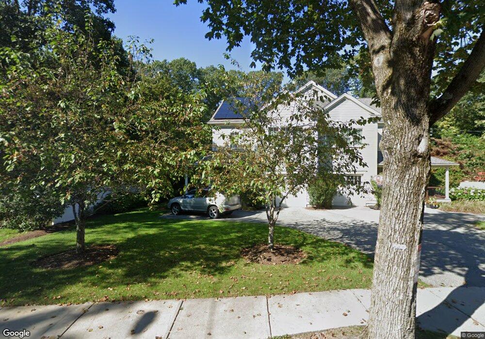
87 Thurston Rd Unit 87 Newton, MA 02464
Newton Upper Falls NeighborhoodEstimated Value: $1,374,000 - $1,622,000
4
Beds
4
Baths
2,872
Sq Ft
$534/Sq Ft
Est. Value
About This Home
This home is located at 87 Thurston Rd Unit 87, Newton, MA 02464 and is currently estimated at $1,533,776, approximately $534 per square foot. 87 Thurston Rd Unit 87 is a home located in Middlesex County with nearby schools including Zervas Elementary School, Angier Elementary School, and Charles E Brown Middle School.
Ownership History
Date
Name
Owned For
Owner Type
Purchase Details
Closed on
Feb 10, 2011
Sold by
85 Thurston Road Rt and Zegarelli
Bought by
Chang Jaime and Chang Jing Hsiu
Current Estimated Value
Home Financials for this Owner
Home Financials are based on the most recent Mortgage that was taken out on this home.
Original Mortgage
$523,000
Outstanding Balance
$355,634
Interest Rate
4.88%
Mortgage Type
Purchase Money Mortgage
Estimated Equity
$1,178,142
Create a Home Valuation Report for This Property
The Home Valuation Report is an in-depth analysis detailing your home's value as well as a comparison with similar homes in the area
Home Values in the Area
Average Home Value in this Area
Purchase History
| Date | Buyer | Sale Price | Title Company |
|---|---|---|---|
| Chang Jaime | $775,000 | -- | |
| Chang Jaime | $775,000 | -- | |
| Chang Jaime | $775,000 | -- |
Source: Public Records
Mortgage History
| Date | Status | Borrower | Loan Amount |
|---|---|---|---|
| Open | Chang Jaime | $523,000 | |
| Closed | Chang Jaime | $523,000 |
Source: Public Records
Tax History
| Year | Tax Paid | Tax Assessment Tax Assessment Total Assessment is a certain percentage of the fair market value that is determined by local assessors to be the total taxable value of land and additions on the property. | Land | Improvement |
|---|---|---|---|---|
| 2025 | $11,614 | $1,185,100 | $0 | $1,185,100 |
| 2024 | $11,230 | $1,150,600 | $0 | $1,150,600 |
| 2023 | $10,841 | $1,064,900 | $0 | $1,064,900 |
| 2022 | $10,669 | $1,014,200 | $0 | $1,014,200 |
| 2021 | $10,295 | $956,800 | $0 | $956,800 |
| 2020 | $9,989 | $956,800 | $0 | $956,800 |
| 2019 | $9,707 | $928,900 | $0 | $928,900 |
| 2018 | $9,740 | $900,200 | $0 | $900,200 |
| 2017 | $9,443 | $849,200 | $0 | $849,200 |
| 2016 | $9,031 | $793,600 | $0 | $793,600 |
| 2015 | $8,775 | $755,800 | $0 | $755,800 |
Source: Public Records
Map
Nearby Homes
- 51 Pettee St Unit 11
- 200 Elliot St Unit 1
- 1077 Boylston St Unit 1
- 1003 Chestnut St
- 14 Pennsylvania Ave Unit 14
- 12 Pennsylvania Ave Unit 14
- 20 Pennsylvania Ave
- 20 Pennsylvania Ave Unit 20
- 66 Linden St
- 27 Hamilton Place
- 27 High St Unit 27
- 25 High St Unit 25
- 25 High St
- 193 Oak St Unit 403
- 52 Heatherland Rd
- 187 Saint Mary St
- 128 Charlemont St
- 181 Saint Mary St
- 34 Larchmont Ave
- 97 Bound Brook Rd
- 85 Thurston Rd
- 85 Thurston Rd Unit 85
- 75 Thurston Rd
- 140 Roundwood Rd
- 60 White Pine Rd
- 69 Thurston Rd Unit 71
- 128 Roundwood Rd
- 56 White Pine Rd
- 88A Thurston Rd
- 88 Thurston Rd Unit B
- 88 Thurston Rd Unit A
- 92-94 Thurston Rd Unit 94
- 94 Thurston Rd Unit 94
- 92 Thurston Rd
- 122 Roundwood Rd
- 61 Thurston Rd Unit 63
- 100 Thurston Rd Unit 100
- 61 White Pine Rd
- 102 Thurston Rd
- 102 Thurston Rd Unit 102