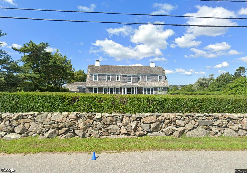
87 Warrens Point Rd Little Compton, RI 02837
Estimated Value: $3,151,000 - $3,590,814
Studio
--
Bath
--
Sq Ft
49,223
Sq Ft Lot
About This Home
This home is located at 87 Warrens Point Rd, Little Compton, RI 02837 and is currently estimated at $3,391,954. 87 Warrens Point Rd is a home located in Newport County with nearby schools including Wilbur & McMahon School.
Ownership History
Date
Name
Owned For
Owner Type
Purchase Details
Closed on
Jan 19, 2026
Sold by
Richard W Lisle Jr T W and Richard Lisle
Bought by
Lisle Elizabeth
Current Estimated Value
Purchase Details
Closed on
Dec 8, 2021
Sold by
Lisle Richard W and Lisle Janet T
Bought by
Richard W Lisle Jr T W and Richard Lisle
Purchase Details
Closed on
Dec 30, 1991
Sold by
Lisle Richard
Bought by
Lisle Richard
Create a Home Valuation Report for This Property
The Home Valuation Report is an in-depth analysis detailing your home's value as well as a comparison with similar homes in the area
Home Values in the Area
Average Home Value in this Area
Purchase History
| Date | Buyer | Sale Price | Title Company |
|---|---|---|---|
| Lisle Elizabeth | -- | -- | |
| Lisle Elizabeth | -- | -- | |
| Richard W Lisle Jr T W | -- | None Available | |
| Lisle Richard | $300,000 | -- | |
| Lisle Richard | $300,000 | -- |
Source: Public Records
Mortgage History
| Date | Status | Borrower | Loan Amount |
|---|---|---|---|
| Previous Owner | Lisle Richard | $370,000 | |
| Previous Owner | Lisle Richard | $415,000 | |
| Previous Owner | Lisle Richard | $418,000 |
Source: Public Records
Tax History
| Year | Tax Paid | Tax Assessment Tax Assessment Total Assessment is a certain percentage of the fair market value that is determined by local assessors to be the total taxable value of land and additions on the property. | Land | Improvement |
|---|---|---|---|---|
| 2025 | $12,924 | $2,698,200 | $1,818,200 | $880,000 |
| 2024 | $11,725 | $2,308,000 | $1,491,300 | $816,700 |
| 2023 | $11,448 | $2,308,000 | $1,491,300 | $816,700 |
| 2022 | $11,309 | $2,308,000 | $1,491,300 | $816,700 |
| 2021 | $11,931 | $1,975,400 | $1,203,100 | $772,300 |
| 2020 | $11,833 | $1,975,400 | $1,203,100 | $772,300 |
| 2019 | $11,714 | $1,975,400 | $1,203,100 | $772,300 |
| 2018 | $11,735 | $1,969,000 | $1,203,100 | $765,900 |
| 2016 | $11,164 | $1,969,000 | $1,203,100 | $765,900 |
| 2015 | $11,252 | $1,956,900 | $1,177,200 | $779,700 |
| 2014 | $11,037 | $1,956,900 | $1,177,200 | $779,700 |
Source: Public Records
Map
Nearby Homes
- 61 Warrens Point Rd
- 61 Warren's Point Rd
- 63 Warren's Point Rd
- 63 Warrens Point Rd
- 83 Warrens Point Rd
- 86 Warrens Point Rd
- 1B Grinnell Rd
- 1 Grinnell Rd
- 84 Warrens Point Rd
- 0 Grinnell Rd
- 2 Grinnell Rd
- 15 Long Pond Ln
- 5 Grinnell Rd
- 3 Grinnell Rd
- 14 Grinnell Rd
- 80 Warrens Point Rd
- 9 Long Pond Ln
- 77 Warrens Point Rd
- 82B Warrens Point Rd
- 82 Warrens Point Rd
Your Personal Tour Guide
Ask me questions while you tour the home.