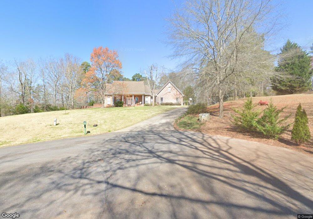
87 Weaver Rd Cedartown, GA 30125
Estimated Value: $396,000 - $492,569
4
Beds
4
Baths
3,884
Sq Ft
$115/Sq Ft
Est. Value
About This Home
This home is located at 87 Weaver Rd, Cedartown, GA 30125 and is currently estimated at $445,642, approximately $114 per square foot. 87 Weaver Rd is a home located in Polk County.
Ownership History
Date
Name
Owned For
Owner Type
Purchase Details
Closed on
Jul 16, 2001
Sold by
Sorrells Herbert Hoover
Bought by
Sorrells Herbert H and Sorrells Kathie D
Current Estimated Value
Purchase Details
Closed on
Nov 6, 1992
Sold by
Peek Charles Bryan
Bought by
Sorrells Herbert H
Purchase Details
Closed on
Sep 29, 1989
Sold by
Nekiel Joseph and Nekiel
Bought by
Pruitt Roy N
Purchase Details
Closed on
Nov 6, 1985
Bought by
Nekiel Joseph and Nekiel
Create a Home Valuation Report for This Property
The Home Valuation Report is an in-depth analysis detailing your home's value as well as a comparison with similar homes in the area
Purchase History
| Date | Buyer | Sale Price | Title Company |
|---|---|---|---|
| Sorrells Herbert H | -- | -- | |
| Sorrells Herbert H | $8,500 | -- | |
| Pruitt Roy N | $19,700 | -- | |
| Nekiel Joseph | -- | -- |
Source: Public Records
Tax History
| Year | Tax Paid | Tax Assessment Tax Assessment Total Assessment is a certain percentage of the fair market value that is determined by local assessors to be the total taxable value of land and additions on the property. | Land | Improvement |
|---|---|---|---|---|
| 2025 | $3,623 | $178,248 | $11,128 | $167,120 |
| 2024 | $3,365 | $175,680 | $8,560 | $167,120 |
| 2023 | $2,687 | $126,592 | $8,560 | $118,032 |
| 2022 | $2,396 | $114,336 | $8,560 | $105,776 |
| 2021 | $2,427 | $114,336 | $8,560 | $105,776 |
| 2020 | $2,432 | $114,336 | $8,560 | $105,776 |
| 2019 | $2,528 | $107,474 | $7,192 | $100,282 |
| 2018 | $2,104 | $89,698 | $6,817 | $82,881 |
| 2017 | $2,074 | $89,698 | $6,817 | $82,881 |
| 2016 | $2,074 | $89,698 | $6,817 | $82,881 |
| 2015 | $2,544 | $95,207 | $7,192 | $88,015 |
| 2014 | $2,260 | $84,189 | $6,557 | $77,632 |
Source: Public Records
Map
Nearby Homes
- 75 Weaver Rd
- 0 Santa Claus Rd Unit 7735787
- 0 Santa Claus Rd Unit 7706526
- 0 Santa Claus Rd Unit 10676218
- 612 Michael Blvd
- 354 Michael Blvd
- 387 Michael Blvd
- 0 Mountain Home Rd Unit 1020-B 10351940
- 0 Mountain Home Rd Unit 1020-C 10351948
- 0 Mountain Home Rd Unit 1020-A 10351930
- 425 Chubbtown Rd
- 0 Cave Spring Rd Unit 10631588
- 0 Cave Spring Rd Unit 7671027
- 1343 Prior Station Rd
- 914 Chubbtown Rd
- 39 Summerwind Dr
- 8 Stonegate Dr
- 508 Branch St
- 512 Branch St
- 524 Branch St
- 87 Weaver Rd
- 87 Weaver Rd
- 99 Weaver Rd
- 76 Weaver Rd
- 250 Santa Claus Rd
- 215 Santa Claus Rd
- 215 Santa Claus Rd
- 520 Parrish Rd
- 418 Parrish Rd
- 460 Parrish Rd
- 298 Santa Claus Rd
- 0 Weaver Rd
- 480 Parrish Rd
- 452 Parrish Rd
- 321 Santa Claus Rd
- 432 Parrish Rd
- 404 Parrish Rd
- 201 Santa Claus Rd
- 402 Parrish Rd
- 192 Santa Claus Rd
Your Personal Tour Guide
Ask me questions while you tour the home.