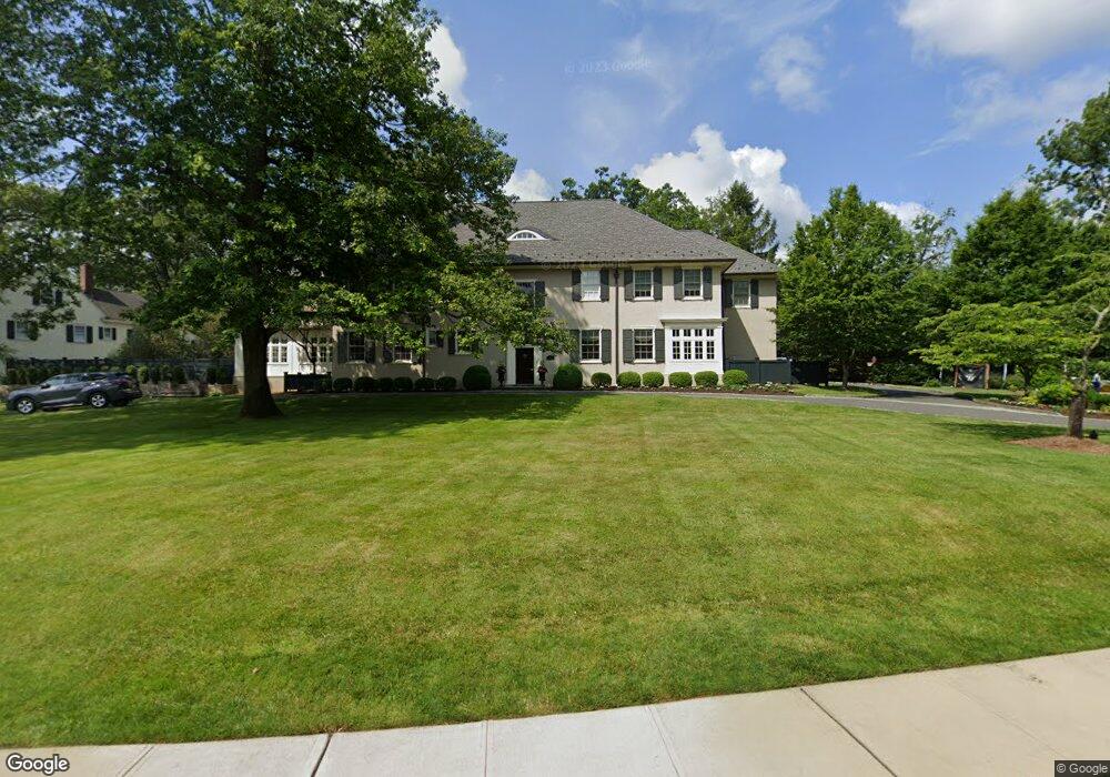
87 Whittredge Rd Summit, NJ 07901
Estimated Value: $4,494,013 - $6,298,000
--
Bed
--
Bath
7,505
Sq Ft
$724/Sq Ft
Est. Value
About This Home
This home is located at 87 Whittredge Rd, Summit, NJ 07901 and is currently estimated at $5,435,338, approximately $724 per square foot. 87 Whittredge Rd is a home located in Union County with nearby schools including L C Johnson Summit Middle School, Summit Sr High School, and Kent Place School.
Ownership History
Date
Name
Owned For
Owner Type
Purchase Details
Closed on
Mar 28, 2019
Sold by
Owens Walter J and Owens Regina B
Bought by
Brugg Jordan L and Brugg Maria A
Current Estimated Value
Home Financials for this Owner
Home Financials are based on the most recent Mortgage that was taken out on this home.
Original Mortgage
$2,925,000
Outstanding Balance
$2,485,663
Interest Rate
2.77%
Mortgage Type
Adjustable Rate Mortgage/ARM
Estimated Equity
$2,949,675
Purchase Details
Closed on
Dec 14, 2005
Sold by
Hubbard Frank G
Bought by
Owens Walter J and Owens Regina B
Home Financials for this Owner
Home Financials are based on the most recent Mortgage that was taken out on this home.
Original Mortgage
$700,000
Interest Rate
5.86%
Mortgage Type
New Conventional
Create a Home Valuation Report for This Property
The Home Valuation Report is an in-depth analysis detailing your home's value as well as a comparison with similar homes in the area
Home Values in the Area
Average Home Value in this Area
Purchase History
| Date | Buyer | Sale Price | Title Company |
|---|---|---|---|
| Brugg Jordan L | $4,850,000 | Commonwealth Ttl Monmouth Ag | |
| Owens Walter J | $3,650,000 | -- |
Source: Public Records
Mortgage History
| Date | Status | Borrower | Loan Amount |
|---|---|---|---|
| Open | Brugg Jordan L | $2,925,000 | |
| Previous Owner | Owens Walter J | $700,000 |
Source: Public Records
Tax History Compared to Growth
Tax History
| Year | Tax Paid | Tax Assessment Tax Assessment Total Assessment is a certain percentage of the fair market value that is determined by local assessors to be the total taxable value of land and additions on the property. | Land | Improvement |
|---|---|---|---|---|
| 2025 | $72,963 | $1,755,000 | $528,200 | $1,226,800 |
| 2024 | $72,477 | $1,675,000 | $528,200 | $1,146,800 |
| 2023 | $72,477 | $1,675,000 | $528,200 | $1,146,800 |
| 2022 | $69,599 | $1,625,000 | $528,200 | $1,096,800 |
| 2021 | $70,151 | $1,625,000 | $528,200 | $1,096,800 |
| 2020 | $70,850 | $1,625,000 | $528,200 | $1,096,800 |
| 2019 | $70,931 | $1,625,000 | $528,200 | $1,096,800 |
| 2018 | $70,476 | $1,625,000 | $528,200 | $1,096,800 |
| 2017 | $70,931 | $1,625,000 | $528,200 | $1,096,800 |
| 2016 | $78,020 | $1,814,000 | $528,200 | $1,285,800 |
| 2015 | $76,496 | $1,814,000 | $528,200 | $1,285,800 |
| 2014 | $74,519 | $1,814,000 | $528,200 | $1,285,800 |
Source: Public Records
Map
Nearby Homes
- 58 Prospect Hill Ave
- 59 West Rd
- 160 Springfield Ave
- 39 Huntley Rd
- 16 West Rd
- 181 Summit Ave
- 10 Waldron Ave
- 60 Fernwood Rd
- 133 Summit Ave Unit 10
- 12 Coniston Rd
- 1 Irving Place
- 55 Oxbow Ln
- 50 Parmley Place Unit 203
- 23 Euclid Ave
- 103 Park Ave Unit E206
- 103 Park Ave Unit E201
- 28 Morris Ave Unit G4
- 41A Middle Ave
- 115 Beechwood Rd
- 285 Taylor Rd S
- 95 Whittredge Rd
- 65 Lenox Rd
- 59 Lenox Rd
- 90 Whittredge Rd
- 96 Whittredge Rd
- 99 Whittredge Rd
- 86 Whittredge Rd
- 80 Whittredge Rd
- 53 Lenox Rd
- 6 Westminster Rd
- 100 Whittredge Rd
- 5 Westminster Rd
- 105 Whittredge Rd
- 74 Whittredge Rd
- 10 Westminster Rd
- 47 Lenox Rd
- 10 Glendale Rd
- 54 Lenox Rd
- 33 Templar Way
- 8 Glendale Rd