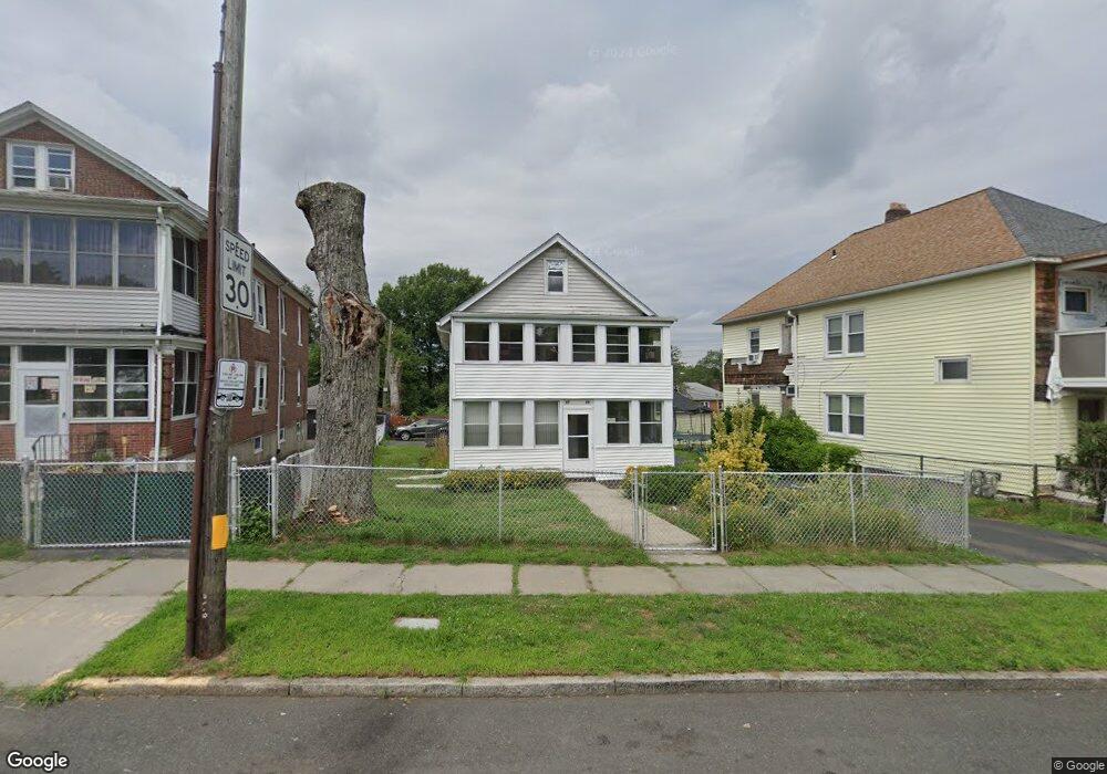
87 Zion St Unit 89 Hartford, CT 06106
Behind the Rocks NeighborhoodEstimated Value: $294,762 - $434,000
6
Beds
2
Baths
2,244
Sq Ft
$169/Sq Ft
Est. Value
About This Home
This home is located at 87 Zion St Unit 89, Hartford, CT 06106 and is currently estimated at $379,691, approximately $169 per square foot. 87 Zion St Unit 89 is a home located in Hartford County with nearby schools including Environmental Sciences Magnet School at Mary Hooker, Kennelly School, and Sanchez School.
Ownership History
Date
Name
Owned For
Owner Type
Purchase Details
Closed on
Jan 22, 1987
Sold by
Charest Robert
Bought by
Flores Eduardo
Current Estimated Value
Home Financials for this Owner
Home Financials are based on the most recent Mortgage that was taken out on this home.
Original Mortgage
$113,400
Interest Rate
9.36%
Mortgage Type
Purchase Money Mortgage
Create a Home Valuation Report for This Property
The Home Valuation Report is an in-depth analysis detailing your home's value as well as a comparison with similar homes in the area
Home Values in the Area
Average Home Value in this Area
Purchase History
| Date | Buyer | Sale Price | Title Company |
|---|---|---|---|
| Flores Eduardo | $126,000 | -- |
Source: Public Records
Mortgage History
| Date | Status | Borrower | Loan Amount |
|---|---|---|---|
| Closed | Flores Eduardo | $89,000 | |
| Closed | Flores Eduardo | $113,400 |
Source: Public Records
Tax History Compared to Growth
Tax History
| Year | Tax Paid | Tax Assessment Tax Assessment Total Assessment is a certain percentage of the fair market value that is determined by local assessors to be the total taxable value of land and additions on the property. | Land | Improvement |
|---|---|---|---|---|
| 2025 | $6,464 | $93,749 | $7,313 | $86,436 |
| 2024 | $6,464 | $93,749 | $7,313 | $86,436 |
| 2023 | $6,464 | $93,749 | $7,313 | $86,436 |
| 2022 | $6,464 | $93,749 | $7,313 | $86,436 |
| 2021 | $4,093 | $55,090 | $10,150 | $44,940 |
| 2020 | $4,093 | $55,090 | $10,150 | $44,940 |
| 2019 | $4,093 | $55,090 | $10,150 | $44,940 |
| 2018 | $3,955 | $53,233 | $9,808 | $43,425 |
| 2016 | $3,515 | $47,316 | $9,340 | $37,976 |
| 2015 | $3,348 | $45,069 | $8,897 | $36,172 |
| 2014 | $3,266 | $43,967 | $8,680 | $35,287 |
Source: Public Records
Map
Nearby Homes
- 199 Zion St
- 205 Zion St
- 87 Grandview Terrace Unit 89
- 49 Newbury St Unit 51
- 50 Harwich St
- 119 Bonner St Unit 121
- 452 Broadview Terrace
- 90 Harwich St Unit 92
- 77 Mountford St
- 73 Mountford St Unit 3B
- 69 Mountford St Unit 3A
- 136 Wilson St
- 23 Harbison Ave
- 218 Saybrooke St
- 60 Coolidge St
- 147 Newbury St Unit 149
- 67 Harbison Ave Unit 69
- 190 Bonner St
- 510 New Britain Ave
- 405 W Preston St Unit 407
- 93 Zion St Unit 95
- 83 Zion St Unit 85
- 101 Zion St Unit 103
- 17 Curtiss St
- 109 Zion St
- 16 Curtiss St
- 21 Curtiss St
- 115 Zion St Unit 117
- 25 Curtiss St Unit 27
- 121 Zion St Unit 3-C
- 121 Zion St
- 15 Flatbush Ave
- 123 Zion St Unit 2-B
- 123 Zion St Unit 3-N
- 28 Curtiss St
- 21 Flatbush Ave
- 20 Hughes St
- 23 Flatbush Ave Unit 25
- 35 Curtiss St