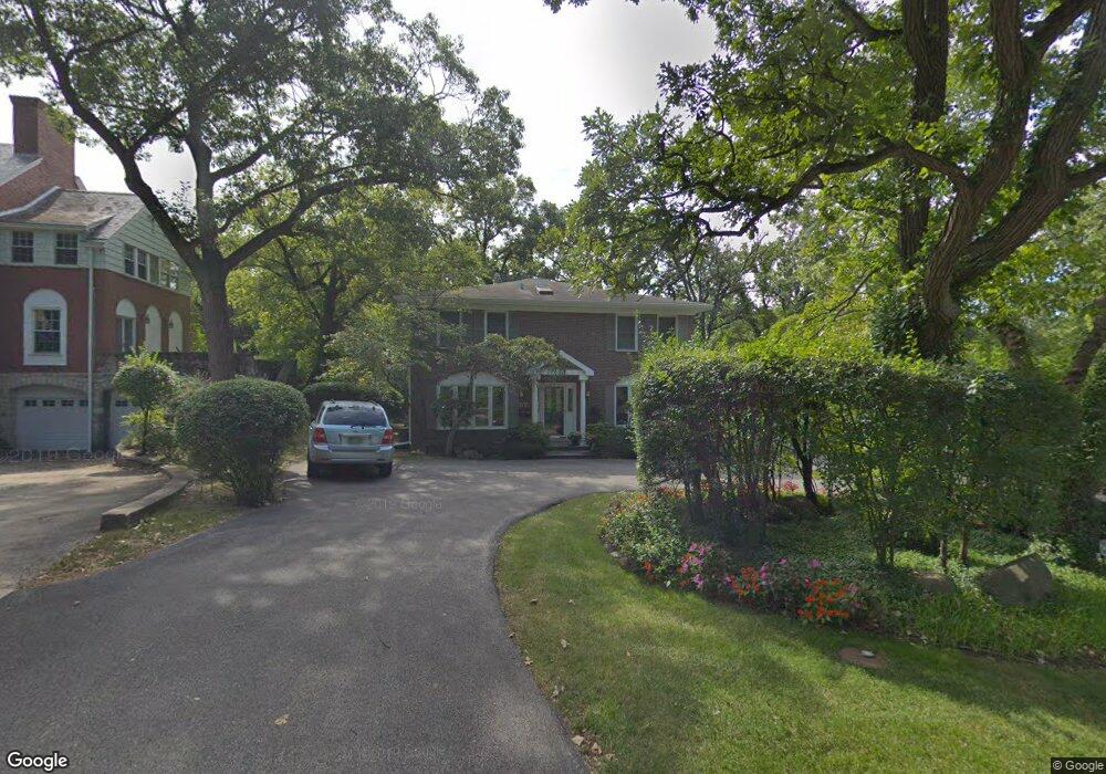
870 Bob o Link Rd Highland Park, IL 60035
West Highland Park NeighborhoodEstimated Value: $928,912 - $1,145,000
4
Beds
3
Baths
3,005
Sq Ft
$338/Sq Ft
Est. Value
About This Home
This home is located at 870 Bob o Link Rd, Highland Park, IL 60035 and is currently estimated at $1,015,728, approximately $338 per square foot. 870 Bob o Link Rd is a home located in Lake County with nearby schools including Indian Trail Elementary School, Edgewood Middle School, and Treasure Valley Leadership Academy.
Ownership History
Date
Name
Owned For
Owner Type
Purchase Details
Closed on
Dec 18, 2019
Sold by
Rubinoff Earl E and Rubinoff Rochelle D
Bought by
Rubinoff Rochelle D and Rubinoff Earl E
Current Estimated Value
Purchase Details
Closed on
Feb 22, 1994
Sold by
Hurvitz Michael S and Hurvitz Susan L
Bought by
Rubinoff Earl E and Rubinoff Rochelle D
Home Financials for this Owner
Home Financials are based on the most recent Mortgage that was taken out on this home.
Original Mortgage
$200,000
Interest Rate
7.1%
Create a Home Valuation Report for This Property
The Home Valuation Report is an in-depth analysis detailing your home's value as well as a comparison with similar homes in the area
Home Values in the Area
Average Home Value in this Area
Purchase History
| Date | Buyer | Sale Price | Title Company |
|---|---|---|---|
| Rubinoff Rochelle D | -- | Attorney | |
| Rubinoff Earl E | $244,333 | -- |
Source: Public Records
Mortgage History
| Date | Status | Borrower | Loan Amount |
|---|---|---|---|
| Closed | Rubinoff Earl E | $200,000 |
Source: Public Records
Tax History Compared to Growth
Tax History
| Year | Tax Paid | Tax Assessment Tax Assessment Total Assessment is a certain percentage of the fair market value that is determined by local assessors to be the total taxable value of land and additions on the property. | Land | Improvement |
|---|---|---|---|---|
| 2024 | $16,070 | $211,937 | $86,169 | $125,768 |
| 2023 | $14,998 | $191,038 | $77,672 | $113,366 |
| 2022 | $14,998 | $172,400 | $85,328 | $87,072 |
| 2021 | $13,821 | $166,650 | $82,482 | $84,168 |
| 2020 | $13,374 | $166,650 | $82,482 | $84,168 |
| 2019 | $13,812 | $176,861 | $82,096 | $94,765 |
| 2018 | $15,203 | $199,980 | $89,885 | $110,095 |
| 2017 | $15,383 | $209,734 | $89,367 | $120,367 |
| 2016 | $14,828 | $199,671 | $85,079 | $114,592 |
| 2015 | $14,352 | $185,516 | $79,048 | $106,468 |
| 2014 | $13,601 | $172,090 | $80,047 | $92,043 |
| 2012 | $13,233 | $173,094 | $80,514 | $92,580 |
Source: Public Records
Map
Nearby Homes
- 650 Walnut St Unit 301
- 1633 2nd St Unit 302
- 1789 Green Bay Rd Unit B
- 1087 Deerfield Place Unit 1087
- 1767 Clifton Ave
- 860 Green Bay Rd
- 1490 Avignon Ct
- 215 Prospect Ave
- 566 Bellevue Place
- 2066 Saint Johns Ave Unit 404
- 2514 Hidden Oak (Lot 9) Cir
- 666 Barberry Rd
- 2086 Saint Johns Ave Unit 207
- 2086 Saint Johns Ave Unit 306
- 55 Prospect Ave
- 1317 Arbor Ave
- 1230 Park Ave W Unit 213
- 2276 Linden Ave
- 1460 Ferndale Ave
- 1653 Mccraren Rd
- 888 Bob o Link Rd
- 860 Bob-O-link Rd
- 860 Bob o Link Rd
- 906 Rollingwood Rd
- 908 Rollingwood Rd
- 1270 Crofton Ave N
- 871 Fairview Rd
- 910 Bob o Link Rd
- 887 Bob o Link Rd
- 1254 Crofton Ave N
- 912 Rollingwood Rd
- 907 Rollingwood Rd
- 849 Bob o Link Rd
- 1265 Crofton Ave N
- 909 Bob o Link Rd
- 832 Bob-O-link Rd
- 909 Rollingwood Rd
- 920 Bob o Link Rd
- 832 Bob o Link Rd
- 1240 Crofton Ave N