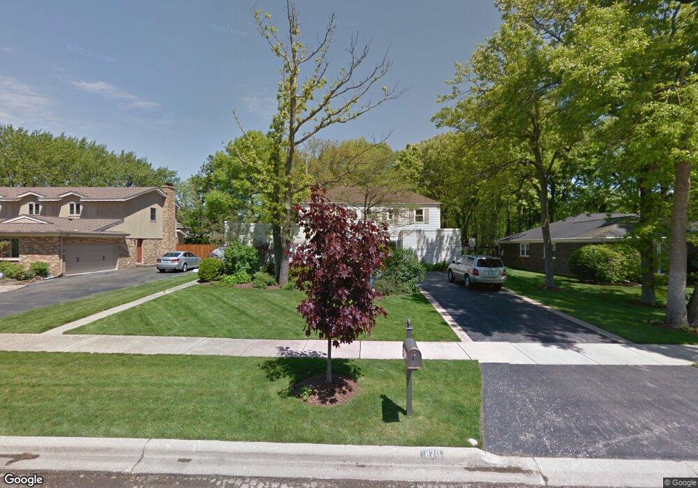
870 Mountain Dr Deerfield, IL 60015
Estimated Value: $997,569 - $1,248,000
4
Beds
3
Baths
3,555
Sq Ft
$313/Sq Ft
Est. Value
About This Home
This home is located at 870 Mountain Dr, Deerfield, IL 60015 and is currently estimated at $1,112,892, approximately $313 per square foot. 870 Mountain Dr is a home located in Lake County with nearby schools including Walden Elementary School, Alan B Shepard Middle School, and Deerfield High School.
Ownership History
Date
Name
Owned For
Owner Type
Purchase Details
Closed on
Apr 14, 2014
Sold by
Apple Jason M and Apple Wendy
Bought by
Apple Jason M and Apple Wendy
Current Estimated Value
Purchase Details
Closed on
Aug 15, 2005
Sold by
Fishbein Jeffrey A and Fishbein Sharyl I
Bought by
Apple Jason M and Apple Wendy
Home Financials for this Owner
Home Financials are based on the most recent Mortgage that was taken out on this home.
Original Mortgage
$500,000
Outstanding Balance
$265,352
Interest Rate
5.82%
Mortgage Type
Fannie Mae Freddie Mac
Estimated Equity
$847,540
Purchase Details
Closed on
Aug 7, 2002
Sold by
Rubin Ronald
Bought by
Fishbein Jeffrey A and Fishbein Sharyl I
Home Financials for this Owner
Home Financials are based on the most recent Mortgage that was taken out on this home.
Original Mortgage
$473,300
Interest Rate
6.4%
Create a Home Valuation Report for This Property
The Home Valuation Report is an in-depth analysis detailing your home's value as well as a comparison with similar homes in the area
Home Values in the Area
Average Home Value in this Area
Purchase History
| Date | Buyer | Sale Price | Title Company |
|---|---|---|---|
| Apple Jason M | -- | None Available | |
| Apple Jason M | $870,000 | Fort Dearborn Land Title | |
| Fishbein Jeffrey A | $612,000 | -- |
Source: Public Records
Mortgage History
| Date | Status | Borrower | Loan Amount |
|---|---|---|---|
| Open | Apple Jason M | $500,000 | |
| Previous Owner | Fishbein Jeffrey A | $473,300 |
Source: Public Records
Tax History Compared to Growth
Tax History
| Year | Tax Paid | Tax Assessment Tax Assessment Total Assessment is a certain percentage of the fair market value that is determined by local assessors to be the total taxable value of land and additions on the property. | Land | Improvement |
|---|---|---|---|---|
| 2024 | $22,065 | $252,712 | $55,794 | $196,918 |
| 2023 | $22,297 | $242,526 | $53,545 | $188,981 |
| 2022 | $22,297 | $241,406 | $59,811 | $181,595 |
| 2021 | $21,041 | $232,748 | $57,666 | $175,082 |
| 2020 | $20,235 | $233,237 | $57,787 | $175,450 |
| 2019 | $19,774 | $232,841 | $57,689 | $175,152 |
| 2018 | $10,235 | $228,531 | $61,145 | $167,386 |
| 2017 | $18,474 | $227,802 | $60,950 | $166,852 |
| 2016 | $17,970 | $219,188 | $58,645 | $160,543 |
| 2015 | $17,613 | $205,946 | $55,102 | $150,844 |
| 2014 | $18,619 | $214,333 | $55,497 | $158,836 |
| 2012 | $17,159 | $212,442 | $55,007 | $157,435 |
Source: Public Records
Map
Nearby Homes
- 1504 Northwoods Rd
- 1770 Overland Trail
- 1423 Northwoods Rd
- 1342 Barclay Ln Unit 36
- 970 Ivy Ln Unit C
- 1131 Linden Ave
- 1265 Woodland Dr
- 1410 Berkley Ct
- 2005 Keats Ln
- 1670 Meadow Ln
- 1045 Fairoaks Ave
- 1380 Valley Rd
- 1341 Carlisle Place
- 2372 Tennyson Ln
- 1953 Keats Ct
- 1263 Carlisle Place
- 1666 Cloverdale Ave
- 1127 Kenton Rd
- 2230 Shady Ln
- 1620 Berkeley Ct
- 860 Mountain Dr
- 890 Mountain Dr
- 1725 E Summit Ct
- 900 Mountain Dr
- 1735 E Summit Ct
- 1700 Portage Pass
- 1720 Portage Pass
- 865 Mountain Dr
- 885 Mountain Dr
- 1730 Portage Pass
- 1730 E Summit Ct
- 1680 Portage Pass
- 1715 Mountain Ct
- 1705 Mountain Ct
- 1745 E Summit Ct
- 1740 Portage Pass
- 1725 Mountain Ct
- 1670 Portage Pass
- 1740 E Summit Ct
- 915 Mountain Dr