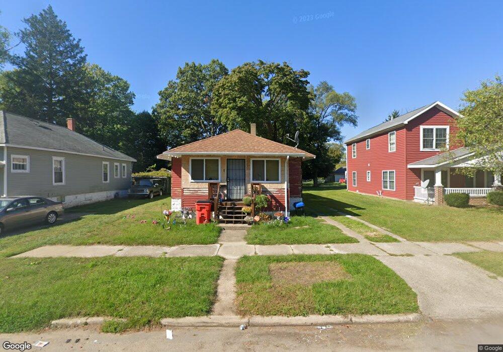
870 Ogden Ave Benton Harbor, MI 49022
Estimated Value: $85,750 - $101,000
2
Beds
1
Bath
1,193
Sq Ft
$80/Sq Ft
Est. Value
About This Home
This home is located at 870 Ogden Ave, Benton Harbor, MI 49022 and is currently estimated at $95,688, approximately $80 per square foot. 870 Ogden Ave is a home located in Berrien County with nearby schools including Fair Plain Middle School, Benton Harbor High School, and Benton Harbor Charter School Academy.
Ownership History
Date
Name
Owned For
Owner Type
Purchase Details
Closed on
Mar 19, 2021
Sold by
Jeffries Milo
Bought by
Jeffries Milo and Jeffries Tracy
Current Estimated Value
Purchase Details
Closed on
Dec 15, 2017
Sold by
Williams Sharon A and Ridges Sharon A
Bought by
Jeffries Milo
Purchase Details
Closed on
Oct 12, 2017
Sold by
Blair Oscar and Blair Alice R
Bought by
Blair Oscar and Oscar Blair Jr And Alice R Blair Revocab
Purchase Details
Closed on
Dec 26, 2006
Sold by
Jackson Bertha Mae
Bought by
Blair Oscar and Blair Alice R
Purchase Details
Closed on
Nov 13, 2000
Purchase Details
Closed on
Sep 1, 1989
Create a Home Valuation Report for This Property
The Home Valuation Report is an in-depth analysis detailing your home's value as well as a comparison with similar homes in the area
Home Values in the Area
Average Home Value in this Area
Purchase History
| Date | Buyer | Sale Price | Title Company |
|---|---|---|---|
| Jeffries Milo | -- | None Available | |
| Jeffries Milo | $7,500 | None Available | |
| Blair Oscar | -- | None Available | |
| Blair Oscar | -- | None Available | |
| -- | $13,500 | -- | |
| -- | $13,500 | -- |
Source: Public Records
Tax History Compared to Growth
Tax History
| Year | Tax Paid | Tax Assessment Tax Assessment Total Assessment is a certain percentage of the fair market value that is determined by local assessors to be the total taxable value of land and additions on the property. | Land | Improvement |
|---|---|---|---|---|
| 2025 | $1,030 | $32,100 | $0 | $0 |
| 2024 | $991 | $28,400 | $0 | $0 |
| 2023 | $793 | $20,000 | $0 | $0 |
| 2022 | $899 | $14,900 | $0 | $0 |
| 2021 | $929 | $14,800 | $700 | $14,100 |
| 2020 | $949 | $15,100 | $0 | $0 |
| 2019 | $937 | $14,900 | $0 | $0 |
| 2018 | $954 | $15,200 | $0 | $0 |
| 2017 | $904 | $14,700 | $0 | $0 |
| 2016 | $889 | $14,800 | $0 | $0 |
| 2015 | $886 | $14,200 | $0 | $0 |
| 2014 | $957 | $17,200 | $0 | $0 |
Source: Public Records
Map
Nearby Homes
- 349 E Empire Ave
- 960 Jennings Ave
- 833 Pearl St
- 730 Superior St
- 972 Pearl St
- 1045 Broadway
- 361 E May St
- 1097 Pearl St
- 1129 Jennings Ave
- 872 Mcalister Ave
- 1142 Bishop Ave
- 960 Union Ave
- 171 E Empire Ave
- 979 Lavette Ave
- 1219 Ogden Ave
- 614 Pavone St
- 131 Clay St
- 416 E Britain Ave
- 941 Colfax Ave
- 161 Kline Ave