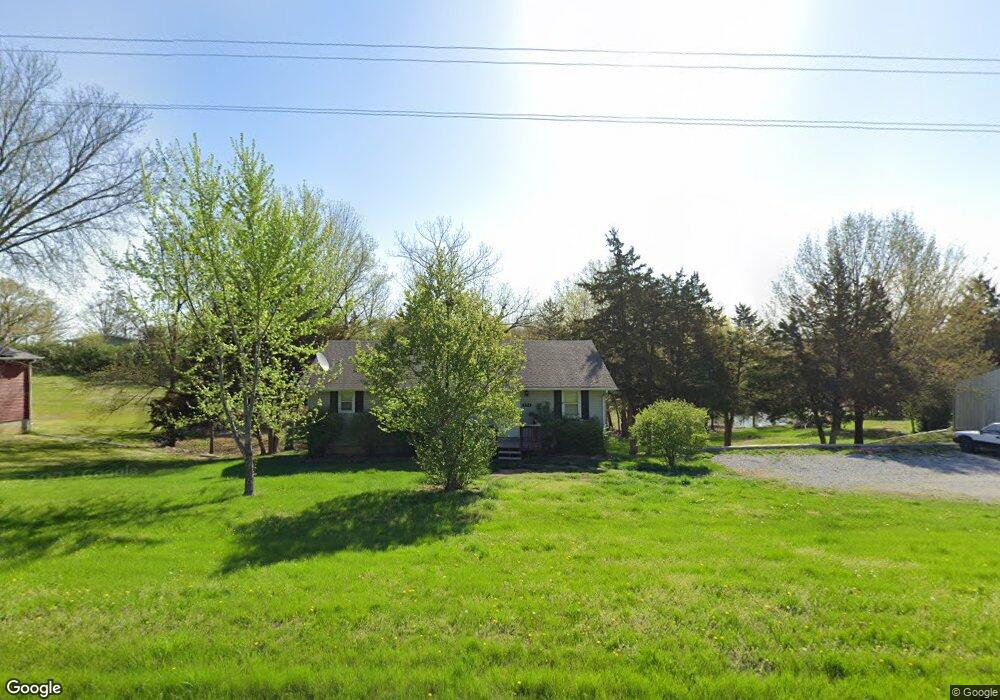
8700 N Route E Columbia, MO 65202
Estimated Value: $202,000 - $279,000
3
Beds
2
Baths
1,232
Sq Ft
$187/Sq Ft
Est. Value
About This Home
This home is located at 8700 N Route E, Columbia, MO 65202 and is currently estimated at $230,399, approximately $187 per square foot. 8700 N Route E is a home located in Boone County with nearby schools including West Boulevard Elementary School, Smithton Middle School, and David H. Hickman High School.
Ownership History
Date
Name
Owned For
Owner Type
Purchase Details
Closed on
Oct 29, 2019
Sold by
Lancaster Lori
Bought by
Jay Dee Properties Llc
Current Estimated Value
Home Financials for this Owner
Home Financials are based on the most recent Mortgage that was taken out on this home.
Original Mortgage
$79,000
Outstanding Balance
$69,638
Interest Rate
3.7%
Mortgage Type
Commercial
Estimated Equity
$160,762
Purchase Details
Closed on
Jul 16, 2012
Sold by
Spaeth Lawrence E
Bought by
Lancaster Lori
Home Financials for this Owner
Home Financials are based on the most recent Mortgage that was taken out on this home.
Original Mortgage
$72,800
Interest Rate
3.79%
Mortgage Type
New Conventional
Create a Home Valuation Report for This Property
The Home Valuation Report is an in-depth analysis detailing your home's value as well as a comparison with similar homes in the area
Purchase History
| Date | Buyer | Sale Price | Title Company |
|---|---|---|---|
| Jay Dee Properties Llc | -- | None Available | |
| Lancaster Lori | -- | Boone Central Title Company |
Source: Public Records
Mortgage History
| Date | Status | Borrower | Loan Amount |
|---|---|---|---|
| Open | Jay Dee Properties Llc | $79,000 | |
| Previous Owner | Lancaster Lori | $72,800 |
Source: Public Records
Tax History
| Year | Tax Paid | Tax Assessment Tax Assessment Total Assessment is a certain percentage of the fair market value that is determined by local assessors to be the total taxable value of land and additions on the property. | Land | Improvement |
|---|---|---|---|---|
| 2025 | $1,407 | $20,007 | $3,363 | $16,644 |
| 2024 | $1,315 | $18,183 | $3,363 | $14,820 |
| 2023 | $1,304 | $18,183 | $3,363 | $14,820 |
| 2022 | $1,206 | $16,834 | $3,363 | $13,471 |
| 2021 | $1,208 | $16,834 | $3,363 | $13,471 |
| 2020 | $1,231 | $16,189 | $3,363 | $12,826 |
| 2019 | $1,231 | $16,189 | $3,363 | $12,826 |
| 2018 | $1,147 | $0 | $0 | $0 |
| 2017 | $1,134 | $14,991 | $3,363 | $11,628 |
| 2016 | $1,132 | $14,991 | $3,363 | $11,628 |
| 2015 | $1,045 | $14,991 | $3,363 | $11,628 |
| 2014 | $1,048 | $14,991 | $3,363 | $11,628 |
Source: Public Records
Map
Nearby Homes
- 5700 W Wilhite Rd
- 9855 North Route E
- 7275 North Route E
- LOT 5 W Rd
- LOT 12 W Mariposa Ridge Rd
- 6045 North Route E
- 0 North Route E
- 2560 W Botner Rd
- 0 N Evert School Rd
- 12390 N Highway Yy
- 13120 Bethlehem Rd
- 11735 N Old Number 7
- 8600 N Highway Vv
- LOT 6 N Locust Grove Church Rd
- 10385 N Highway Vv
- 10050 N Highway Vv
- 13100 N Bethlehem Rd
- 7751 W Old Barclay Creek Ln
- 7630 N Highway Vv
- LOT 1 E Hinton Rd
- 8612 N Route E
- 8612 N Route E
- 8608 N Route E
- 8770 N Route E
- 5504 W Wilhite Rd
- 8687 N Route E
- 8607 N Route E
- 8607 North Route E
- 8600 N Route E
- 5600 W Wilhite Rd
- 5551 W Wilhite Rd
- 8600 North Route E
- 8709 N Kimmy Ct
- 8613 N Kimmy Ct
- 5601 W Wilhite Rd
- 8704 N Kimmy Ct
- 8500 North Route E
- 8500 N Route E
- 5501 W Tracy Ct
- 8501 N Route E
Your Personal Tour Guide
Ask me questions while you tour the home.