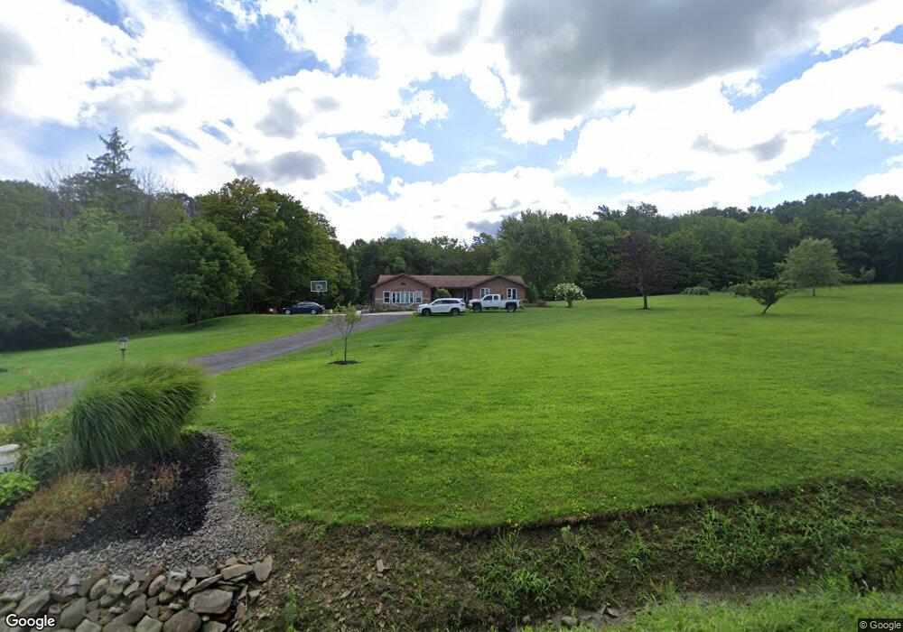
8700 Ransom Rd Brocton, NY 14716
Estimated Value: $157,000 - $391,000
3
Beds
1
Bath
1,672
Sq Ft
$158/Sq Ft
Est. Value
About This Home
This home is located at 8700 Ransom Rd, Brocton, NY 14716 and is currently estimated at $264,060, approximately $157 per square foot. 8700 Ransom Rd is a home located in Chautauqua County with nearby schools including Brocton Elementary School and Brocton Middle/High School.
Ownership History
Date
Name
Owned For
Owner Type
Purchase Details
Closed on
Dec 19, 2008
Sold by
Ehmeke William H
Bought by
Ehmeke Joshua J
Current Estimated Value
Home Financials for this Owner
Home Financials are based on the most recent Mortgage that was taken out on this home.
Original Mortgage
$110,000
Outstanding Balance
$72,824
Interest Rate
6.17%
Mortgage Type
Purchase Money Mortgage
Estimated Equity
$191,236
Create a Home Valuation Report for This Property
The Home Valuation Report is an in-depth analysis detailing your home's value as well as a comparison with similar homes in the area
Home Values in the Area
Average Home Value in this Area
Purchase History
| Date | Buyer | Sale Price | Title Company |
|---|---|---|---|
| Ehmeke Joshua J | $130,000 | Charles R Loveland |
Source: Public Records
Mortgage History
| Date | Status | Borrower | Loan Amount |
|---|---|---|---|
| Open | Ehmeke Joshua J | $110,000 |
Source: Public Records
Tax History
| Year | Tax Paid | Tax Assessment Tax Assessment Total Assessment is a certain percentage of the fair market value that is determined by local assessors to be the total taxable value of land and additions on the property. | Land | Improvement |
|---|---|---|---|---|
| 2024 | $5,010 | $23,180 | $3,070 | $20,110 |
| 2023 | $4,746 | $23,180 | $3,070 | $20,110 |
| 2022 | $4,841 | $23,180 | $3,070 | $20,110 |
| 2021 | $4,826 | $23,180 | $3,070 | $20,110 |
| 2020 | $4,039 | $23,180 | $3,070 | $20,110 |
| 2019 | $3,980 | $23,180 | $3,070 | $20,110 |
| 2018 | $3,980 | $23,180 | $3,070 | $20,110 |
| 2017 | $3,908 | $23,180 | $3,070 | $20,110 |
| 2016 | $3,810 | $23,180 | $3,070 | $20,110 |
| 2015 | -- | $23,180 | $3,070 | $20,110 |
| 2014 | -- | $23,180 | $3,070 | $20,110 |
Source: Public Records
Map
Nearby Homes
- 89 Old Mill Rd
- V L Webster Rd Unit LotWP001
- 3842 W Main St
- 0 Highland Ave
- 90 E Main St
- 0 Chautauqua Rd Unit R1657082
- 32 Fay St
- 12 Central Ave
- 9456 North Rd
- 9466 Lake Ave
- 8667 Fay St
- 8689 1st St
- 9709 Farel Rd
- 8170 Campbell Rd
- 6806 Belding Dr S
- 4174 Osborne Rd
- 4436 Rood Rd
- 0 Woleben Rd
- 0 Stone Rd
- 5 Beach Place
- 8731 Ransom Rd
- 8670 Bear Lake Rd
- 8629 Bear Lake Rd
- 8637 Bear Lake Rd
- 8655 Bear Lake Rd
- 8691 Bear Lake Rd
- 8693 Bear Lake Rd
- 5390 Blockhouse Rd
- 8703 Bear Lake Rd
- 5531 Ellicott Rd
- 8722 Bear Lake Rd
- 5300 Blockhouse Rd
- 5529 Ellicott Rd
- 8578 Bear Lake Rd
- 5476 Ellicott Rd
- 5385 Ellicott Rd
- 5404 Ellicott Rd
- 5250 Blockhouse Rd
- 5603 Ellicott Rd
- 5396 Ellicott Rd
Your Personal Tour Guide
Ask me questions while you tour the home.