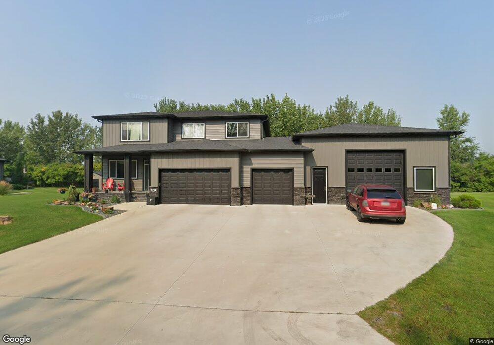
8701 Memory Ln Horace, ND 58047
Estimated Value: $624,000 - $983,000
4
Beds
2
Baths
4,070
Sq Ft
$193/Sq Ft
Est. Value
About This Home
This home is located at 8701 Memory Ln, Horace, ND 58047 and is currently estimated at $783,845, approximately $192 per square foot. 8701 Memory Ln is a home located in Cass County with nearby schools including Horace Elementary School, Liberty Middle School, and West Fargo Sheyenne High School.
Ownership History
Date
Name
Owned For
Owner Type
Purchase Details
Closed on
Dec 2, 2016
Sold by
Deisinger Homes Of Fargo Moorhead Llc
Bought by
Jeanolte Michael J and Jeanolte Misty K
Current Estimated Value
Home Financials for this Owner
Home Financials are based on the most recent Mortgage that was taken out on this home.
Original Mortgage
$417,000
Outstanding Balance
$336,040
Interest Rate
3.54%
Mortgage Type
Commercial
Estimated Equity
$447,805
Create a Home Valuation Report for This Property
The Home Valuation Report is an in-depth analysis detailing your home's value as well as a comparison with similar homes in the area
Home Values in the Area
Average Home Value in this Area
Purchase History
| Date | Buyer | Sale Price | Title Company |
|---|---|---|---|
| Jeanolte Michael J | $655,998 | Title Co |
Source: Public Records
Mortgage History
| Date | Status | Borrower | Loan Amount |
|---|---|---|---|
| Open | Jeanolte Michael J | $417,000 |
Source: Public Records
Tax History
| Year | Tax Paid | Tax Assessment Tax Assessment Total Assessment is a certain percentage of the fair market value that is determined by local assessors to be the total taxable value of land and additions on the property. | Land | Improvement |
|---|---|---|---|---|
| 2024 | $9,135 | $363,500 | $63,000 | $300,500 |
| 2023 | $9,029 | $359,150 | $63,000 | $296,150 |
| 2022 | $9,038 | $344,750 | $63,000 | $281,750 |
| 2021 | $8,437 | $318,350 | $63,000 | $255,350 |
| 2020 | $8,206 | $315,700 | $63,000 | $252,700 |
| 2019 | $8,187 | $315,050 | $46,200 | $268,850 |
| 2018 | $5,920 | $237,400 | $46,200 | $191,200 |
| 2017 | $291 | $10,800 | $10,800 | $0 |
| 2016 | $245 | $10,800 | $10,800 | $0 |
Source: Public Records
Map
Nearby Homes
- 8040 Goldfinch Dr
- 8037 Goldfinch Dr
- 8806 Meadowlark Pkwy
- 8068 Goldfinch Dr
- 302 Sheyenne St
- 249 Chestnut Dr
- 8820 Northern Lights Ave
- 9280 Didrick Dr
- 8912 Meadowlark Pkwy
- 8924 Meadowlark Pkwy
- 7889 Cottonwood Blvd
- 289 Mickey Mouse Ave
- 8221 Dr
- 8209 Hebgen Dr
- 9256 Didrick Dr
- 8136 Memory Ln
- 8174 Memory Ln
- 8141 Memory Ln
- 8124 Memory Ln
- 8106 Memory Ln
- 8609 Memory Ln
- 8709 Memory Ln
- 8601 Memory Ln
- 8717 Memory Ln
- 8517 Memory Ln
- 569 Wall Ave
- 569 Wall Ave
- 8509 Memory Ln
- 8805 Lost River Rd
- 7701 Firefly Ln
- 7705 Firefly Ln
- 8804 Lost River Rd
- 557 Wall Ave
- 608 Sheyenne St
- 7709 Firefly Ln
- 9 W Brook Dr
- LT12,BLK2 Memory Ln
- 8808 Lost River Rd
- 555 W Brook Dr
- 613 Sheyenne St
Your Personal Tour Guide
Ask me questions while you tour the home.