Estimated Value: $292,000 - $458,000
4
Beds
2
Baths
2,500
Sq Ft
$137/Sq Ft
Est. Value
About This Home
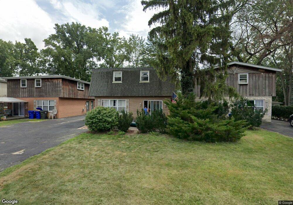
This home is located at 8703 Circle Dr, Lyons, IL 60534 and is currently estimated at $342,434, approximately $136 per square foot. 8703 Circle Dr is a home with nearby schools including Lincoln Elementary School, George Washington Middle School, and J. Sterling Morton High School West.
Ownership History
Date
Name
Owned For
Owner Type
Purchase Details
Closed on
Feb 9, 2026
Sold by
Buhrfiend Michael G
Bought by
Village Of Lyons
Current Estimated Value
Purchase Details
Closed on
Apr 30, 2018
Sold by
Chicago Title Land Trust Co
Bought by
Buhrfiend Michael G
Home Financials for this Owner
Home Financials are based on the most recent Mortgage that was taken out on this home.
Original Mortgage
$92,400
Interest Rate
5.12%
Mortgage Type
New Conventional
Create a Home Valuation Report for This Property
The Home Valuation Report is an in-depth analysis detailing your home's value as well as a comparison with similar homes in the area
Home Values in the Area
Average Home Value in this Area
Purchase History
| Date | Buyer | Sale Price | Title Company |
|---|---|---|---|
| Village Of Lyons | -- | Fidelity National Title | |
| Buhrfiend Michael G | $132,000 | First American Title |
Source: Public Records
Mortgage History
| Date | Status | Borrower | Loan Amount |
|---|---|---|---|
| Previous Owner | Buhrfiend Michael G | $92,400 |
Source: Public Records
Tax History
| Year | Tax Paid | Tax Assessment Tax Assessment Total Assessment is a certain percentage of the fair market value that is determined by local assessors to be the total taxable value of land and additions on the property. | Land | Improvement |
|---|---|---|---|---|
| 2025 | $10,852 | $33,500 | $3,588 | $29,912 |
| 2024 | $10,852 | $33,500 | $3,588 | $29,912 |
| 2023 | $7,524 | $33,500 | $3,588 | $29,912 |
| 2022 | $7,524 | $19,310 | $3,120 | $16,190 |
| 2021 | $7,204 | $19,309 | $3,120 | $16,189 |
| 2020 | $6,587 | $18,248 | $3,120 | $15,128 |
| 2019 | $4,813 | $13,200 | $2,808 | $10,392 |
| 2018 | $4,697 | $13,200 | $2,808 | $10,392 |
| 2017 | $10,740 | $31,212 | $2,808 | $28,404 |
| 2016 | $11,714 | $31,862 | $2,496 | $29,366 |
| 2015 | $11,426 | $31,862 | $2,496 | $29,366 |
| 2014 | $12,895 | $36,488 | $2,496 | $33,992 |
| 2013 | $12,756 | $39,313 | $2,496 | $36,817 |
Source: Public Records
Map
Nearby Homes
- 3901 Custer Ave
- 3845 Mccormick Ave
- 8636 40th St
- 4040 Rose Ave
- 4053 Rose Ave
- 8803 Ogden Ave
- 207 W Quincy St Unit GARD
- 213 W Quincy St Unit 1
- 4218 Konrad Ave
- 3708 Sunnyside Ave
- 8667 Plainfield Rd
- 9016 Southview Ave
- 9011 Sheridan Ave
- 4243 Konrad Ave
- 4247 Anna Ave
- 9031 Fairview Ave
- 4023 Oak Ave
- 4249 Custer Ave
- 336 Fairbank Rd
- 8625 43rd St
- 8703 Circle Dr
- 8705 Circle Dr
- 8701 Circle Dr
- 8699 Circle Dr
- 3908 Circle Dr
- 8709 Circle Dr Unit 2
- 8709 Circle Dr
- 8697 Circle Dr
- 8697 Circle Dr Unit F
- 8695 Circle Dr
- 8711 Circle Dr
- 8708 Circle Dr
- 3904 Circle Dr
- 3911 Circle Dr
- 3907 Circle Dr
- 3900 Circle Dr
- 8707 Southview Ave
- 8647 Patricia Dr
- 8713 Circle Dr
- 8641 Patricia Dr
Your Personal Tour Guide
Ask me questions while you tour the home.