Estimated Value: $617,000 - $663,000
--
Bed
3
Baths
2,246
Sq Ft
$285/Sq Ft
Est. Value
About This Home
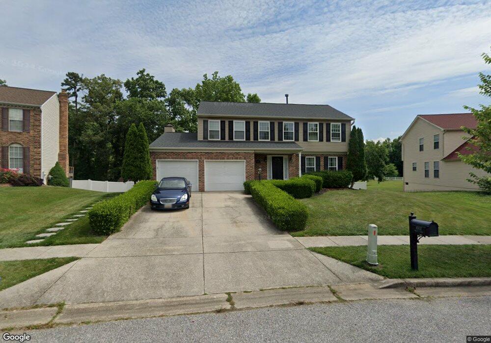
This home is located at 8707 Bryant Ct, Bowie, MD 20720 and is currently estimated at $639,292, approximately $284 per square foot. 8707 Bryant Ct is a home located in Prince George's County with nearby schools including Rockledge Elementary School, Samuel Ogle Middle School, and Bowie High School.
Ownership History
Date
Name
Owned For
Owner Type
Purchase Details
Closed on
Aug 29, 2005
Sold by
Chaudhry Younus
Bought by
Wheeler Lindsy K
Current Estimated Value
Home Financials for this Owner
Home Financials are based on the most recent Mortgage that was taken out on this home.
Original Mortgage
$391,900
Outstanding Balance
$205,035
Interest Rate
5.5%
Mortgage Type
Adjustable Rate Mortgage/ARM
Estimated Equity
$434,257
Purchase Details
Closed on
Nov 30, 1992
Sold by
Lee Chong C
Bought by
Chaudhry Younus and Chaudhry Yasmine I
Purchase Details
Closed on
Oct 31, 1988
Sold by
Ryland Group Inc
Bought by
Lee Chong C
Create a Home Valuation Report for This Property
The Home Valuation Report is an in-depth analysis detailing your home's value as well as a comparison with similar homes in the area
Home Values in the Area
Average Home Value in this Area
Purchase History
| Date | Buyer | Sale Price | Title Company |
|---|---|---|---|
| Wheeler Lindsy K | $489,900 | -- | |
| Chaudhry Younus | $197,000 | -- | |
| Lee Chong C | $178,500 | -- |
Source: Public Records
Mortgage History
| Date | Status | Borrower | Loan Amount |
|---|---|---|---|
| Open | Wheeler Lindsy K | $391,900 | |
| Closed | Wheeler Lindsy K | $48,000 |
Source: Public Records
Tax History Compared to Growth
Tax History
| Year | Tax Paid | Tax Assessment Tax Assessment Total Assessment is a certain percentage of the fair market value that is determined by local assessors to be the total taxable value of land and additions on the property. | Land | Improvement |
|---|---|---|---|---|
| 2024 | $6,191 | $485,033 | $0 | $0 |
| 2023 | $5,877 | $440,667 | $0 | $0 |
| 2022 | $5,522 | $396,300 | $103,200 | $293,100 |
| 2021 | $5,292 | $380,333 | $0 | $0 |
| 2020 | $5,184 | $364,367 | $0 | $0 |
| 2019 | $5,047 | $348,400 | $101,600 | $246,800 |
| 2018 | $4,911 | $337,967 | $0 | $0 |
| 2017 | $4,804 | $327,533 | $0 | $0 |
| 2016 | -- | $317,100 | $0 | $0 |
| 2015 | $4,677 | $300,667 | $0 | $0 |
| 2014 | $4,677 | $284,233 | $0 | $0 |
Source: Public Records
Map
Nearby Homes
- 0 Duckettown Rd
- 8405 Spruill Dr
- 12338 Lanham Severn Rd
- 12605 Lanham Severn Rd
- 12707 Duckettown Rd
- 13001 4th St
- 12203 Lanham Severn Rd
- 11701 Duckettown Rd
- 11911 Frost Dr
- 11718 Backus Dr
- 11690 Duckettown Rd
- 8906 Chestnut Ave
- The Jenkins Plan at Mill Branch Crossing - Townhomes
- 8711 Chestnut Ave
- 13118 6th St
- 13123 10th St
- 13126 10th St
- 11708 Moriarty Ct
- 11710 Moriarty Way
- 8114 Chestnut Ave
- 8709 Bryant Ct
- 8705 Bryant Ct
- 8704 Bryant Ct
- 8703 Bryant Ct
- 8711 Bryant Ct
- 8710 Bryant Ct
- 12409 Duckettown Rd
- 12310 Backus Dr
- 8701 Bryant Ct
- 8713 Bryant Ct
- 12308 Backus Dr
- 8712 Bryant Ct
- 12306 Backus Dr
- 8714 Bryant Ct
- 8715 Bryant Ct
- 12401 Duckettown Rd
- 12304 Backus Dr
- 8614 Undermire Ct
- 8617 Undermire Ct
- 12309 Backus Dr