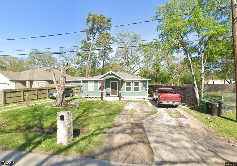
8707 Lanewood Dr Houston, TX 77016
Trinity-Houston Gardens NeighborhoodEstimated Value: $138,584 - $197,000
2
Beds
1
Bath
1,224
Sq Ft
$141/Sq Ft
Est. Value
About This Home
This home is located at 8707 Lanewood Dr, Houston, TX 77016 and is currently estimated at $172,646, approximately $141 per square foot. 8707 Lanewood Dr is a home located in Harris County with nearby schools including Felix Cook Jr. Elementary School, Key Middle, and Kashmere High School.
Ownership History
Date
Name
Owned For
Owner Type
Purchase Details
Closed on
Mar 1, 2019
Sold by
2018 Longterm Re Llc
Bought by
Esquivel Victor David
Current Estimated Value
Home Financials for this Owner
Home Financials are based on the most recent Mortgage that was taken out on this home.
Original Mortgage
$74,000
Interest Rate
4%
Mortgage Type
Purchase Money Mortgage
Purchase Details
Closed on
Aug 26, 2005
Sold by
Tarlo Mary Ann Esther and Estate Of Sam D Tarlo
Bought by
Tarlo Esther and Fishel Jerry
Create a Home Valuation Report for This Property
The Home Valuation Report is an in-depth analysis detailing your home's value as well as a comparison with similar homes in the area
Home Values in the Area
Average Home Value in this Area
Purchase History
| Date | Buyer | Sale Price | Title Company |
|---|---|---|---|
| Esquivel Victor David | -- | None Available | |
| Tarlo Esther | -- | Southern American Title |
Source: Public Records
Mortgage History
| Date | Status | Borrower | Loan Amount |
|---|---|---|---|
| Previous Owner | Esquivel Victor David | $74,000 |
Source: Public Records
Tax History Compared to Growth
Tax History
| Year | Tax Paid | Tax Assessment Tax Assessment Total Assessment is a certain percentage of the fair market value that is determined by local assessors to be the total taxable value of land and additions on the property. | Land | Improvement |
|---|---|---|---|---|
| 2025 | $969 | $98,000 | $52,115 | $45,885 |
| 2024 | $969 | $98,664 | $49,137 | $49,527 |
| 2023 | $969 | $98,991 | $44,670 | $54,321 |
| 2022 | $1,730 | $78,556 | $37,225 | $41,331 |
| 2021 | $1,240 | $53,199 | $18,613 | $34,586 |
| 2020 | $872 | $36,000 | $18,613 | $17,387 |
| 2019 | $911 | $50,673 | $18,613 | $32,060 |
| 2018 | $988 | $39,031 | $16,751 | $22,280 |
| 2017 | $987 | $39,031 | $16,751 | $22,280 |
| 2016 | $987 | $39,031 | $16,751 | $22,280 |
| 2015 | $940 | $36,563 | $16,751 | $19,812 |
| 2014 | $940 | $36,563 | $16,751 | $19,812 |
Source: Public Records
Map
Nearby Homes
- 8700 Lanewood Dr
- 6415 Laura Koppe Rd
- 6320 Laura Koppe Rd
- 6513 Laura Koppe Rd
- 8420 Lanewood Dr
- 8914 Lanewood Dr
- 8502 Shady Dr
- 9009 Compton St
- 7129 Springdale St Unit A/B
- 8312 Lanewood Dr
- 6908 S Hall St
- 6213 Laura Koppe Rd
- 7002 S Hall St
- 7126 Bywood St
- 7126 Bywood A and B St
- 8928 Homestead Rd
- 9205 & 9207 Spaulding St
- 6012 Laura Koppe Rd
- 7101 Weyburn St Unit C
- 7010 S Hall St
- 8711 Lanewood Dr
- 8699 Lanewood Dr
- 8703 Lanewood Dr
- 8722 Compton St
- 8605 Lanewood Dr
- 8708 Lanewood Dr
- 8704 Lanewood Dr
- 8704 Lanewood Dr Unit A
- 8702 Lanewood Dr
- 8601 Lanewood Dr
- 8515 Lanewood Dr
- 8518 Lanewood Dr
- 8616 Compton St
- 8611 Spaulding St
- 6506 Laura Koppe
- 8609 Spaulding St
- 8605 Spaulding St
- 8619 Spaulding St
- 8516 Lanewood Dr
- 8615 Spaulding St