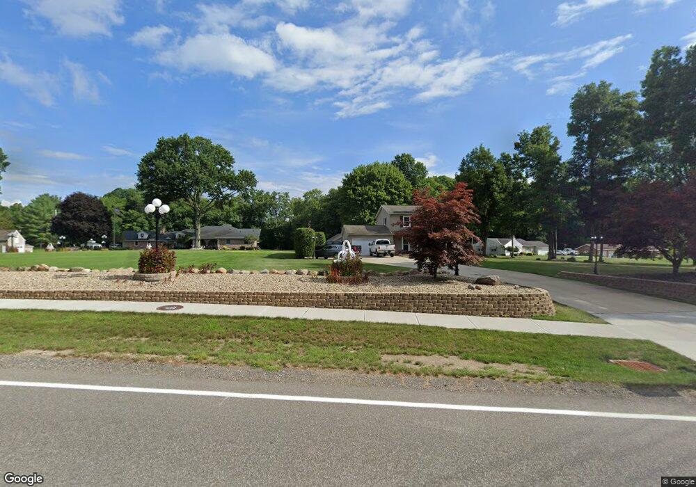
8709 Brookside Rd Independence, OH 44131
Estimated Value: $367,000 - $435,000
4
Beds
3
Baths
2,942
Sq Ft
$136/Sq Ft
Est. Value
About This Home
This home is located at 8709 Brookside Rd, Independence, OH 44131 and is currently estimated at $399,631, approximately $135 per square foot. 8709 Brookside Rd is a home located in Cuyahoga County with nearby schools including Independence Primary School, Independence Middle School, and Independence High School.
Ownership History
Date
Name
Owned For
Owner Type
Purchase Details
Closed on
Oct 8, 1998
Sold by
Fox Dorothy J and Fox Michael J
Bought by
Sirna Gaetano M and Sirna Loretta G
Current Estimated Value
Home Financials for this Owner
Home Financials are based on the most recent Mortgage that was taken out on this home.
Original Mortgage
$153,000
Outstanding Balance
$28,537
Interest Rate
6.9%
Estimated Equity
$371,094
Purchase Details
Closed on
Apr 3, 1985
Sold by
Fox Michael J and Fox Dorothy J
Bought by
Fox Dorothy J and Fox Michael J
Purchase Details
Closed on
Jan 1, 1975
Bought by
Fox Michael J and Fox Dorothy J
Create a Home Valuation Report for This Property
The Home Valuation Report is an in-depth analysis detailing your home's value as well as a comparison with similar homes in the area
Home Values in the Area
Average Home Value in this Area
Purchase History
| Date | Buyer | Sale Price | Title Company |
|---|---|---|---|
| Sirna Gaetano M | $203,000 | Gateway Title Agency Inc | |
| Fox Dorothy J | -- | -- | |
| Fox Michael J | -- | -- |
Source: Public Records
Mortgage History
| Date | Status | Borrower | Loan Amount |
|---|---|---|---|
| Open | Sirna Gaetano M | $153,000 |
Source: Public Records
Tax History
| Year | Tax Paid | Tax Assessment Tax Assessment Total Assessment is a certain percentage of the fair market value that is determined by local assessors to be the total taxable value of land and additions on the property. | Land | Improvement |
|---|---|---|---|---|
| 2025 | $7,715 | $166,845 | $21,630 | $145,215 |
| 2024 | $5,666 | $118,195 | $21,630 | $96,565 |
| 2023 | $3,954 | $74,870 | $22,020 | $52,850 |
| 2022 | $3,933 | $74,870 | $22,020 | $52,850 |
| 2021 | $3,876 | $74,870 | $22,020 | $52,850 |
| 2020 | $3,789 | $68,670 | $20,200 | $48,480 |
| 2019 | $3,658 | $196,200 | $57,700 | $138,500 |
| 2018 | $4,283 | $68,670 | $20,200 | $48,480 |
| 2017 | $4,975 | $89,260 | $21,250 | $68,010 |
| 2016 | $4,924 | $89,260 | $21,250 | $68,010 |
| 2015 | $4,555 | $89,260 | $21,250 | $68,010 |
| 2014 | $4,555 | $82,640 | $19,670 | $62,970 |
Source: Public Records
Map
Nearby Homes
- 7003 Brecksville Rd
- SL 23 Kingscote Park
- 8001 Robin Ln
- 6626 Hawthorne Dr
- 6312 E Pleasant Valley Rd
- 7572 Scenicview Dr
- 6878 W Fitzwater Rd Unit 41
- 6824 W Fitzwater Rd Unit 35
- 6119 E Sprague Rd
- 10905 Greenhaven Pkwy
- 6208 Dora Blvd
- 6930 Carriage Hill Dr Unit 101
- 6910 Carriage Hill Dr Unit 101
- 8442 Settlers Passage
- 0 Brecksville Rd
- 8630 Hollis Ln
- 13330 S Partridge Dr
- 7448 Amber Ln
- 8084 Wright Rd
- 0 Winding Way
- 8715 Bramley Dr
- 8703 Brookside Rd
- 8800 Bramley Dr
- 8800 Brookside Rd
- 8417 Brookside Rd
- 8818 Bramley Dr
- 8801 Bramley Dr
- 8403 Brookside Rd
- 8815 Bramley Dr
- 8414 Brookside Rd
- 8321 Brookside Rd
- 8915 Bramley Dr
- 8410 Brookside Rd
- 8408 Brookside Rd
- 8311 Brookside Rd
- 8926 Brookside Rd
- 8930 Bramley Dr
- 8955 Bramley Dr
- 8927 Brookside Rd
Your Personal Tour Guide
Ask me questions while you tour the home.