Estimated Value: $615,000 - $699,000
Studio
3
Baths
2,512
Sq Ft
$261/Sq Ft
Est. Value
About This Home
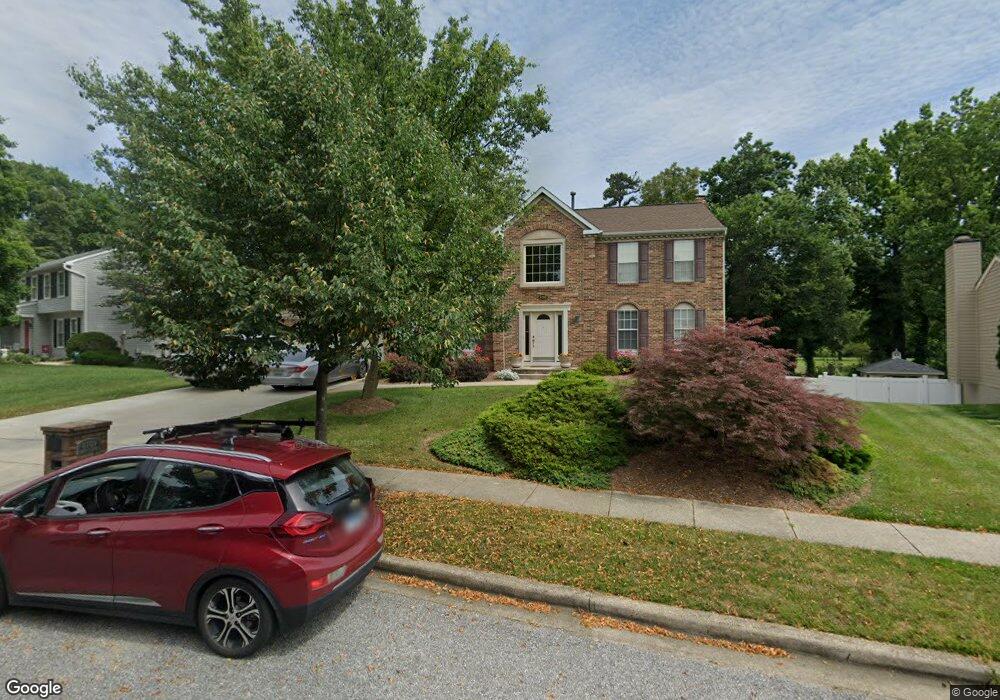
This home is located at 8709 Bryant Ct, Bowie, MD 20720 and is currently estimated at $654,807, approximately $260 per square foot. 8709 Bryant Ct is a home located in Prince George's County with nearby schools including Rockledge Elementary School, Samuel Ogle Middle School, and Bowie High School.
Ownership History
Date
Name
Owned For
Owner Type
Purchase Details
Closed on
Jun 21, 2006
Sold by
Johnson Kent
Bought by
Johnson Kent
Current Estimated Value
Purchase Details
Closed on
Jun 5, 2006
Sold by
Johnson Kent
Bought by
Johnson Kent
Purchase Details
Closed on
Sep 26, 2005
Sold by
Pak Linda A
Bought by
Johnson Kent
Home Financials for this Owner
Home Financials are based on the most recent Mortgage that was taken out on this home.
Original Mortgage
$407,200
Interest Rate
5.63%
Mortgage Type
New Conventional
Purchase Details
Closed on
Jun 30, 2004
Sold by
Pak Linda A
Bought by
Pak Linda A
Purchase Details
Closed on
Jun 29, 2004
Sold by
Pak Linda A
Bought by
Pak Linda A
Purchase Details
Closed on
Feb 6, 2004
Sold by
Pak Linda A
Bought by
Pak Linda A and Pak Jefferey Kim
Create a Home Valuation Report for This Property
The Home Valuation Report is an in-depth analysis detailing your home's value as well as a comparison with similar homes in the area
Home Values in the Area
Average Home Value in this Area
Purchase History
| Date | Buyer | Sale Price | Title Company |
|---|---|---|---|
| Johnson Kent | -- | -- | |
| Johnson Kent | -- | -- | |
| Johnson Kent | $509,000 | -- | |
| Pak Linda A | -- | -- | |
| Pak Linda A | -- | -- | |
| Pak Linda A | -- | -- |
Source: Public Records
Mortgage History
| Date | Status | Borrower | Loan Amount |
|---|---|---|---|
| Previous Owner | Pak Linda A | $407,200 |
Source: Public Records
Tax History
| Year | Tax Paid | Tax Assessment Tax Assessment Total Assessment is a certain percentage of the fair market value that is determined by local assessors to be the total taxable value of land and additions on the property. | Land | Improvement |
|---|---|---|---|---|
| 2025 | $6,611 | $573,100 | $152,200 | $420,900 |
| 2024 | $6,611 | $531,733 | -- | -- |
| 2023 | $6,303 | $490,367 | $0 | $0 |
| 2022 | $5,934 | $449,000 | $102,200 | $346,800 |
| 2021 | $5,696 | $432,867 | $0 | $0 |
| 2020 | $5,586 | $416,733 | $0 | $0 |
| 2019 | $5,446 | $400,600 | $101,100 | $299,500 |
| 2018 | $5,267 | $382,400 | $0 | $0 |
| 2017 | $5,120 | $364,200 | $0 | $0 |
| 2016 | -- | $346,000 | $0 | $0 |
| 2015 | $4,865 | $324,300 | $0 | $0 |
| 2014 | $4,865 | $302,600 | $0 | $0 |
Source: Public Records
Map
Nearby Homes
- 8629 Park Ave
- 8424 Spruill Dr
- 8411 Spruill Dr
- 12800 7th St
- 12603 Lanham Severn Rd
- 12903 7th St
- 13001 4th St
- 8824 Old Laurel Bowie Rd
- 11706 Duckettown Rd
- 9407 Myrtle Ave
- 11690 Duckettown Rd
- 13205 10th St
- 8217 Quill Point Dr
- 11700 Moriarty Ct
- 13203 Falling Water Ct
- 11701 Moriarty Ct
- 12330 Quarterback Ct
- 12340 Quiet Owl Ln
- 8401 Springfield Rd
- 11309 Eliana Ct
- 8707 Bryant Ct
- 8711 Bryant Ct
- 8705 Bryant Ct
- 12409 Duckettown Rd
- 8713 Bryant Ct
- 8704 Bryant Ct
- 8710 Bryant Ct
- 8703 Bryant Ct
- 12401 Duckettown Rd
- 8712 Bryant Ct
- 8715 Bryant Ct
- 12310 Backus Dr
- 8714 Bryant Ct
- 12308 Backus Dr
- 8701 Bryant Ct
- 12306 Backus Dr
- 12307 Duckettown Rd
- 12304 Backus Dr
- 12302 Backus Dr
- 8703 Burns Ct
Your Personal Tour Guide
Ask me questions while you tour the home.