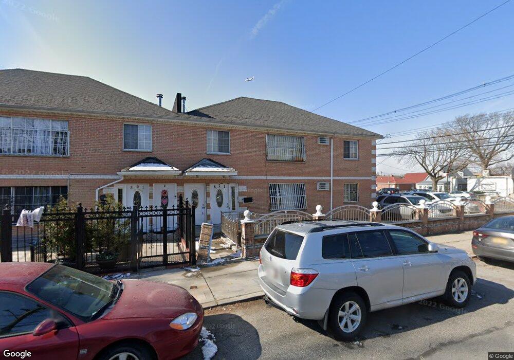
871 Swinton Ave Bronx, NY 10465
Throgs Neck-Edgewater Park NeighborhoodEstimated Value: $843,584 - $1,044,000
5
Beds
4
Baths
3,600
Sq Ft
$269/Sq Ft
Est. Value
About This Home
This home is located at 871 Swinton Ave, Bronx, NY 10465 and is currently estimated at $967,396, approximately $268 per square foot. 871 Swinton Ave is a home located in Bronx County with nearby schools including P.S. 14 Senator John Calandra, Herbert H Lehman High School, and Grand Concourse Academy Charter School.
Ownership History
Date
Name
Owned For
Owner Type
Purchase Details
Closed on
Jun 20, 2014
Sold by
Antwi Daniel and Antwi Josephine
Bought by
Antwi Daniel
Current Estimated Value
Purchase Details
Closed on
Sep 6, 2007
Sold by
Asante Yaw
Bought by
Antwi Daniel and Antwi Josephine
Purchase Details
Closed on
Aug 2, 2006
Sold by
Cooley1 Management Corp
Bought by
Asante Yaw
Home Financials for this Owner
Home Financials are based on the most recent Mortgage that was taken out on this home.
Original Mortgage
$576,000
Interest Rate
6.83%
Mortgage Type
Purchase Money Mortgage
Create a Home Valuation Report for This Property
The Home Valuation Report is an in-depth analysis detailing your home's value as well as a comparison with similar homes in the area
Home Values in the Area
Average Home Value in this Area
Purchase History
| Date | Buyer | Sale Price | Title Company |
|---|---|---|---|
| Antwi Daniel | -- | -- | |
| Antwi Daniel | -- | -- | |
| Asante Yaw | $720,000 | -- |
Source: Public Records
Mortgage History
| Date | Status | Borrower | Loan Amount |
|---|---|---|---|
| Previous Owner | Asante Yaw | $576,000 |
Source: Public Records
Tax History Compared to Growth
Tax History
| Year | Tax Paid | Tax Assessment Tax Assessment Total Assessment is a certain percentage of the fair market value that is determined by local assessors to be the total taxable value of land and additions on the property. | Land | Improvement |
|---|---|---|---|---|
| 2025 | $7,931 | $41,854 | $7,932 | $33,922 |
| 2024 | $7,931 | $39,485 | $6,824 | $32,661 |
| 2023 | $7,969 | $39,240 | $7,693 | $31,547 |
| 2022 | $7,489 | $46,500 | $9,540 | $36,960 |
| 2021 | $7,780 | $46,260 | $9,540 | $36,720 |
| 2020 | $7,383 | $44,460 | $9,540 | $34,920 |
| 2019 | $6,883 | $45,660 | $9,540 | $36,120 |
| 2018 | $6,666 | $32,700 | $9,540 | $23,160 |
| 2017 | $6,372 | $31,260 | $9,540 | $21,720 |
| 2016 | $6,159 | $30,808 | $9,156 | $21,652 |
| 2015 | $3,864 | $29,065 | $9,388 | $19,677 |
| 2014 | $3,864 | $27,420 | $10,620 | $16,800 |
Source: Public Records
Map
Nearby Homes
- 837 Swinton Ave
- 831 Swinton Ave
- 815 Swinton Ave
- 945 Swinton Ave
- - Ave
- 2808 Philip Ave
- 946 Balcom Ave
- 1009 Brinsmade Ave
- 836 Revere Ave
- 2864 Philip Ave
- 2866 Philip Ave
- 1049 Huntington Ave
- 710 Revere Ave
- 755 Logan Ave
- 819 Hollywood Ave
- 3021 Barkley Ave
- 840 Hollywood Ave
- 2887 Lamport Place
- 730 Logan Ave
- 731 Hollywood Ave
- 2788 Lafayette Ave
- 861 Swinton Ave
- 2786 Lafayette Ave
- 857 Swinton Ave
- 870 Swinton Ave
- 860 Swinton Ave
- 855 Swinton Ave
- 853 Swinton Ave
- 2806 Lafayette Ave
- 858 Swinton Ave
- 858 Swinton Ave Unit Front
- 2808 Lafayette Ave
- 851 Swinton Ave
- 2787 Lafayette Ave
- 2783 Lafayette Ave
- 2781 Lafayette Ave
- 900 Swinton Ave
- 843 Swinton Ave
- 854 Swinton Ave
- 902 Brinsmade Ave