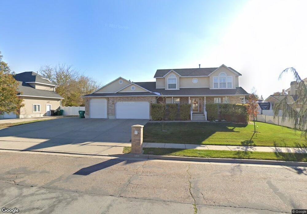
871 W 2300 S Syracuse, UT 84075
Estimated Value: $651,000 - $728,000
3
Beds
3
Baths
3,855
Sq Ft
$178/Sq Ft
Est. Value
About This Home
This home is located at 871 W 2300 S, Syracuse, UT 84075 and is currently estimated at $686,099, approximately $177 per square foot. 871 W 2300 S is a home located in Davis County with nearby schools including Bluff Ridge Elementary, Legacy Junior High School, and Clearfield High School.
Ownership History
Date
Name
Owned For
Owner Type
Purchase Details
Closed on
May 20, 2010
Sold by
Lamar Dennis E and Lamar Jan B
Bought by
Mandleco Lucas K and Mandleco Christine A
Current Estimated Value
Home Financials for this Owner
Home Financials are based on the most recent Mortgage that was taken out on this home.
Original Mortgage
$212,000
Outstanding Balance
$141,015
Interest Rate
5.21%
Mortgage Type
New Conventional
Estimated Equity
$545,084
Create a Home Valuation Report for This Property
The Home Valuation Report is an in-depth analysis detailing your home's value as well as a comparison with similar homes in the area
Home Values in the Area
Average Home Value in this Area
Purchase History
| Date | Buyer | Sale Price | Title Company |
|---|---|---|---|
| Mandleco Lucas K | -- | Security Title Of Davis Cnty |
Source: Public Records
Mortgage History
| Date | Status | Borrower | Loan Amount |
|---|---|---|---|
| Open | Mandleco Lucas K | $212,000 |
Source: Public Records
Tax History
| Year | Tax Paid | Tax Assessment Tax Assessment Total Assessment is a certain percentage of the fair market value that is determined by local assessors to be the total taxable value of land and additions on the property. | Land | Improvement |
|---|---|---|---|---|
| 2025 | $3,557 | $343,200 | $128,486 | $214,714 |
| 2024 | $3,341 | $324,500 | $109,715 | $214,785 |
| 2023 | $3,153 | $558,000 | $152,674 | $405,326 |
| 2022 | $3,305 | $320,650 | $87,406 | $233,244 |
| 2021 | $2,916 | $438,000 | $129,562 | $308,438 |
| 2020 | $2,648 | $385,000 | $111,124 | $273,876 |
| 2019 | $2,543 | $365,000 | $110,748 | $254,252 |
| 2018 | $2,400 | $342,000 | $105,810 | $236,190 |
| 2016 | $2,289 | $171,050 | $40,534 | $130,516 |
| 2015 | $2,210 | $157,300 | $40,534 | $116,766 |
| 2014 | $2,182 | $158,264 | $40,534 | $117,730 |
| 2013 | -- | $140,544 | $38,525 | $102,019 |
Source: Public Records
Map
Nearby Homes
Your Personal Tour Guide
Ask me questions while you tour the home.