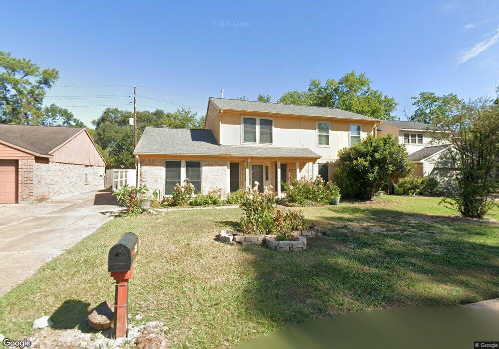
8714 Wind Side Dr Houston, TX 77040
Brookhollow West NeighborhoodEstimated Value: $283,000 - $338,000
3
Beds
3
Baths
2,672
Sq Ft
$117/Sq Ft
Est. Value
About This Home
This home is located at 8714 Wind Side Dr, Houston, TX 77040 and is currently estimated at $313,078, approximately $117 per square foot. 8714 Wind Side Dr is a home located in Harris County with nearby schools including Gleason Elementary School, Cook Middle School, and Jersey Village High School.
Ownership History
Date
Name
Owned For
Owner Type
Purchase Details
Closed on
May 18, 1999
Sold by
Hart David Conrad and Hart Vivian C
Bought by
Cespedes Rafael and Cespedes Andrea R
Current Estimated Value
Home Financials for this Owner
Home Financials are based on the most recent Mortgage that was taken out on this home.
Original Mortgage
$94,000
Outstanding Balance
$24,087
Interest Rate
6.94%
Estimated Equity
$288,991
Create a Home Valuation Report for This Property
The Home Valuation Report is an in-depth analysis detailing your home's value as well as a comparison with similar homes in the area
Home Values in the Area
Average Home Value in this Area
Purchase History
| Date | Buyer | Sale Price | Title Company |
|---|---|---|---|
| Cespedes Rafael | -- | Texas American Title |
Source: Public Records
Mortgage History
| Date | Status | Borrower | Loan Amount |
|---|---|---|---|
| Open | Cespedes Rafael | $94,000 |
Source: Public Records
Tax History
| Year | Tax Paid | Tax Assessment Tax Assessment Total Assessment is a certain percentage of the fair market value that is determined by local assessors to be the total taxable value of land and additions on the property. | Land | Improvement |
|---|---|---|---|---|
| 2025 | $314 | $291,000 | $79,902 | $211,098 |
| 2024 | $314 | $253,853 | $72,450 | $181,403 |
| 2023 | $314 | $274,485 | $72,450 | $202,035 |
| 2022 | $4,004 | $255,200 | $60,444 | $194,756 |
| 2021 | $3,828 | $191,587 | $60,444 | $131,143 |
| 2020 | $3,586 | $166,436 | $50,508 | $115,928 |
| 2019 | $3,909 | $174,825 | $17,388 | $157,437 |
| 2018 | $1,550 | $165,773 | $17,388 | $148,385 |
| 2017 | $3,462 | $154,797 | $17,388 | $137,409 |
| 2016 | $3,462 | $154,797 | $17,388 | $137,409 |
| 2015 | $2,246 | $151,494 | $17,388 | $134,106 |
| 2014 | $2,246 | $135,108 | $14,490 | $120,618 |
Source: Public Records
Map
Nearby Homes
- 8710 Congo Ln
- 7714 Rolling Fork Ln
- 8715 Andante Dr
- 8411 Battleoak Dr
- 9523 Bayou Lake Ln
- 8126 Ivan Reid Dr
- 8203 Ivan Reid Dr
- 8210 Bo Jack Dr
- 7818 Stoneyway Dr
- 8323 E Ridge Dr
- 7794 Hillbarn Dr
- 7914 Stoneyway Dr
- 9023 Mauna Loa Ln
- 7926 Stoneyway Dr
- 7815 Terra Cotta Dr
- 7923 Ouray Dr
- 7814 Terra Cotta Dr
- 8802 Leadore Dr
- 7839 Greenedge Dr
- 7311 Woodoak Dr
- 8718 Wind Side Dr
- 8710 Wind Side Dr
- 8722 Wind Side Dr
- 8706 Wind Side Dr
- 8715 Wind Side Dr
- 8711 Wind Side Dr
- 8719 Wind Side Dr
- 8726 Wind Side Dr
- 8723 Wind Side Dr
- 8702 Wind Side Dr
- 8802 Wind Side Dr
- 8727 Wind Side Dr
- 8838 Congo Ln
- 8838 Congo Ln
- 8710 Storm Wood St
- 8706 Storm Wood St
- 8714 Storm Wood St
- 8702 Storm Wood St
- 0 Windside
- 8718 Storm Wood St
Your Personal Tour Guide
Ask me questions while you tour the home.