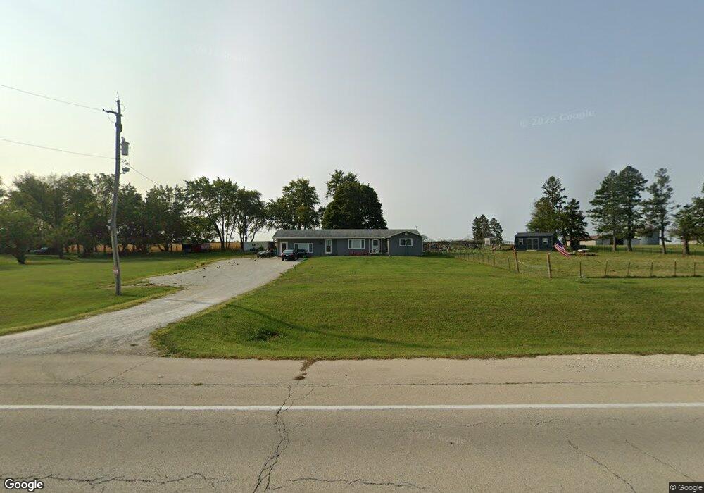
8718 W State Route 17 Bonfield, IL 60913
Estimated Value: $174,000 - $293,247
--
Bed
--
Bath
--
Sq Ft
2
Acres
About This Home
This home is located at 8718 W State Route 17, Bonfield, IL 60913 and is currently estimated at $237,312. 8718 W State Route 17 is a home with nearby schools including Herscher High School.
Ownership History
Date
Name
Owned For
Owner Type
Purchase Details
Closed on
Aug 2, 2023
Sold by
Tapp Helen M
Bought by
Tapp Lawrence A
Current Estimated Value
Home Financials for this Owner
Home Financials are based on the most recent Mortgage that was taken out on this home.
Original Mortgage
$210,000
Outstanding Balance
$205,125
Interest Rate
6.71%
Mortgage Type
New Conventional
Estimated Equity
$32,187
Purchase Details
Closed on
May 22, 2019
Sold by
Tapp Fredie J
Bought by
Tapp Fredie J and Tapp Helen M
Purchase Details
Closed on
Nov 2, 2005
Sold by
Trust 1978
Bought by
Tapp Fredie J
Home Financials for this Owner
Home Financials are based on the most recent Mortgage that was taken out on this home.
Original Mortgage
$152,000
Interest Rate
9.85%
Mortgage Type
New Conventional
Create a Home Valuation Report for This Property
The Home Valuation Report is an in-depth analysis detailing your home's value as well as a comparison with similar homes in the area
Home Values in the Area
Average Home Value in this Area
Purchase History
| Date | Buyer | Sale Price | Title Company |
|---|---|---|---|
| Tapp Lawrence A | $280,000 | Burnet Title | |
| Tapp Fredie J | -- | -- | |
| Tapp Fredie J | $160,000 | Commonwealth Land Title Ins |
Source: Public Records
Mortgage History
| Date | Status | Borrower | Loan Amount |
|---|---|---|---|
| Open | Tapp Lawrence A | $210,000 | |
| Previous Owner | Tapp Fredie J | $152,000 |
Source: Public Records
Tax History Compared to Growth
Tax History
| Year | Tax Paid | Tax Assessment Tax Assessment Total Assessment is a certain percentage of the fair market value that is determined by local assessors to be the total taxable value of land and additions on the property. | Land | Improvement |
|---|---|---|---|---|
| 2024 | $2,872 | $46,749 | $9,181 | $37,568 |
| 2023 | $2,314 | $43,083 | $8,461 | $34,622 |
| 2022 | $2,158 | $40,147 | $7,884 | $32,263 |
| 2021 | $2,226 | $40,147 | $7,884 | $32,263 |
| 2020 | $2,149 | $38,789 | $7,617 | $31,172 |
| 2019 | $2,473 | $42,792 | $7,359 | $35,433 |
| 2018 | $2,439 | $42,264 | $7,268 | $34,996 |
| 2017 | $2,358 | $41,132 | $7,073 | $34,059 |
| 2016 | $2,234 | $39,550 | $6,801 | $32,749 |
| 2015 | $2,103 | $38,804 | $6,459 | $32,345 |
| 2014 | $2,015 | $37,674 | $6,271 | $31,403 |
| 2013 | -- | $38,345 | $6,383 | $31,962 |
Source: Public Records
Map
Nearby Homes
- 1359 N 7000 Rd W
- 0 W 3000 Rd N Unit 23921814
- 10561 W State Route 17
- 2414 N 7000w Rd
- 5690 W State Route 17
- 5285 W State Route 17 Unit A
- 5101 W 1000n Rd
- 4052 Foxborough Dr
- 4020 Foxborough Dr
- 4079 Foxwood Dr
- 4015 Foxwood Dr
- 3842 Stone Oaks Dr
- 12710 W 1000n Rd
- 464 E Pilot Dr
- 502 E 3rd St
- 2089 Sunset View Ln
- 532 E 2nd St
- 4751 N 5500w Rd
- 35 E Tobey Dr
- 301 N Main St
- 8664 W State Route 17
- 8654 W State Route 17
- 8594 W State Route 17
- 8367 W State Route 17
- 8492 W State Route 17
- 8444A Illinois 17
- 8444B W State Route 17
- 8444A W State Route 17
- 8396 W State Route 17
- 217 N 8000w Rd
- 8372 W State Route 17
- 8344 W State Route 17
- 8808 W State Route 17
- 8342 Rte 17
- 375 N 8000w Rd
- 9184 W State Route 17
- 7623 W State Route 17
- 9270 W State Route 17
- 7705 W State Route 17
- 9292 W State Route 17