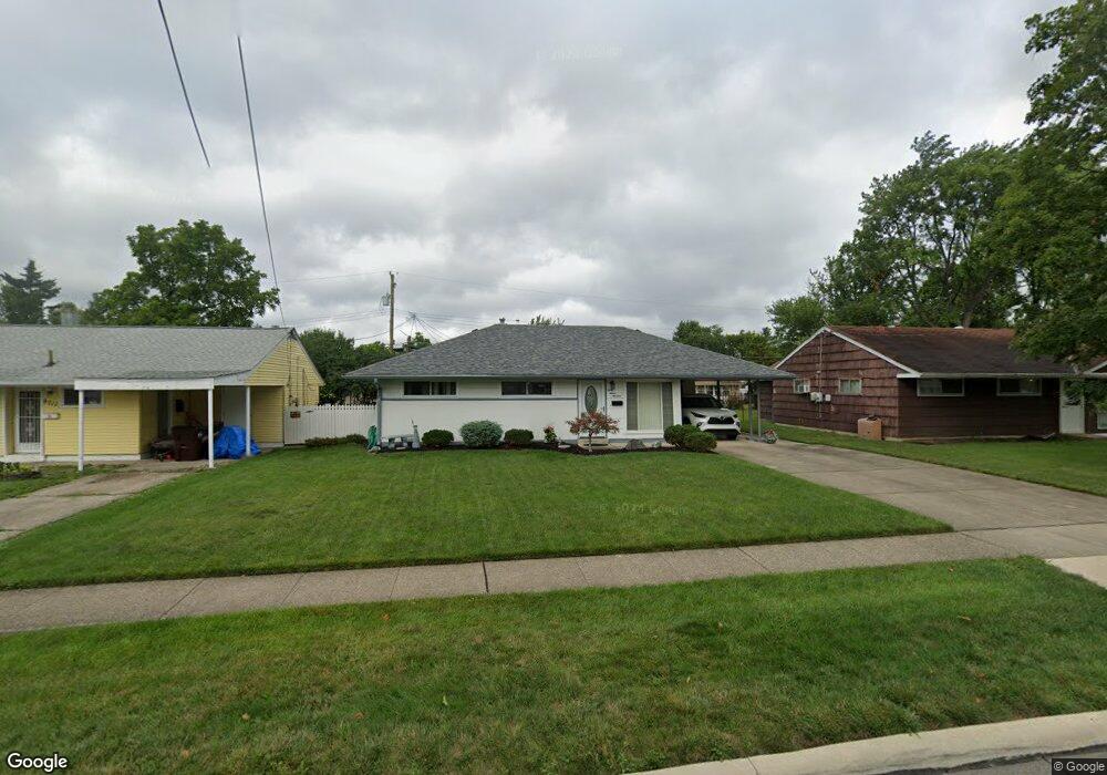
8719 Daly Rd Cincinnati, OH 45231
Finneytown NeighborhoodEstimated Value: $117,908 - $205,000
3
Beds
1
Bath
918
Sq Ft
$177/Sq Ft
Est. Value
About This Home
This home is located at 8719 Daly Rd, Cincinnati, OH 45231 and is currently estimated at $162,477, approximately $176 per square foot. 8719 Daly Rd is a home located in Hamilton County with nearby schools including Mt Healthy High School, St. Vivian School, and Central Baptist Academy.
Create a Home Valuation Report for This Property
The Home Valuation Report is an in-depth analysis detailing your home's value as well as a comparison with similar homes in the area
Home Values in the Area
Average Home Value in this Area
Tax History
We collect this data history from publicly available records. To have your information removed, we recommend requesting removal directly through your county’s website.
| Year | Tax Paid | Tax Assessment Tax Assessment Total Assessment is a certain percentage of the fair market value that is determined by local assessors to be the total taxable value of land and additions on the property. | Land | Improvement |
|---|---|---|---|---|
| 2025 | $1,640 | $28,042 | $4,676 | $23,366 |
| 2023 | $1,545 | $28,042 | $4,676 | $23,366 |
| 2022 | $999 | $12,993 | $4,631 | $8,362 |
| 2021 | $972 | $12,993 | $4,631 | $8,362 |
| 2020 | $987 | $12,993 | $4,631 | $8,362 |
| 2019 | $977 | $12,030 | $4,288 | $7,742 |
| 2018 | $983 | $12,030 | $4,288 | $7,742 |
| 2017 | $933 | $12,030 | $4,288 | $7,742 |
| 2016 | $1,245 | $15,887 | $4,627 | $11,260 |
| 2015 | $1,254 | $15,887 | $4,627 | $11,260 |
| 2014 | $1,213 | $15,425 | $4,627 | $10,798 |
| 2013 | $1,249 | $16,237 | $4,872 | $11,365 |
Source: Public Records
Map
Nearby Homes
- 8668 Daly Rd
- 8754 Monsanto Dr
- 8634 Daly Rd
- 8779 Daly Rd
- 8796 Balboa Dr
- 1116 Madeleine Cir
- 8587 Daly Rd
- 8760 Grenada Dr
- 8616 Balboa Dr
- 8811 Grenada Dr
- 8819 Grenada Dr
- 1149 Madeleine Cir
- 8877 Balboa Dr
- 1176 Madeleine Cir
- 1290 Aldrich Ave
- 8710 Mockingbird Ln
- 8719 Hood Ct
- 1313 Landis Ln
- 8868 Ebro Ct
- 8471 Shuman Ln
Your Personal Tour Guide
Ask me questions while you tour the home.