Estimated Value: $300,000 - $354,000
3
Beds
2
Baths
1,288
Sq Ft
$252/Sq Ft
Est. Value
About This Home
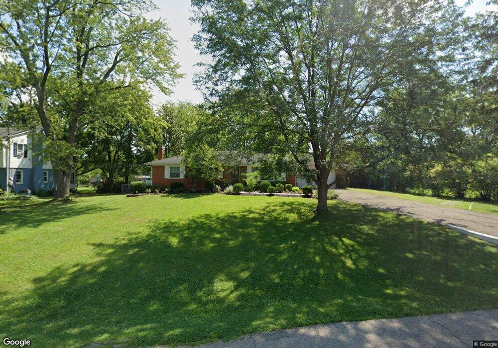
This home is located at 872 Cherokee Dr, Mason, OH 45040 and is currently estimated at $324,857, approximately $252 per square foot. 872 Cherokee Dr is a home located in Warren County with nearby schools including Mason Intermediate Elementary School, Mason Middle School, and William Mason High School.
Ownership History
Date
Name
Owned For
Owner Type
Purchase Details
Closed on
May 7, 2015
Sold by
Enneking Kurt A and Enneking Erin M
Bought by
Weaver Stephanie L
Current Estimated Value
Purchase Details
Closed on
Nov 18, 1998
Sold by
Borchelt Gratian J
Bought by
Enneking Kurt A and Enneking Erin M
Home Financials for this Owner
Home Financials are based on the most recent Mortgage that was taken out on this home.
Original Mortgage
$70,000
Interest Rate
6.59%
Mortgage Type
New Conventional
Create a Home Valuation Report for This Property
The Home Valuation Report is an in-depth analysis detailing your home's value as well as a comparison with similar homes in the area
Home Values in the Area
Average Home Value in this Area
Purchase History
| Date | Buyer | Sale Price | Title Company |
|---|---|---|---|
| Weaver Stephanie L | -- | None Available | |
| Enneking Kurt A | $95,000 | -- |
Source: Public Records
Mortgage History
| Date | Status | Borrower | Loan Amount |
|---|---|---|---|
| Previous Owner | Enneking Kurt A | $70,000 |
Source: Public Records
Tax History
| Year | Tax Paid | Tax Assessment Tax Assessment Total Assessment is a certain percentage of the fair market value that is determined by local assessors to be the total taxable value of land and additions on the property. | Land | Improvement |
|---|---|---|---|---|
| 2025 | $3,572 | $88,010 | $24,500 | $63,510 |
| 2024 | $3,572 | $88,010 | $24,500 | $63,510 |
| 2023 | $3,430 | $71,386 | $15,067 | $56,318 |
| 2022 | $3,385 | $71,386 | $15,068 | $56,319 |
| 2021 | $3,207 | $71,386 | $15,068 | $56,319 |
| 2020 | $3,041 | $58,037 | $12,250 | $45,787 |
| 2019 | $2,796 | $58,037 | $12,250 | $45,787 |
| 2018 | $2,805 | $58,037 | $12,250 | $45,787 |
| 2017 | $2,331 | $45,028 | $8,750 | $36,278 |
| 2016 | $2,401 | $45,028 | $8,750 | $36,278 |
| 2015 | $2,406 | $45,028 | $8,750 | $36,278 |
| 2014 | $2,304 | $40,200 | $7,810 | $32,390 |
| 2013 | $2,309 | $45,020 | $8,750 | $36,270 |
Source: Public Records
Map
Nearby Homes
- 5988 Snider Cove Way
- 6705 Willow Ln
- 5670 Villas Creek Dr
- 607 Tylersville Rd
- 6176 Nicholas Way
- 6762 Lexington Park Blvd
- 6172 Nicholas Way
- 6168 Nicholas Way
- 6164 Nicholas Way
- 5673 Melbury Ct
- 5641 Melbury Ct
- 6191 Nicholas Way
- 6187 Nicholas Way
- 6179 Nicholas Way
- 6175 Nicholas Way
- 6171 Nicholas Way
- 6130 Nicholas Way
- 6390 Coverage Ct
- 6126 Nicholas Way
- 6386 Coverage Ct
- 858 Cherokee Dr
- 570 Apache Ln
- 846 Cherokee Dr
- 869 Cherokee Dr
- 899 Cherokee Dr
- 851 Cherokee Dr
- 540 Apache Ln
- 832 Cherokee Dr
- 577 Apache Ln
- 908 Cherokee Dr
- 909 Cherokee Dr
- 827 Cherokee Dr
- 816 Cherokee Dr
- 854 Brookcrest Dr
- 848 Brookcrest Dr
- 885 Indianwood Dr
- 549 Cocinda Ln
- 533 Apache Ln
- 836 Brookcrest Dr
- 864 Brookcrest Dr
Your Personal Tour Guide
Ask me questions while you tour the home.