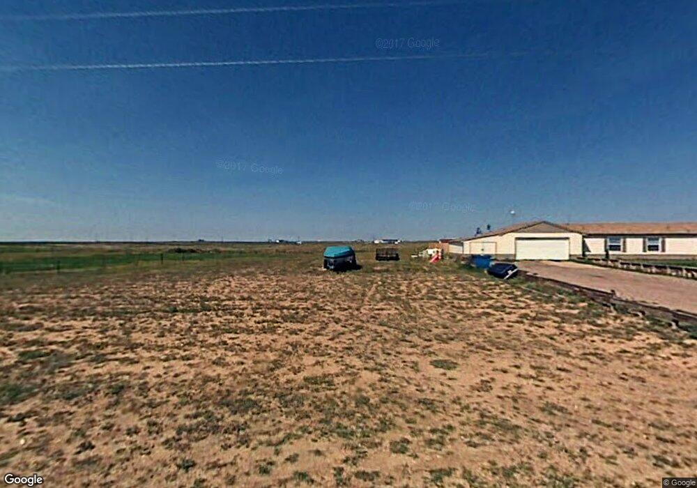
872 East Rd Carpenter, WY 82054
Estimated Value: $507,000 - $696,000
--
Bed
--
Bath
2,956
Sq Ft
$206/Sq Ft
Est. Value
About This Home
This home is located at 872 East Rd, Carpenter, WY 82054 and is currently estimated at $610,102, approximately $206 per square foot. 872 East Rd is a home located in Laramie County.
Ownership History
Date
Name
Owned For
Owner Type
Purchase Details
Closed on
Dec 21, 2000
Sold by
Parry Ronald E and Parry Shawna R
Bought by
Housley Mark and Housley Mark L
Current Estimated Value
Home Financials for this Owner
Home Financials are based on the most recent Mortgage that was taken out on this home.
Original Mortgage
$111,150
Outstanding Balance
$41,255
Interest Rate
7.8%
Mortgage Type
Construction
Estimated Equity
$568,847
Purchase Details
Closed on
Jun 8, 2000
Sold by
Mckinney Pearl B
Bought by
Parry Ronald E and Parry Shawna R
Home Financials for this Owner
Home Financials are based on the most recent Mortgage that was taken out on this home.
Original Mortgage
$9,900
Interest Rate
8.13%
Mortgage Type
Seller Take Back
Create a Home Valuation Report for This Property
The Home Valuation Report is an in-depth analysis detailing your home's value as well as a comparison with similar homes in the area
Home Values in the Area
Average Home Value in this Area
Purchase History
| Date | Buyer | Sale Price | Title Company |
|---|---|---|---|
| Housley Mark | -- | -- | |
| Parry Ronald E | -- | -- |
Source: Public Records
Mortgage History
| Date | Status | Borrower | Loan Amount |
|---|---|---|---|
| Open | Housley Mark | $111,150 | |
| Previous Owner | Parry Ronald E | $9,900 |
Source: Public Records
Tax History Compared to Growth
Tax History
| Year | Tax Paid | Tax Assessment Tax Assessment Total Assessment is a certain percentage of the fair market value that is determined by local assessors to be the total taxable value of land and additions on the property. | Land | Improvement |
|---|---|---|---|---|
| 2025 | $3,684 | $40,114 | $6,046 | $34,068 |
| 2024 | $3,684 | $53,621 | $8,570 | $45,051 |
| 2023 | $3,584 | $52,160 | $8,570 | $43,590 |
| 2022 | $2,655 | $37,827 | $5,380 | $32,447 |
| 2021 | $2,476 | $35,203 | $5,380 | $29,823 |
| 2020 | $2,213 | $31,910 | $5,380 | $26,530 |
| 2019 | $2,164 | $30,824 | $5,380 | $25,444 |
| 2018 | $2,010 | $29,088 | $5,380 | $23,708 |
| 2017 | $1,970 | $28,078 | $5,108 | $22,970 |
| 2016 | $1,869 | $26,626 | $3,842 | $22,784 |
| 2015 | $1,829 | $26,041 | $3,842 | $22,199 |
| 2014 | $1,820 | $25,743 | $3,418 | $22,325 |
Source: Public Records
Map
Nearby Homes
- S 1/2 Tract 7 East Rd
- 876 West Rd
- 4154 Antelope Meadows Dr
- Tract 4 Road 143
- Tract 3 Road 143
- Tract 2 Road 143
- Tract 1 Road 143
- Tract 10 Road 143
- 3870 Blue Sky Rd
- Tract 16 Blue Duck Trail
- Tract 5 Jake Spoon Trail
- Tract 19 Lonesome Dove Trail
- Tract 2 Jake Spoon Trail
- Tract 20 Lonesome Dove Trail
- Tract 18 Lonesome Dove Trail
- Tract 15 Blue Duck Trail
- Tract 23 Lonesome Dove Trail
- Tract 21 Lonesome Dove Trail
- Tract 7 Blue Duck Trail
- Tract 9 Jake Spoon Trail