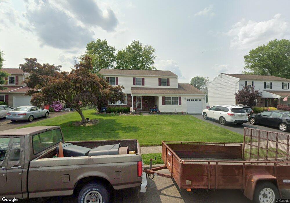
872 Phillips Rd Warminster, PA 18974
Estimated Value: $550,072 - $573,000
4
Beds
3
Baths
2,420
Sq Ft
$231/Sq Ft
Est. Value
About This Home
This home is located at 872 Phillips Rd, Warminster, PA 18974 and is currently estimated at $560,018, approximately $231 per square foot. 872 Phillips Rd is a home located in Bucks County with nearby schools including McDonald Elementary School, Log College Middle School, and William Tennent High School.
Ownership History
Date
Name
Owned For
Owner Type
Purchase Details
Closed on
May 24, 2004
Sold by
Abel Dennis R and Abel Lori A
Bought by
Abel Denis R and Abel Lori A
Current Estimated Value
Home Financials for this Owner
Home Financials are based on the most recent Mortgage that was taken out on this home.
Original Mortgage
$191,500
Outstanding Balance
$48,143
Interest Rate
6.12%
Mortgage Type
New Conventional
Estimated Equity
$511,875
Purchase Details
Closed on
Dec 28, 2000
Sold by
Wesler Herbert T and Wesler Shirley A
Bought by
Abel Dennis R and Abel Lori A
Home Financials for this Owner
Home Financials are based on the most recent Mortgage that was taken out on this home.
Original Mortgage
$156,000
Interest Rate
7.15%
Create a Home Valuation Report for This Property
The Home Valuation Report is an in-depth analysis detailing your home's value as well as a comparison with similar homes in the area
Home Values in the Area
Average Home Value in this Area
Purchase History
| Date | Buyer | Sale Price | Title Company |
|---|---|---|---|
| Abel Denis R | -- | Lawyers Title Ins | |
| Abel Dennis R | $195,000 | Lawyers Title Insurance Corp |
Source: Public Records
Mortgage History
| Date | Status | Borrower | Loan Amount |
|---|---|---|---|
| Open | Abel Denis R | $191,500 | |
| Previous Owner | Abel Dennis R | $156,000 | |
| Closed | Abel Denis R | $30,000 |
Source: Public Records
Tax History
| Year | Tax Paid | Tax Assessment Tax Assessment Total Assessment is a certain percentage of the fair market value that is determined by local assessors to be the total taxable value of land and additions on the property. | Land | Improvement |
|---|---|---|---|---|
| 2025 | $6,416 | $30,400 | $5,120 | $25,280 |
| 2024 | $6,416 | $30,400 | $5,120 | $25,280 |
| 2023 | $6,219 | $30,400 | $5,120 | $25,280 |
| 2022 | $6,086 | $30,400 | $5,120 | $25,280 |
| 2021 | $5,944 | $30,400 | $5,120 | $25,280 |
| 2020 | $5,861 | $30,400 | $5,120 | $25,280 |
| 2019 | $5,549 | $30,400 | $5,120 | $25,280 |
| 2018 | $5,417 | $30,400 | $5,120 | $25,280 |
| 2017 | $5,258 | $30,400 | $5,120 | $25,280 |
| 2016 | $5,258 | $30,400 | $5,120 | $25,280 |
| 2015 | $5,123 | $30,400 | $5,120 | $25,280 |
| 2014 | $5,123 | $30,400 | $5,120 | $25,280 |
Source: Public Records
Map
Nearby Homes
- 854 Phillips Rd
- 641 Whittier Dr
- 632 Longfellow Ct
- 630 Whittier Dr
- 631 Whittier Dr
- 786 Boxwood Dr
- 737 Tennyson Dr
- 745 Tennyson Dr
- 505 Orchard Ave
- 422 Brandywine Ct Unit YV422
- 909 Holden Ct
- Lot 15 Kennedy Way
- 0 York Rd
- 942 Stein Ct
- 11 Lincoln Ave
- 202 Strawberry Ct Unit 249
- 403 Silver Oak Ct
- 746 Spruce Rd
- 992 Jamison St
- 841 Nathaniel Trail
- 868 Phillips Rd
- 876 Phillips Rd
- 533 Brook Ln
- 535 Brook Ln
- 864 Phillips Rd
- 880 Phillips Rd
- 531 Brook Ln
- 537 Brook Ln
- 879 Phillips Rd
- 860 Phillips Rd
- 871 Phillips Rd
- 884 Phillips Rd
- 875 Phillips Rd
- 867 Phillips Rd
- 529 Brook Ln
- 539 Brook Ln
- 501 Harting Cir
- 863 Phillips Rd
- 858 Phillips Rd
- 888 Phillips Rd
Your Personal Tour Guide
Ask me questions while you tour the home.