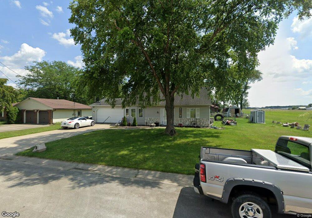
872 State St van Wert, OH 45891
Estimated Value: $151,000 - $185,000
4
Beds
2
Baths
946
Sq Ft
$174/Sq Ft
Est. Value
About This Home
This home is located at 872 State St, van Wert, OH 45891 and is currently estimated at $164,132, approximately $173 per square foot. 872 State St is a home located in Van Wert County with nearby schools including Van Wert Early Childhood Center, Van Wert High School, and Lifelinks Community School.
Ownership History
Date
Name
Owned For
Owner Type
Purchase Details
Closed on
Nov 18, 2019
Sold by
Springer Dale R and Springer Carol L
Bought by
Springer Brandon W and Springer Brandon W
Current Estimated Value
Purchase Details
Closed on
Mar 11, 2011
Sold by
Taylor Edward M and Taylor Marlene Jane
Bought by
Taylor Edward M and Taylor Marlene Jane
Purchase Details
Closed on
Oct 30, 2010
Bought by
Whiteman Patricia Ann
Purchase Details
Closed on
Apr 1, 2004
Bought by
Springer Dale R and Springer Carol L
Purchase Details
Closed on
Mar 31, 2003
Bought by
Taylor Edward M Y Marlene Jane
Create a Home Valuation Report for This Property
The Home Valuation Report is an in-depth analysis detailing your home's value as well as a comparison with similar homes in the area
Home Values in the Area
Average Home Value in this Area
Purchase History
| Date | Buyer | Sale Price | Title Company |
|---|---|---|---|
| Springer Brandon W | -- | None Available | |
| Taylor Edward M | -- | Attorney | |
| Whiteman Patricia Ann | $97,500 | -- | |
| Springer Dale R | $91,000 | -- | |
| Taylor Edward M Y Marlene Jane | -- | -- |
Source: Public Records
Tax History Compared to Growth
Tax History
| Year | Tax Paid | Tax Assessment Tax Assessment Total Assessment is a certain percentage of the fair market value that is determined by local assessors to be the total taxable value of land and additions on the property. | Land | Improvement |
|---|---|---|---|---|
| 2024 | $908 | $45,660 | $4,850 | $40,810 |
| 2023 | $908 | $45,660 | $4,850 | $40,810 |
| 2022 | $616 | $32,450 | $3,610 | $28,840 |
| 2021 | $601 | $32,450 | $3,610 | $28,840 |
| 2020 | $599 | $32,450 | $3,610 | $28,840 |
| 2019 | $1,101 | $28,900 | $3,610 | $25,290 |
| 2018 | $1,111 | $28,900 | $3,610 | $25,290 |
| 2017 | $1,111 | $28,900 | $3,610 | $25,290 |
| 2016 | $1,107 | $30,180 | $3,610 | $26,570 |
| 2015 | $1,107 | $30,180 | $3,610 | $26,570 |
| 2014 | $1,095 | $30,180 | $3,610 | $26,570 |
| 2013 | $1,179 | $30,180 | $3,610 | $26,570 |
Source: Public Records
Map
Nearby Homes
- 1006 Hughes St
- 1213 David St
- 736 Leeson Ave
- 1312 Rye Dr
- 1119 Gatsby Blvd
- 1440 Moby Ct
- 927 Woodland Ave
- 1318 Rye Dr
- 510 Euclid Ave
- 522 South Ave
- 729 George St
- 1028 Westchester Ct
- 960 Glenn St
- 1055 Westchester Ct
- 706 Woodland Ave
- 1421 Krendl Dr
- 1384 Rye Dr
- 1391 Rye Dr
- 1397 Rye Dr
- 9188 John Brown Rd Unit Lot 37