Estimated Value: $549,000 - $790,219
3
Beds
1
Bath
1,100
Sq Ft
$628/Sq Ft
Est. Value
About This Home
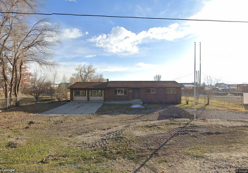
This home is located at 8720 W 9600 N, Lehi, UT 84043 and is currently estimated at $690,805, approximately $628 per square foot. 8720 W 9600 N is a home located in Utah County with nearby schools including Lehi Elementary School, Lehi Junior High School, and Lehi High School.
Ownership History
Date
Name
Owned For
Owner Type
Purchase Details
Closed on
Apr 4, 2008
Sold by
Peterson L Gene L and Peterson Robyn V
Bought by
Peterson Real Estate Holdings Llc
Current Estimated Value
Purchase Details
Closed on
Nov 17, 2005
Sold by
Rogers Robert and Rogers Denise
Bought by
Peterson L Gene L and Peterson Robyn Vest
Home Financials for this Owner
Home Financials are based on the most recent Mortgage that was taken out on this home.
Original Mortgage
$100,000
Interest Rate
5.93%
Mortgage Type
Fannie Mae Freddie Mac
Purchase Details
Closed on
Jul 10, 2002
Sold by
Covington Kay and Covington Betty
Bought by
Rogers Robert and Rogers Denise
Home Financials for this Owner
Home Financials are based on the most recent Mortgage that was taken out on this home.
Original Mortgage
$178,000
Interest Rate
6.71%
Mortgage Type
Purchase Money Mortgage
Purchase Details
Closed on
May 9, 1997
Sold by
Covington Kay
Bought by
Covington Kay and Covington Betty
Create a Home Valuation Report for This Property
The Home Valuation Report is an in-depth analysis detailing your home's value as well as a comparison with similar homes in the area
Home Values in the Area
Average Home Value in this Area
Purchase History
| Date | Buyer | Sale Price | Title Company |
|---|---|---|---|
| Peterson Real Estate Holdings Llc | -- | None Available | |
| Peterson L Gene L | -- | Equity Title | |
| Rogers Robert | -- | Equity Title Agency Inc | |
| Covington Kay | -- | -- |
Source: Public Records
Mortgage History
| Date | Status | Borrower | Loan Amount |
|---|---|---|---|
| Previous Owner | Peterson L Gene L | $100,000 | |
| Previous Owner | Rogers Robert | $178,000 |
Source: Public Records
Tax History Compared to Growth
Tax History
| Year | Tax Paid | Tax Assessment Tax Assessment Total Assessment is a certain percentage of the fair market value that is determined by local assessors to be the total taxable value of land and additions on the property. | Land | Improvement |
|---|---|---|---|---|
| 2025 | $3,239 | $388,030 | $430,300 | $174,000 |
| 2024 | $3,239 | $373,440 | $0 | $0 |
| 2023 | $3,016 | $372,240 | $0 | $0 |
| 2022 | $3,123 | $587,800 | $356,400 | $231,400 |
| 2021 | $2,845 | $435,200 | $246,600 | $188,600 |
| 2020 | $2,721 | $407,200 | $230,900 | $176,300 |
| 2019 | $2,504 | $384,200 | $230,900 | $153,300 |
| 2018 | $2,368 | $349,500 | $205,800 | $143,700 |
| 2017 | $2,084 | $193,810 | $0 | $0 |
| 2016 | $2,012 | $171,865 | $0 | $0 |
| 2015 | $2,078 | $169,555 | $0 | $0 |
| 2014 | $1,942 | $157,805 | $0 | $0 |
Source: Public Records
Map
Nearby Homes
- 1332 W 1500 N
- 1094 W 1425 N
- 1610 N 1125 W
- 1249 W 1800 N
- 1272 W 1800 N
- 1132 Titan Dr
- 1627 W Boxwood Dr Unit 110
- 1659 W Boxwood Dr Unit 109
- 1127 N 1500 W
- 902 W 1500 N
- 1032 Titan Dr
- 1301 N 900 W Unit 12
- 1011 W Mountain Way Unit 316
- 1817 W Bad Rock Cir
- 1542 N 1900 W
- 1908 N 2230 W
- 1896 N 2230 W
- 1970 N 2090 St W
- 5312 N Springview Ct Unit 106
- 1027 N 3685 W Unit 248
- 1262 W 1400 N
- 8833 W 9600 N
- 8850 W 9600 N
- 1350 W 1400 N
- 1238 W 1500 N
- 1230 W 1400 N
- 8941 W 9600 N
- 1318 W 1500 N
- 10800 N 8800 W
- 1402 W 1400 N
- 1317 W 1550 N
- 1194 W Mitchell Ln Unit 5
- 1351 W 1400 N
- 1263 W 1400 N
- 1193 W Mitchell Ln
- 1331 W 1550 N
- 1196 W 1425 N
- 1231 W 1400 N
- 1352 W 1500 N Unit 103
- 1187 W 1500 N